
Current Advisories:

– A Blizzard Watch has been issued for the Eastern Shore
– A Winter Storm Warning has been issued for western Maryland
– A Winter Storm Watch has been issued for the lower Eastern Shore
After reviewing the model data from this morning and afternoon, I have adjusted my forecast slightly.
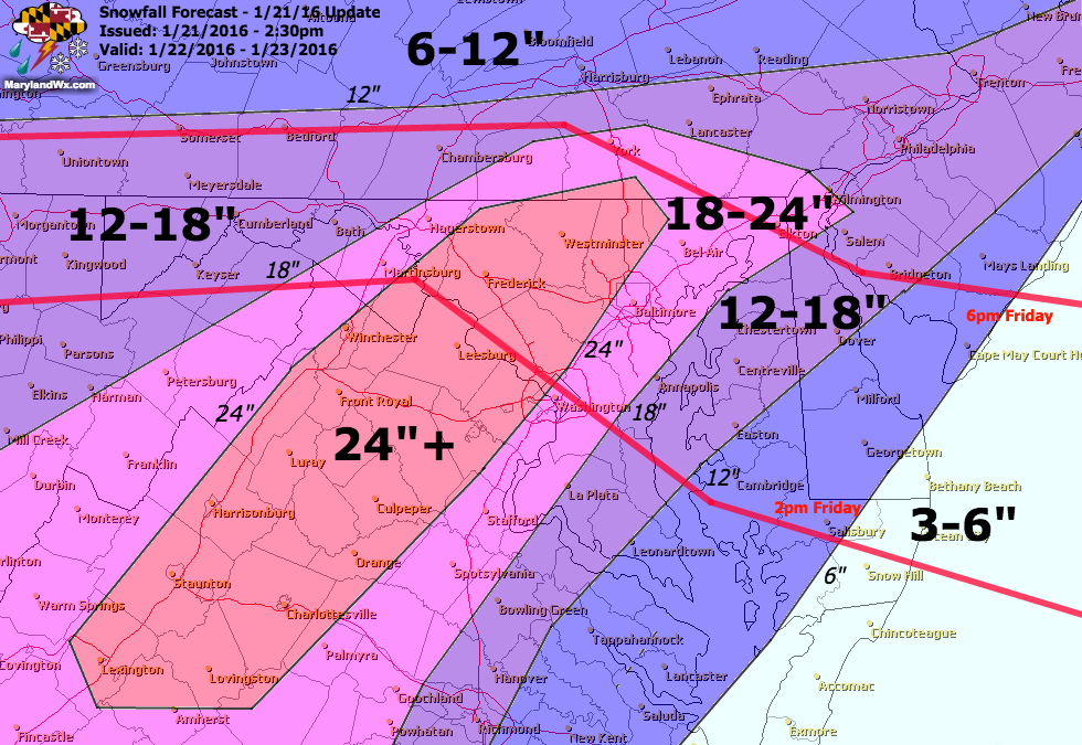
(click to enlarge)
For areas along and east of I-95, 18-24″ is possible. Further south and east, 12-18″ while across extreme southern Maryland and the lower Eastern Shore can expect up to a foot. Along the coast, where mixing is likely, 3-6″ is possible.
Timing: The snow will develop from southwest to northeast during the afternoon and evening hours tomorrow, become steady and heavy overnight Friday through Saturday. During this time, Blizzard conditions will be possible with strong winds and whiteout conditions. The snow will continue into Saturday night before tapering off.
If needed, I will update this forecast once more tonight or early tomorrow morning.
Stay up to date with storm information on your favorite social media site!
Follow me on Twitter, Facebook and Google+!