
Summary: High pressure to our northeast will continue to move away as a cold front approaches from the west. Low pressure will develop along the front tomorrow. High pressure returns on Friday and persists through the weekend.
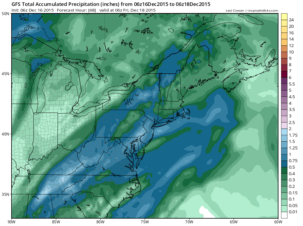
Rain will continue, moderate to heavy at times through the day tomorrow. When all is said and done tomorrow night, over an inch of rain is possible. Highs will be in the mid 50s.
The front will pass through late Thursday night or early Friday morning, ending the rainfall. It will turn breezy on Friday, with wind gusts to around 20 mph. High temperatures will be in the upper 40s.
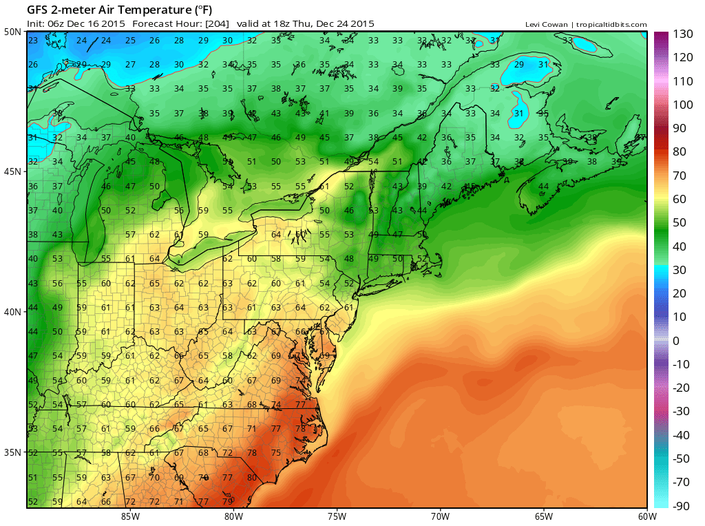
Looking to the end of next week, another storm system will likely affect our area Thursday into Friday. At this time, temperatures look to be well above normal, with highs into the mid to upper 60s Christmas Eve.
Additionally, the storm system will could spread rain into the area Christmas Eve into Christmas Day.
Stay up to date with storm information on your favorite social media site!
Follow me on Twitter, Facebook and Google+!