
Low pressure will move through tonight followed by another system Saturday into Saturday night.
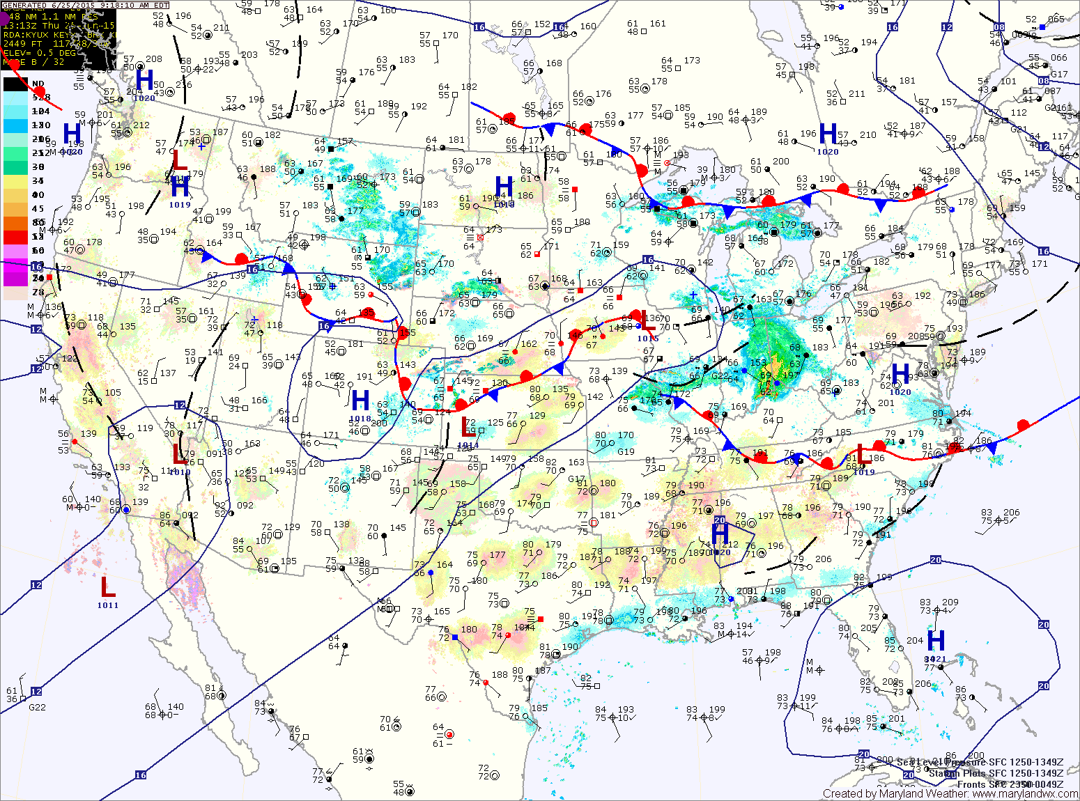
Some of the storms could become severe, with damaging winds and large hail. Highs will be in the mid to upper 80s.
FRIDAY: We will be between systems, with one low departing and another moving in. Showers will be likely through the day, with highs in the upper 70s to low 80s.
Rain chances will increase Friday night into Saturday morning.
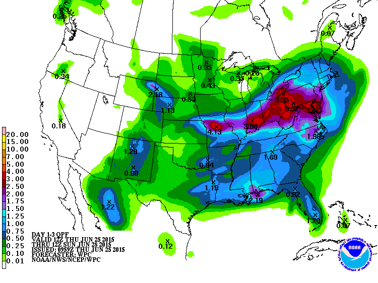
Rain will continue to overspread the area during the morning, becoming heavy at times by the afternoon and evening. Thunderstorms will also be possible throughout the period. Highs will be in the mid 70s.
The showers and storms will continue Saturday night, tapering off by Sunday morning.
SUNDAY: Expect a mix of clouds and sun, with highs in the mid 70s.
OUTLOOK: Next week starts out dry, with mostly sunny skies on Monday. Showers and thunderstorms will be possible on Tuesday as another system moves towards the area.
Stay up to date with storm information on your favorite social media site!
Follow me on Twitter, Facebook and Google+!