
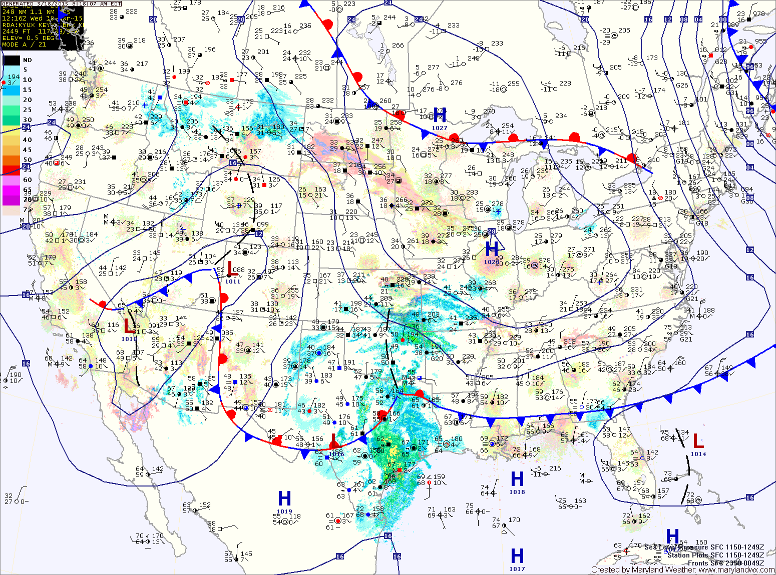
Today will be sunny but cold, with occasionally gusty northwest winds. Highs will be in the upper 40s to around 50° under sunny skies.
Clouds will increase tomorrow as the area of low pressure moves towards our area. Highs will be in the mid to upper 40s.
Temperatures will fall back into the low 30s tomorrow night as the leading edge of the precipitation pushes into the area. This will set the stage for some light snow late tomorrow night and Friday morning. With temperatures likely above freezing and surface temperatures that have warmed over the past few days, little to no accumulation is expected. Any snow that does manage to stick to grassy surfaces will melt Friday morning as temperatures warm into the mid to upper 30s.
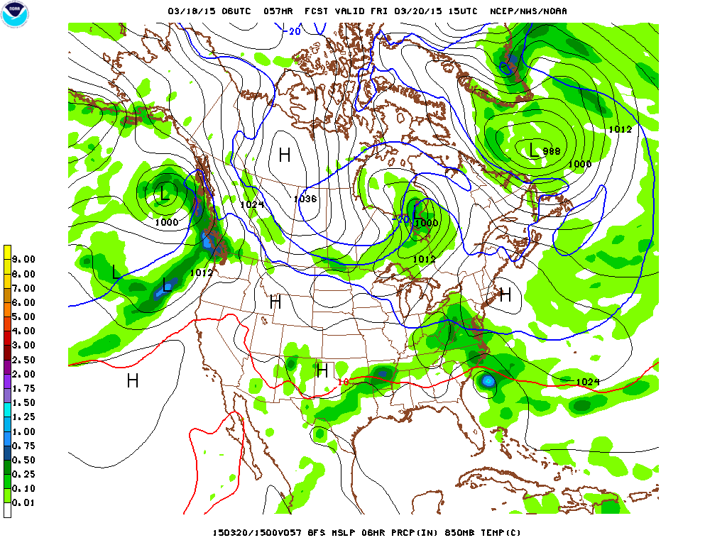
No matter the precipitation type, the first day of spring will not feel very “spring-like.” It will be a wet and raw day with highs in the upper 30s to low 40s.
Light rain will continue during the afternoon hours and into the evening before ending after sunset.
A cold front will pass through on Saturday but highs will likely hit the mid 50s prior to the passage. Behind the front, temperatures dip again, with highs on Sunday and Monday only reaching the low to mid 40s with mostly sunny skies each day.
Stay up to date with storm information on your favorite social media site!
Follow me on Twitter, Facebook and Google+!