
A Winter Storm Watch has been issued for: Allegeny, Frederick, Garrett and Washington counties.
With a very cold airmass in place, an area of low pressure will approach from the southwest today and move into the area tomorrow.
Moisture will overspread the area from southwest to northeast and fall as snow during the day tomorrow. The storm will take a track just to our west, pulling in warmer air tomorrow night and changing the snow over to a wintry mix. East of the mountains, the wintry mix will change to plain rain during the overnight and into Sunday morning.
At this time, the potential exists for several inches of snow before the changeover occurs. The changeover will happen quicker across southern Maryland where up to an inch of snow is possible before mixing and changing over during the evening, while further west it will snow into the night time hours before mixing. In far western Maryland, it will likely remain all snow, leading to the highest totals.
Here is my snowfall forecast with the approximate start times in red:
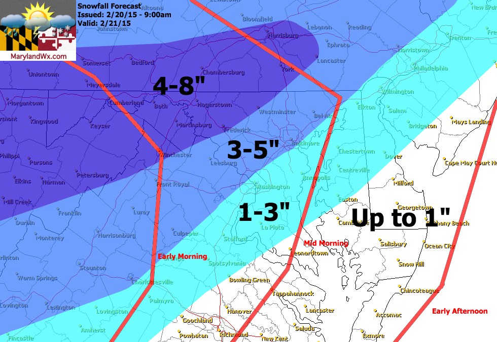
By Sunday morning, just about everyone east of the mountains should be seeing plain rain but there may be a brief changeover back to snow before it ends Sunday afternoon.
Behind the system, another shot of cold arctic air will move in. Sunday night, lows will fall into the mid 10s, and Monday’s highs will likely only reach the low to mid 20s.
This snowfall forecast will be updated this evening if necessary.