
The models have maintained their solutions today, bringing an area of low pressure towards the area tomorrow and sliding it off the North Carolina coast.
Winter Storm Watches have been issued by the National Weather Service for the entire state in the expectation of our most significant snowfall of the season thus far.
Timing:
Currently, it appears light snow will develop from southwest to northeast during the late afternoon and evening hours tomorrow. The snow will become heavier tomorrow night and into Tuesday morning. It will then taper off from southwest to northeast during the morning hours Tuesday.
Accumulations:
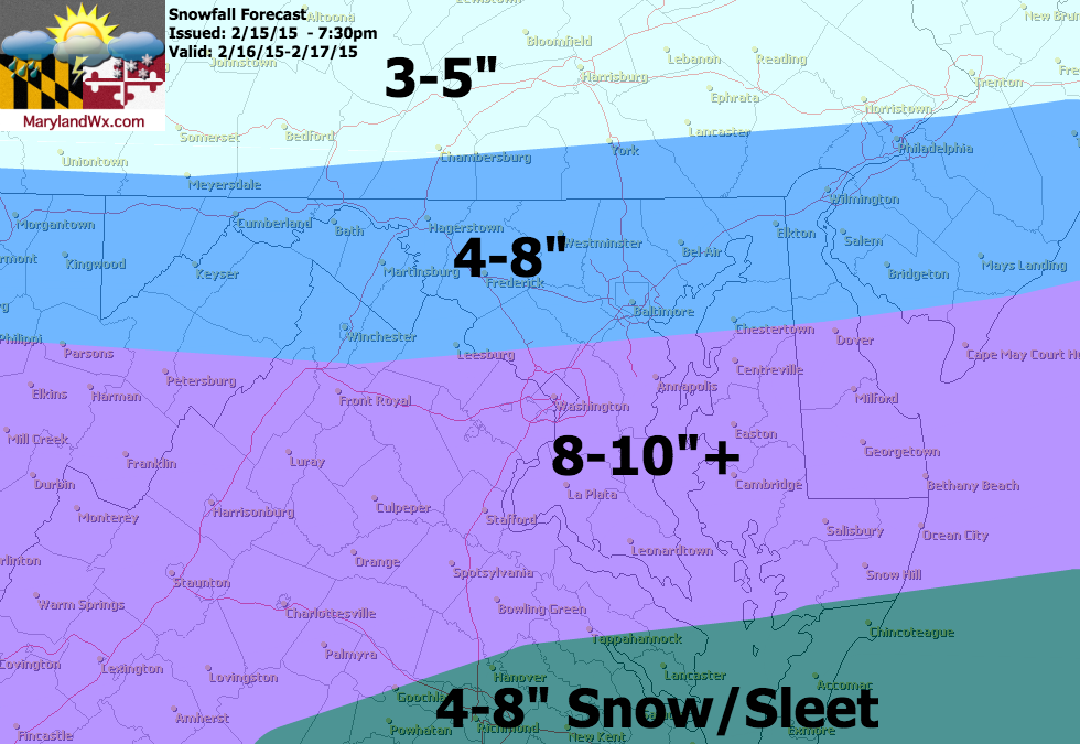
Snow totals will be greatest across southern portions of the state and will taper down as you head northward. At this time, it looks like southern Maryland will see 8-10″ with isolated spots around 12″. Further north, totals will range from around 4″ near the Mason-Dixon line to about 8″ across central Maryland.
Behind the system, another shot of very cold air will work in. Expect temperatures back in the teens and 20s for highs for the latter half of the week.