
A Winter Storm Watch has been issued for Garrett county.
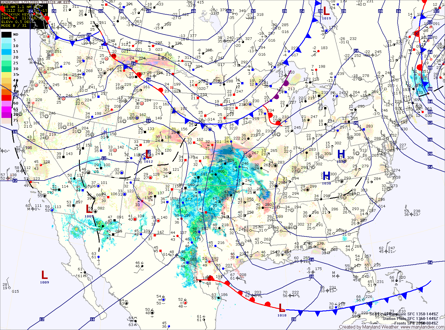
A few days ago, the models had cold Canadian high pressure suppressing the storm to the south and keeping it south of our area. This would have kept us on the cold/northern side of the low, resulting in a moderate snowstorm.
Over the past 2 days, the models have gotten a better handle on how that area of high pressure will interact with the storm. The high is further west than originally modeled which allows the storm to travel further north on its journey eastward.
As a result, cold air will be in place at the start allowing light snow to develop during the evening tomorrow. The snow will continue and pick up in intensity tomorrow night, resulting in minor accumulations before it begins to changeover to a wintry mix. The mix will continue into the overnight before changing to plain rain around midnight. Temperatures will rise into the mid 30s during the night as the rain continues into early Monday morning.
As the storm moves east of the area, colder air will begin to flow back in possibly changing the rain back to snow before ending Monday morning. Light snow showers may continue into Monday afternoon, with a dusting possible from this activity.
At this time, only minor snow accumulations are expected across the state, except in Garrett county where up to 6″ of snow is expected.
During the transition, there will likely be a period of frozen precipitation that could result in minor ice accumulations before temperatures warm above freezing tomorrow night.
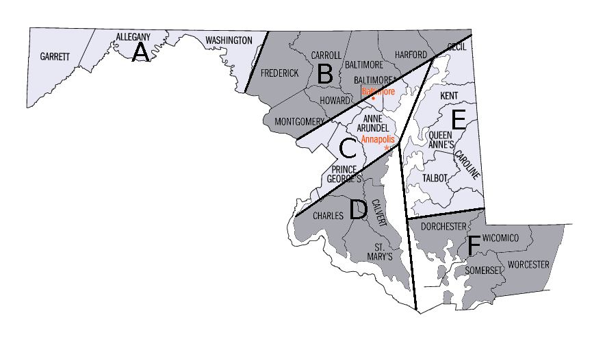
Zone B: Snow, mixing with and changing to sleet and freezing rain Sunday night. The mix may turn back to snow before ending Monday morning. 2-4″ of snow and sleet is possible along the Mason-Dixon line, 1-2″ further south.
Zone C: Snow, changing to sleet and freezing rain before changing to plain rain Sunday night. The rain may mix with or change back to snow before ending Monday morning. An inch or less of snow and sleet accumulation is expected before the changeover.
Zone D: Snow, changing to sleet and freezing rain before changing to plain rain during the late evening hours. The rain may mix with or change to snow before ending Monday morning. Little to no snow and sleet accumulation is expected.
Zone E: Rain, changing to a wintry mix during the evening hours and then back to plain rain Sunday night. The rain may mix with or change back to snow before ending Monday morning. Little to no snow accumulation is expected.
Zone F: Rain, changing to a wintry mix during the evening hours and then back to plain rain Sunday night, possibly mixing with or ending as snow Monday morning. No snow accumulation is expected.
Behind the system, it will turn windy and colder once again, with lows plunging into the lower teens Monday night.