Current TemperaturesVery cold air pushed into the region last night on gusty northwest winds. Those winds will continue to gust today and temperatures will only warm into the low to mid teens for highs this afternoon.
The good news is that this bitter cold will be short lived. Lows tonight will drop back down into the single digits but will rebound into the mid to upper 20s tomorrow afternoon under mostly sunny skies.
The warming trend continues on Thursday as highs push into the mid 30s.
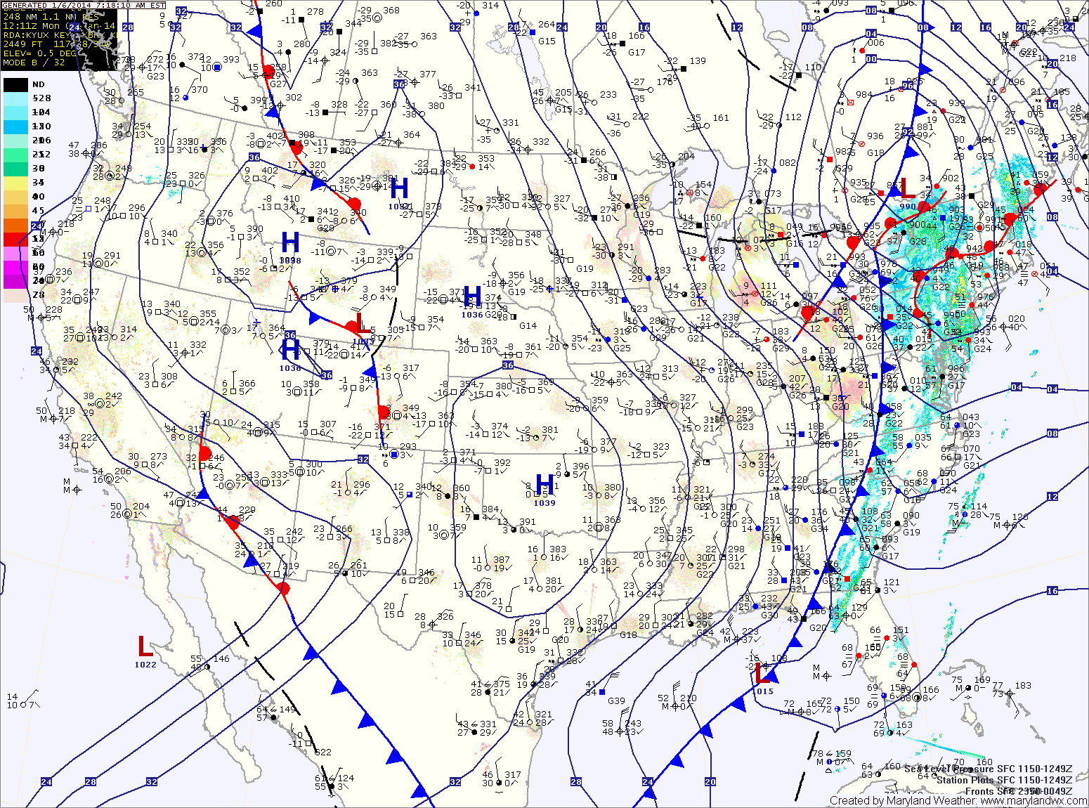
Current Surface MapA cold front is pressing eastward toward the area this morning with scattered showers. This front is separating temperatures in the 40s from the leading edge of a polar airmass that will spill into the area this afternoon. Today’s high temperature was hit this morning, 45 degrees at 7:41. Temperatures will continue to fall today, into the low 30s by evening.
A Wind Chill Advisory is in effect for tonight through 6pm tomorrow. Winds will increase tonight and temperatures will plummet to around 5 degrees. The combination of cold and wind will make it feel like -5 to -15 degrees.
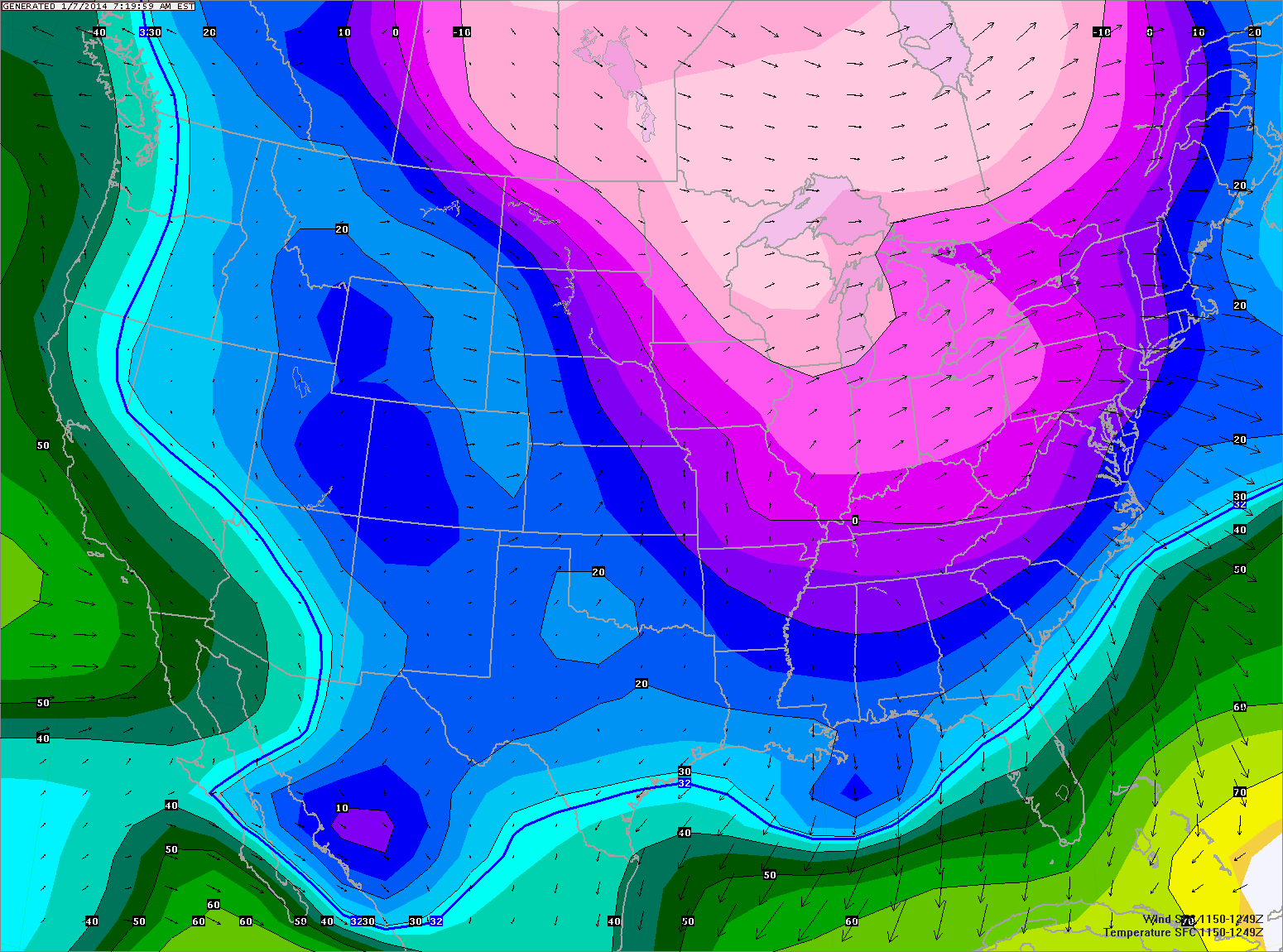
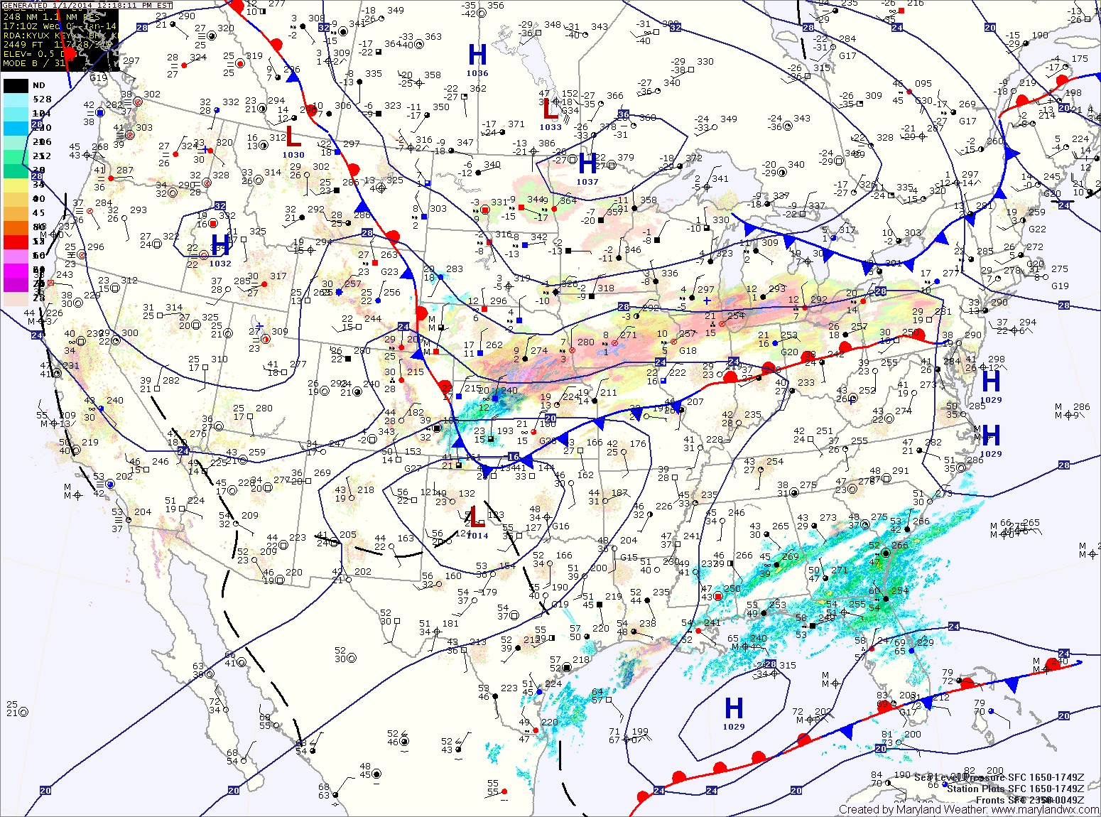
Current Surface MapThe storm system that brought snow to the state last night is now moving off the New England coast. Snowfall totals ranged from 1 inch in Southern Maryland to 7.5 inches in Harford county. For a listing of area snow totals compiled by the National Weather Service, click here.
Behind the system, gusty northwest winds are ushering in very cold air. Today’s high was at midnight and temperatures will remain in the upper teens to near 20 this afternoon.
Temps will likely fall into the single digits tonight before rebounding into the low 30s tomorrow under sunny skies.
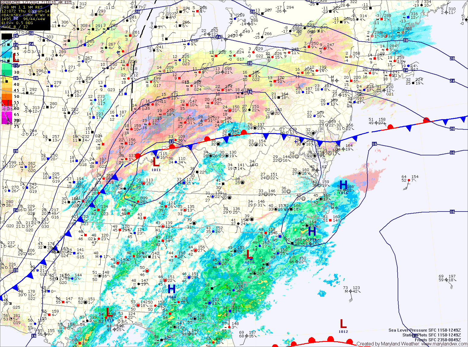
Current Surface MapA storm system is still on track to bring precipitation to the area this evening into tomorrow. The precip will start as rain or a rain/snow mix this evening then change to snow tonight.
Generally, 1-3″ are likely across central and southern Maryland while 2-4″ are likely across northern Maryland. A Winter Weather Advisory is in effect for that area.
The storm will strengthen rapidly as it pulls north of the area tonight into tomorrow. Winds will pick up, gusting to around 30mph as colder air is pulled into the area. Highs tomorrow will only be in the upper teens to around 20.
Temperatures will warm this weekend as southerly flow develops. Saturday will be mostly sunny with highs in the low to mid 30s.
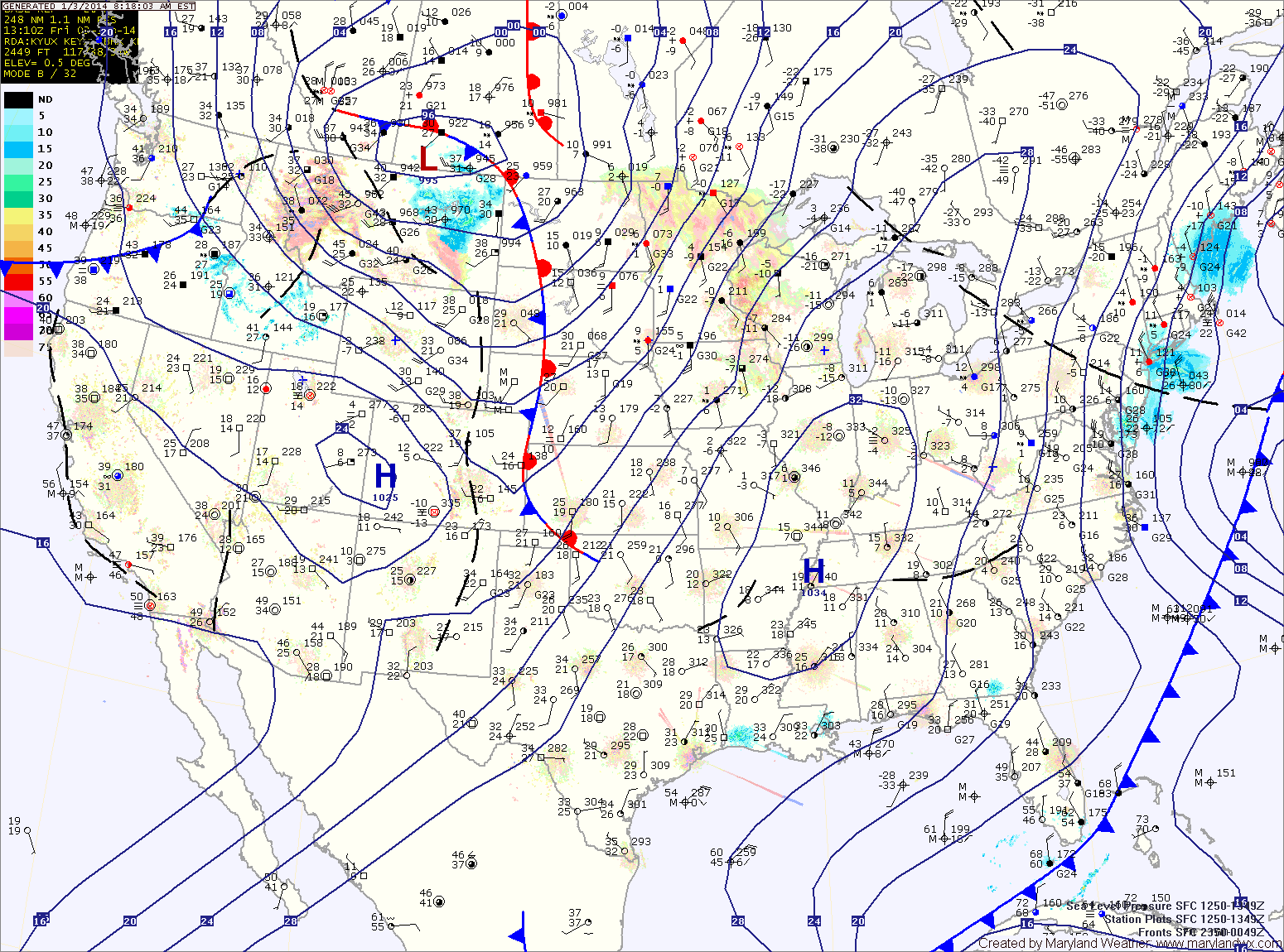
Current Surface MapA complicated setup will bring light snow to the area tomorrow evening into Friday morning.
A northern stream of energy currently over the midwest is sliding south and east towards the coast while a storm system is developing along the Gulf coast. These two pieces of energy will combine to form one low off the mid-atlantic coast. The combined storm will intensify as it moves northeastward and will likely bring blizzard-like conditions to areas of the northeast.
Here in Maryland, the storms will combine too far north to bring significant snowfall to the state. Current trends favor a light snowfall in the order of 1-3 or 2-4 inches with highest amounts in the northeast portion of the state.