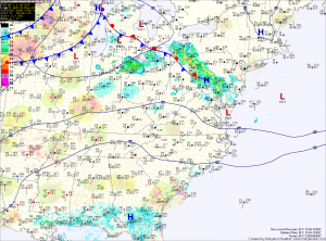
Additional rainfall is expected this afternoon and evening across most of the state as scattered showers and thunderstorms develop. Some of these storms may become severe, with damaging winds being the greatest threat. Highs today will reach the mid to upper 70s.
A cold front will move into the area tonight and pass through tomorrow. The front will bring another round of scattered thunderstorms tomorrow afternoon. It should clear the state during the evening hours, ending rain chances and bringing in cooler and drier air. Highs tomorrow will be in the low 80s.
Northwest flow behind the front will provide breezy conditions on Friday. Expect mostly sunny skies with increasing clouds in the afternoon with highs in the mid to upper 70s.
Saturday will start out mostly sunny, but instability could lead to an isolated thunderstorm during the afternoon. Highs will be in the low 70s.
Sunday will be sunny, with highs in the mid to upper 70s.
We remain dry as we move into next week, with mostly sunny skies on Monday and highs around 80.
Yesterday’s Weather Station Stats:
High Temp: 79.6°
Low Temp: 47.7°
Rain: 0.00″
