
With high pressure overhead, expect a quiet start to the week. Today and tomorrow will be mostly sunny with highs around 30.
An area of low pressure will develop over the southeast Wednesday and move towards the northeast on Wednesday night. The exact track of the low is uncertain at this time, but the models are converging on the idea of a track up the coast, resulting in a major east coast snow storm.
It is too early to tell how much snow we will receive or if the snow will mix with sleet or rain, but at this time, it appears that during the late Wednesday and Thursday timeframe, we will be impacted by this storm.
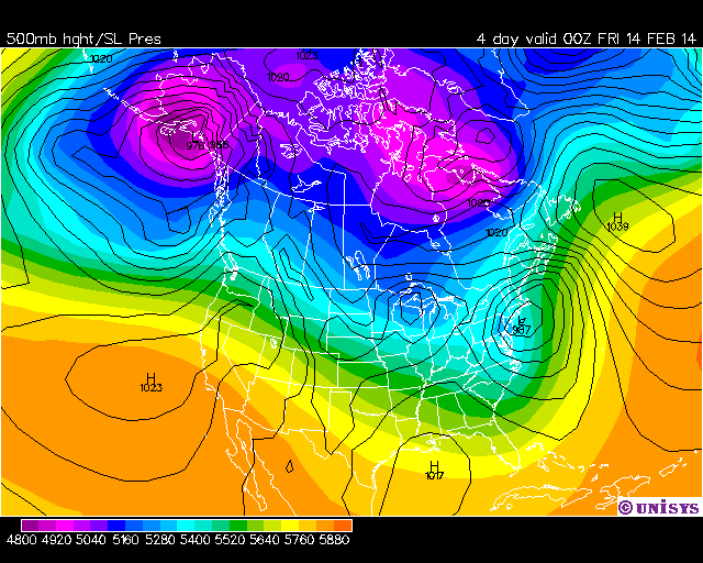
If the track is along the coast, but not far enough east, the snow will mix with or even change to rain.
As you can see, there are a lot of details to be worked out and as is always the case with coastal storms, the exact track of the low will determine what impact it has to our area.
The details are coming into focus but will need to be refined over the next day or two before snowfall forecasts can be made.
Behind that system, a series of clipper-like lows will move through this weekend, keeping skies generally cloudy with light snow chances Saturday night into Sunday.
Yesterday’s Weather Station Stats:
High Temp: 31.7°
Low Temp: 18.9°
Rain: 0.00″