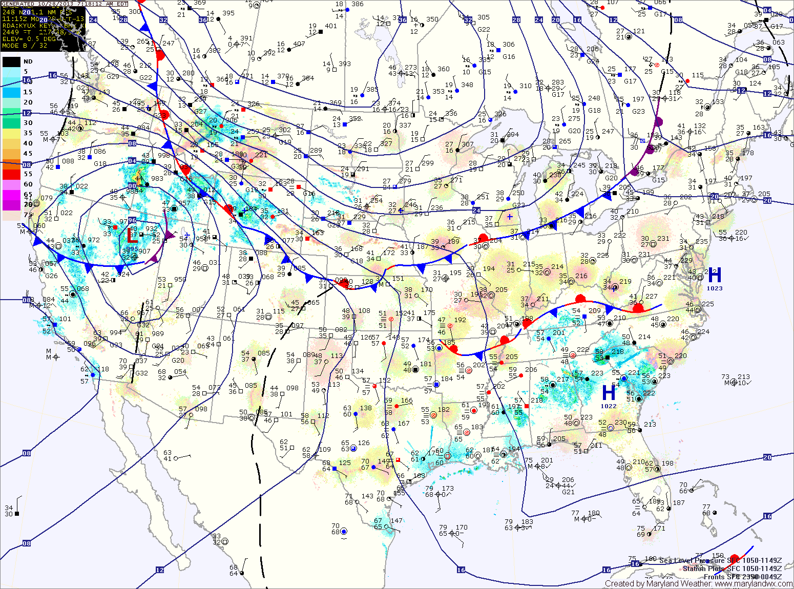
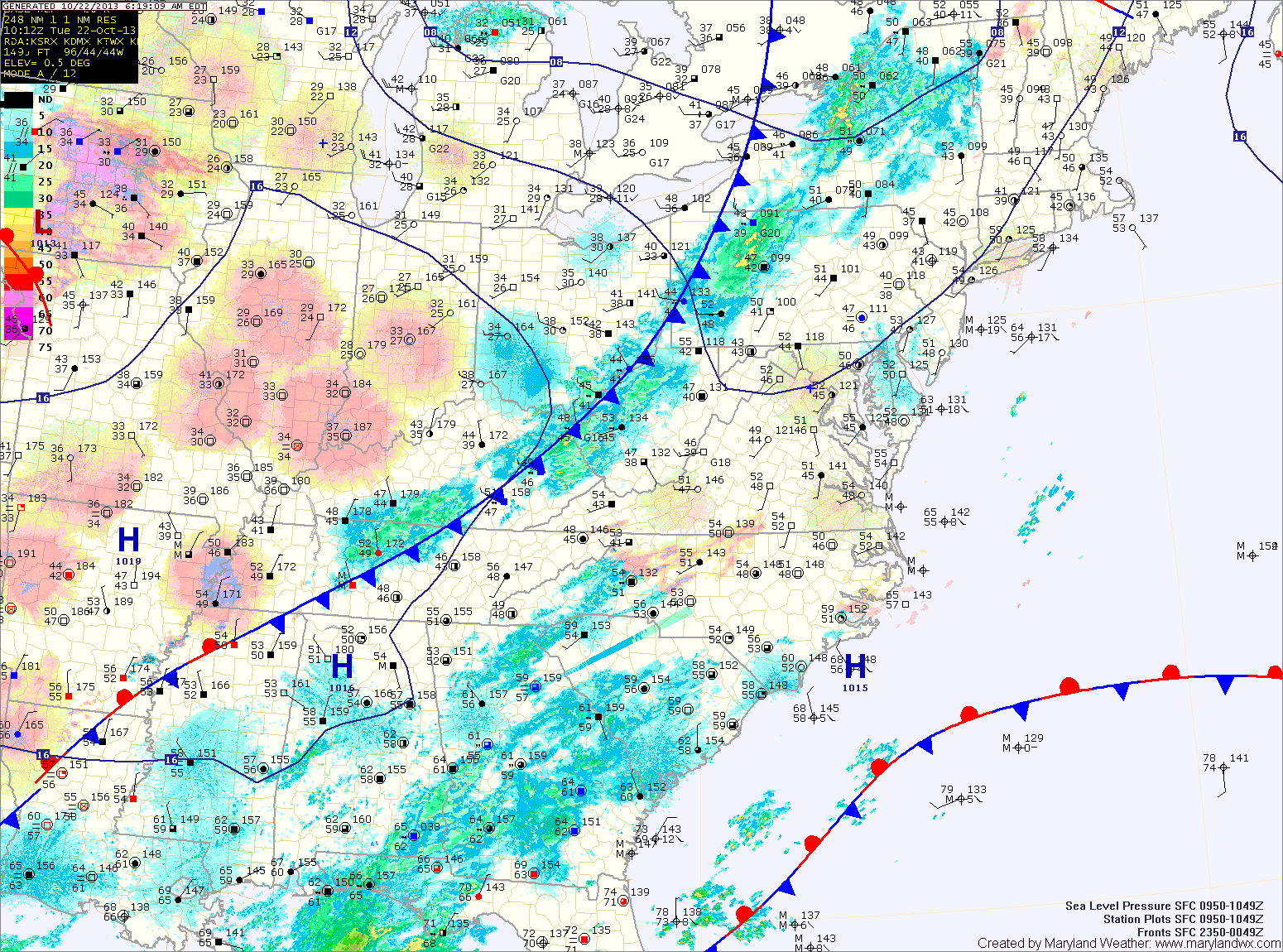
Current Surface MapA strong cold front is approaching the area from the west. Out ahead of the front, gusty winds, along with showers and a line of thunderstorms are currently moving through. The rain should come to an end this afternoon as the front moves to the east.
Temperatures are already near 70 and will top out in the low 70s before dropping a bit behind the front.
An upper level trough will swing through tomorrow, bringing a reinforcing shot of cold air and clouds to the area. A few showers are possible in the mountains. Highs will be in the mid 60s under partly sunny skies.
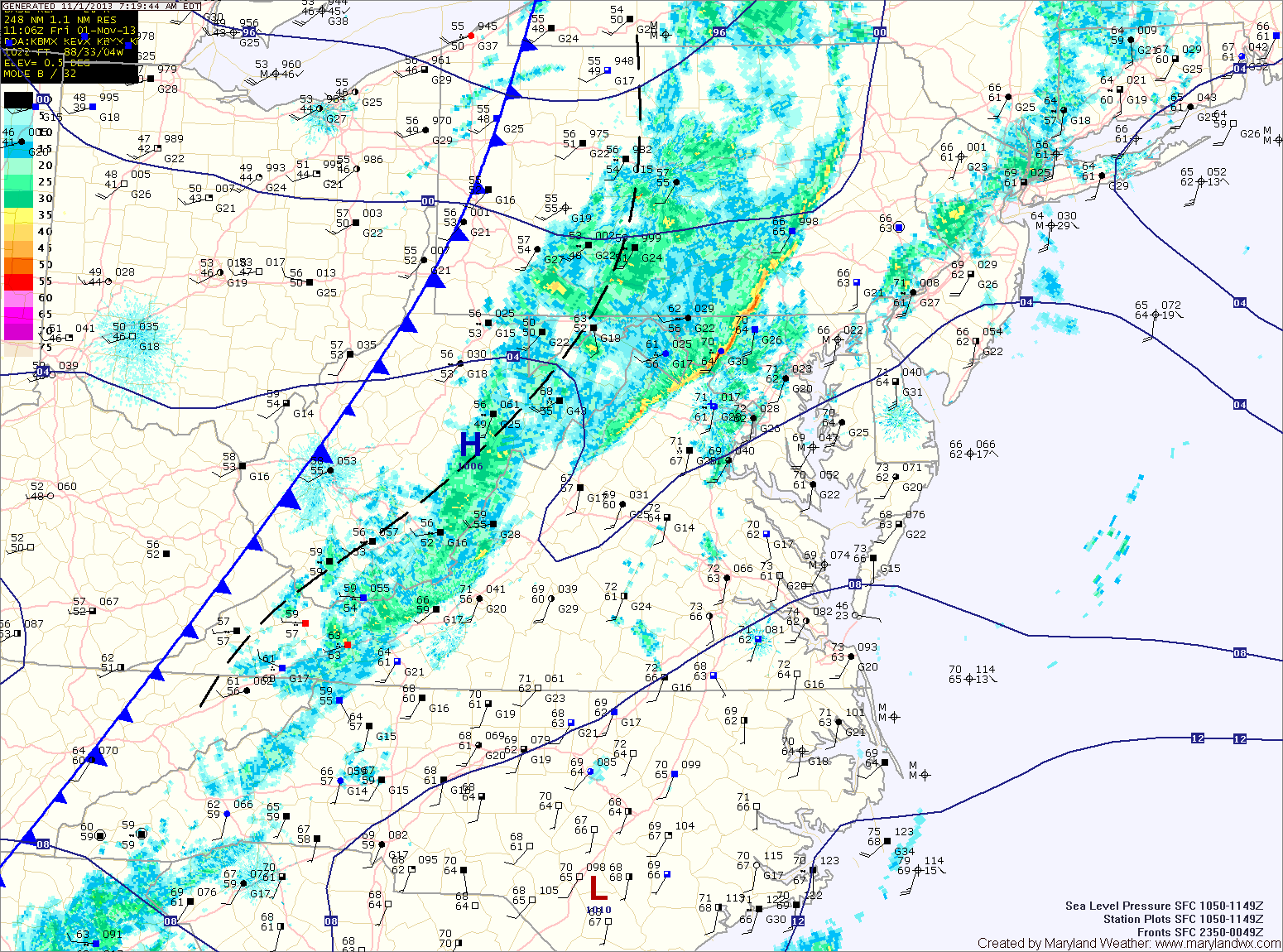
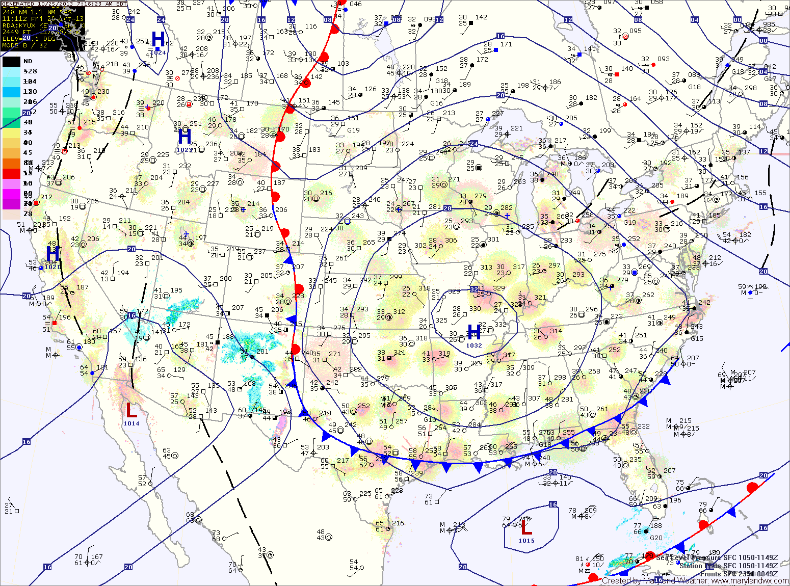
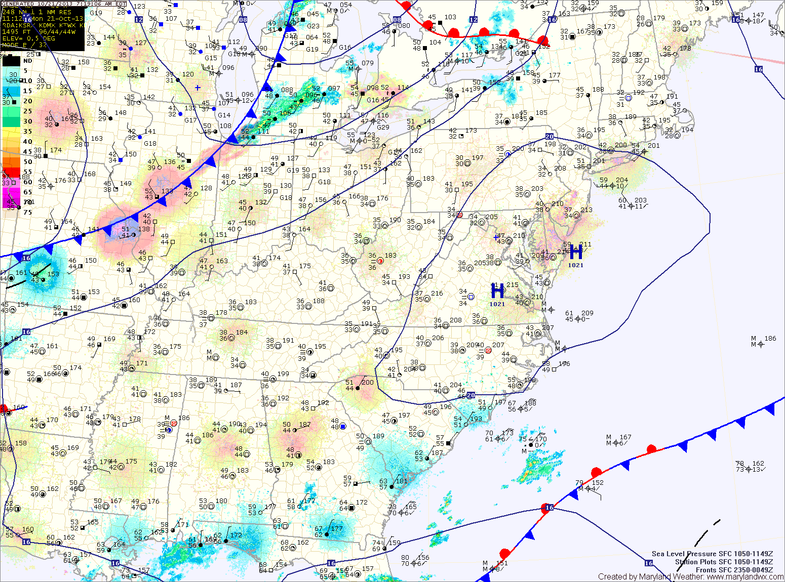
Current Surface MapAreas of fog will give way to partly sunny skies this afternoon. Southerly winds will increase through the day as a cold front approaches from the west. Highs today will be in the low 70s.
The front will spread rain showers and isolated thunderstorms into the area late tonight. Some of the showers and storms may produce locally gusty winds.
The front will continue to push showers and isolated storms through the area tomorrow The front will slow and may even stall along the bay Friday afternoon and evening. This will allow shower chances to persist into tomorrow night. Highs will be around 70 degrees.
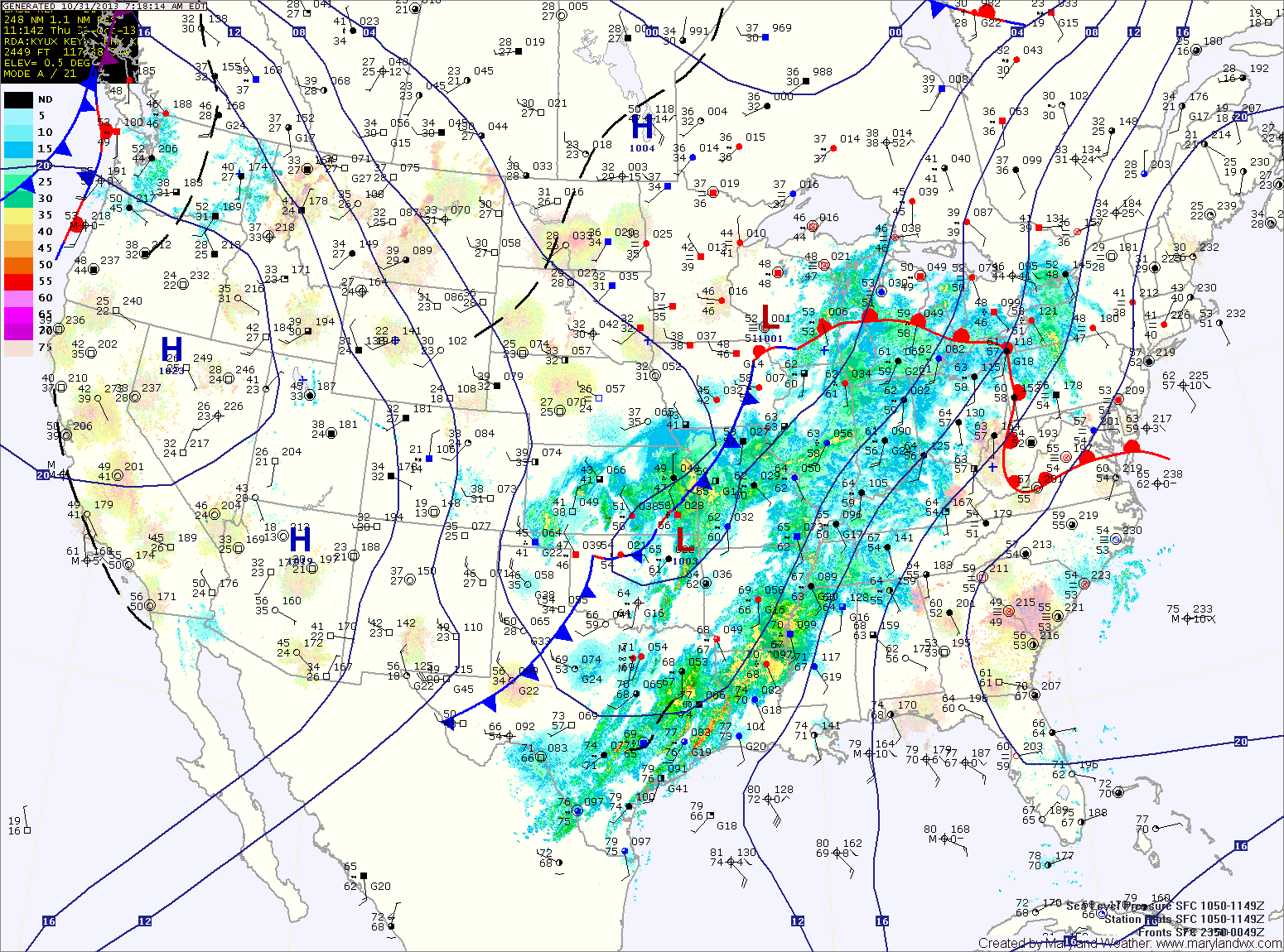
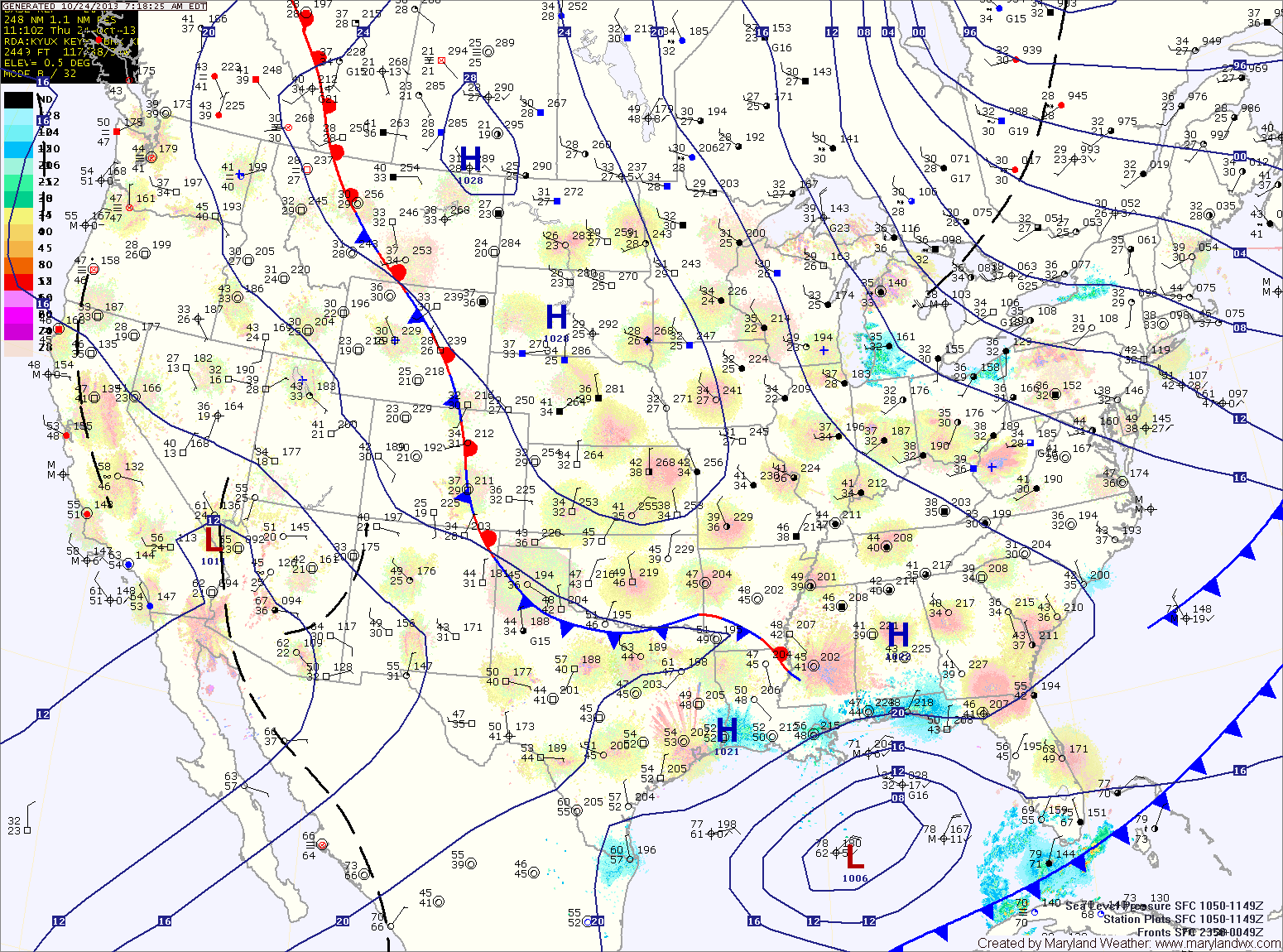
Current Surface MapAreas of light rain are moving through the state this morning while a warm front remains to our south. The front will lift northward this afternoon, bringing an end to the rainfall. Highs today will be in the low to mid 60s.
Tomorrow will see generally cloudy skies. Southerly flow ahead of an approaching cold front will increase winds through the day, with gusts near 25 mph by tomorrow night. Highs will be around 70 degrees.
The front will spread rainfall into the area late tomorrow night or early Friday morning. Winds will continue to gust to near 25 mph through the day on Friday. Additionally, an isolated thunderstorm is possible Friday with localized strong gusty winds. Highs on Friday will be in the low 70s.
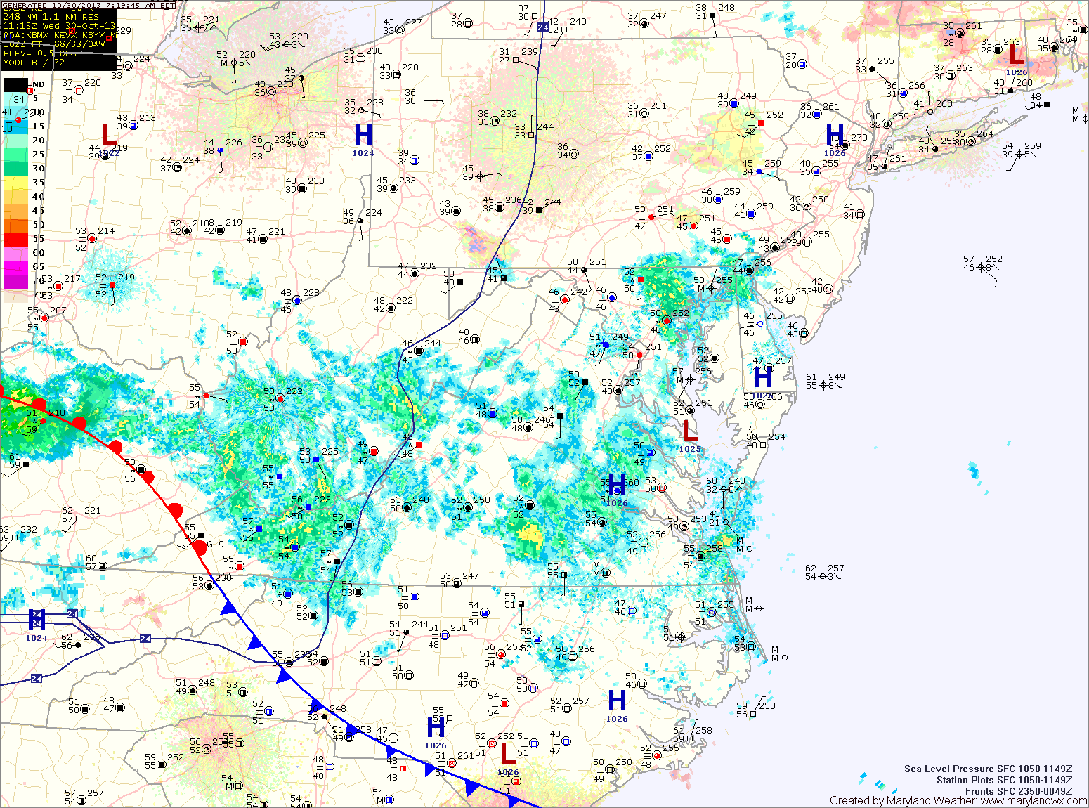
Current Surface MapHigh pressure will build into the area today, leading to mostly sunny skies. Highs will be around 60.
A disturbance will spread clouds and possibly a shower into the area tonight and tomorrow. Otherwise, expect partly sunny skies with highs in the mid 60s.
A cold front will approach on Thursday, spreading abundant Gulf moisture northward into the region. Scattered showers are possible Thursday evening. Highs will be near 70.
More wide-spread showers are expected Thursday night and there could even be a few embedded thunderstorms. These storms could produce strong gusty winds.
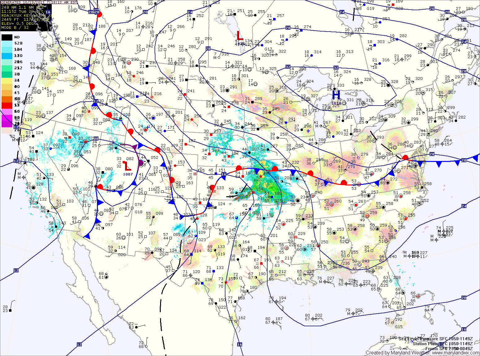
Current Surface MapA weak cold front will move through this afternoon, doing nothing more than shifting the winds to the northwest. Expect mostly sunny skies and highs in the low 60s.
Tomorrow will be mostly sunny with highs in the upper 50s.
Wednesday will see an increase in clouds and perhaps a few afternoon showers as a disturbance moves by. Highs will be in the low to mid 60s.
Thursday will feature more clouds than sun as a cold front approaches from the west. Highs will approach 70 degrees as southerly flow develops ahead of the front.
Current Surface MapToday will be very similar to yesterday. Breezy and cool under variable clouds. Highs will be in the low 50s.
Another night of low temperatures near or below freezing for most areas away from the water tonight.
After a chilly start, tomorrow will be sunny with highs in the mid to upper 50s.
A weak cold front will move through tomorrow night bringing scattered clouds with it as it does. The front will clear out on Sunday morning and afternoon highs will reach the mid to upper 50s under mostly sunny skies.
Current Surface MapNorthwest flow around an upper level trough over the eastern US will keep temperatures down through the weekend. Today will be mostly sunny and breezy with highs in the low to mid 50s. Temperatures will drop to near freezing tonight east of and along I-95, below freezing further west, under mostly clear skies.
Tomorrow will be very similar to today. Mostly sunny, breezy and cool with highs in the low to mid 50s.
Lows tomorrow night will again be near freezing along and east of I-95 and below freezing to the west.
Current Surface MapAn area of low pressure is moving northeast and away from the area this morning. The low has brought light rain, mainly to the southern and eastern portions of the state. Expect decreasing clouds today and highs in the mid 50s.
Cooler air will flow into the region tonight and tomorrow. Upslope rain and snow showers are likely in the mountains and lows in the mid 30s are expected across central and eastern portions of the state tonight.
Tomorrow will be mostly sunny with highs in the low to mid 50s.
A reinforcing shot of colder air will move in tomorrow, and highs on Friday will be in the low 50s with overnight lows dropping to near freezing Friday night.
Current Surface MapA cold front will push through today with limited moisture. Expect clouds to increase into the afternoon, with highs in the upper 60s.
An area of low pressure will form along the front and move towards the area tonight and tomorrow morning. Expect light rain to develop tonight, lasting through the morning hours tomorrow.
Behind the system, breezy northwest winds will bring in colder and drier air. Highs will be in the upper 50s.
Several upper level disturbances will pass through Thursday and Friday, bringing more clouds and reinforcing the colder air. Highs on Thursday will be in the mid 50s while highs on Friday will be held in the low 50s. Friday night could see temperatures drop to near freezing by Saturday morning.
Current Surface MapAfter starting out in the mid 30s this morning, temperatures will climb to the upper 60s this afternoon under sunny skies.
Clouds will increase tomorrow as another cold front approaches from the west. Highs will be in the low to mid 60s.
The front will cross tomorrow night, bringing scattered showers while an area of low pressure develops along it and brings more showers Wednesday morning and into the afternoon.