URGENT - WINTER WEATHER MESSAGE NATIONAL WEATHER SERVICE BALTIMORE MD/WASHINGTON DC 1009 AM EST MON DEC 9 2013 WASHINGTON-FREDERICK MD-CARROLL-NORTHERN BALTIMORE-HARFORD-MONTGOMERY-HOWARD-SOUTHERN BALTIMORE-PRINCE GEORGES-ANNE ARUNDEL INCLUDING THE CITIES OF...HAGERSTOWN...FREDERICK... WESTMINSTER...GAITHERSBURG...COLUMBIA...BALTIMORE...ANNAPOLIS... ..WINTER…
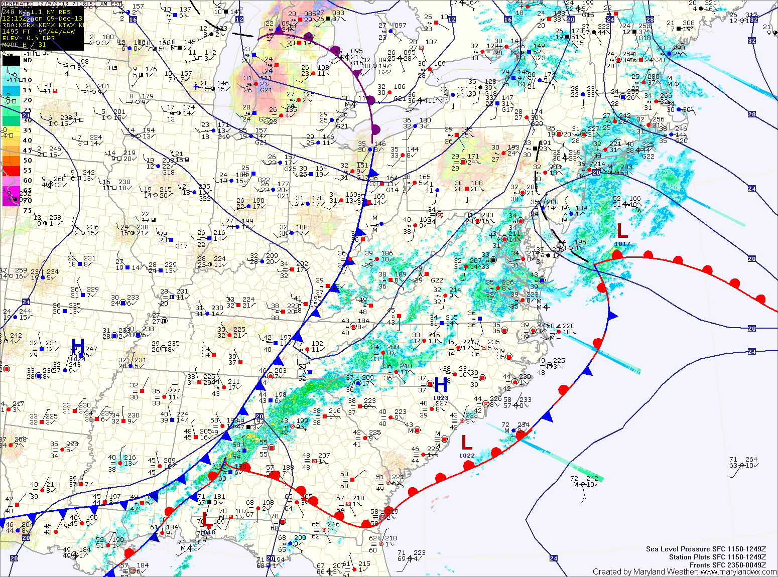
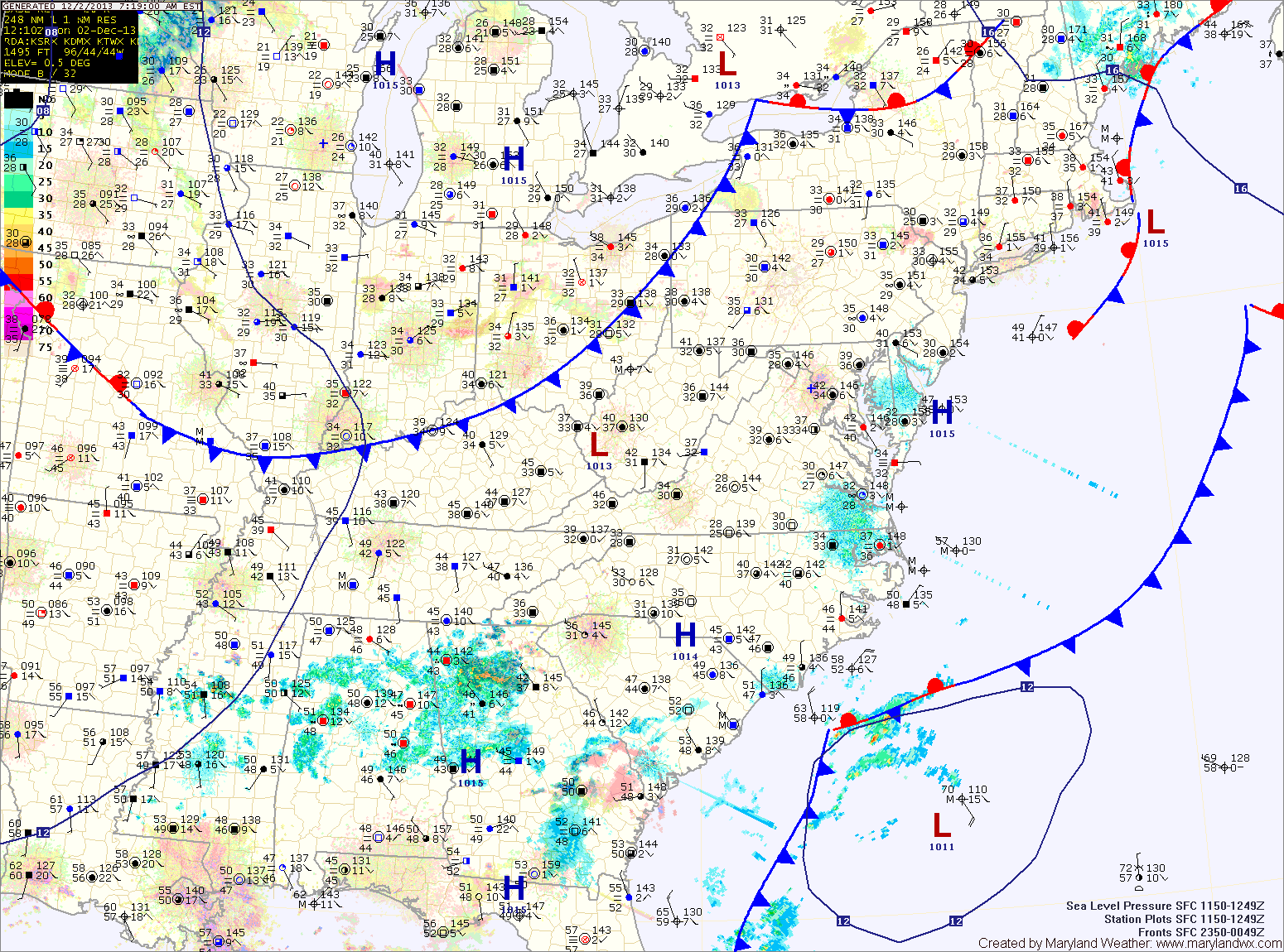
Current Surface MapAs one storm leaves the area today, another system will bring another shot of precipitation tomorrow.
Temperatures are slowly climbing above freezing across the state this morning as scattered drizzle/freezing drizzle continues to move through. Highs today will climb towards 40 degrees by this afternoon.
A cold front will push into the area tonight with another round of precipitation. Light rain or snow showers will move in during the overnight, turning to snow tomorrow. An inch or two of snow is possible before it ends tomorrow afternoon or evening. Highs will be in the low 30s.
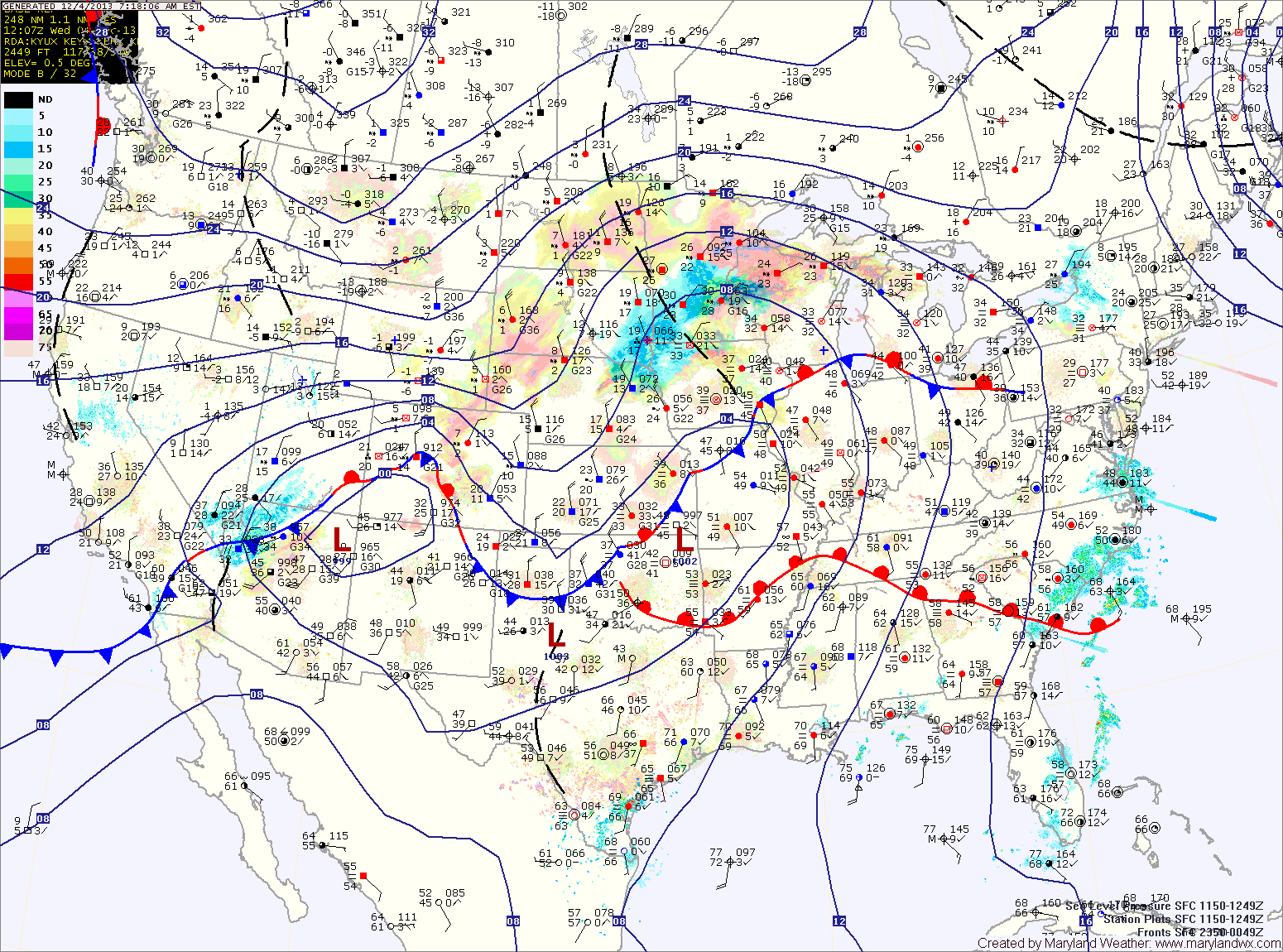
Current Surface MapA warm front currently moving through the state has spread ample moisture up the coast resulting in foggy, misty conditions. Highs today will be in the mid 60s.
A cold front is approaching from the west and will move into the area tonight. Expect showers to break out before daybreak tomorrow morning.
Rain chances will increase through the day tomorrow and last thorough tomorrow night. Highs will be in the low to mid 50s tomorrow.
Saturday will be a transition day, as the cold front settles to our south allowing partial clearing. It will be colder with highs in the low 40s.
Cold high pressure will continue to settle into the region late Saturday and Saturday night. This will set the stage for Sunday as an area of low pressure approaches from the southwest.
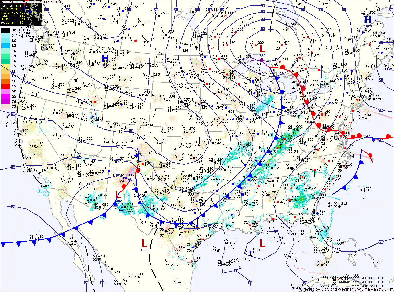
Current Surface MapClouds have overspread the area as a warm front approaches from the south. The front will move through tonight, increasing moisture which may lead to patchy drizzle during the overnight. Highs today will warm into the low 50s.
Clouds will decrease slightly tomorrow morning before increasing again ahead of a cold front. The front will bring showers to the area tomorrow night. Highs will be warmer than today, pushing into the mid 60s ahead of the front.
The front will slow down and possibly stall out over the area on Friday. Expect periods of rain through the day on Friday and into Friday night. Highs will top out in the upper 50s.
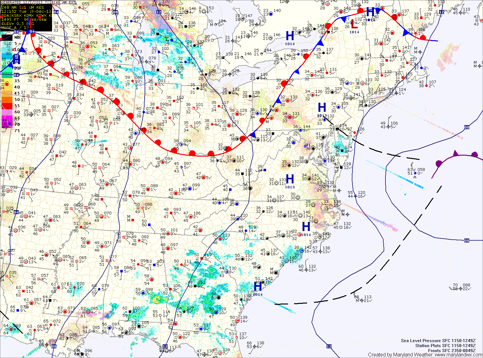
Current Surface MapHigh pressure will push into the area this afternoon. As it does, it will scour out the stagnant air that has prompted Air Quality alerts across the state. Expect a bit more sunshine this afternoon as highs push into the low 50s.
A warm front will move into the area tomorrow, bringing a return to cloudy conditions by the afternoon and perhaps light rain or drizzle tomorrow night. Highs will be in the low to mid 50s.
A slow moving cold front will approach on Thursday, bringing a slight chance of showers to the area. Highs will be in the low 60s.
Current Surface MapAn area of low pressure is developing off the Carolina coast. This system has spread clouds into the area today. Highs will top out in the upper 40s to around 50.
The system will move away from the area tonight and tomorrow as high pressure moves in. Tomorrow and Wednesday will be similar to today, a little warmer, with a bit more sun. Highs will be in the mid 50s.
A cold front will approach on Thursday, spreading showers into the area. Highs will warm into the low 60s.
The front will be a slow mover and may stall out near the area. This will keep rain in the forecast on Friday. Highs on Friday will be in the low 50s.