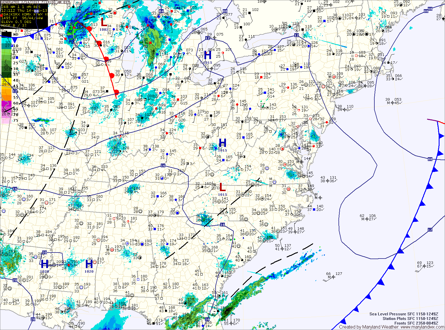
Current Surface MapLast night’s rain/snow has created very icy conditions this morning. The good news is that temperatures will rise above freezing over the next hour or so and will top out in the mid to upper 40s under mostly sunny skies.
Clouds will increase tomorrow as two cold fronts pass through. The models are showing signs that an area of low pressure will develop along the second front late Friday, bringing another round of rain to snow during the overnight. The possibility exists for another light accumulation by Saturday morning.
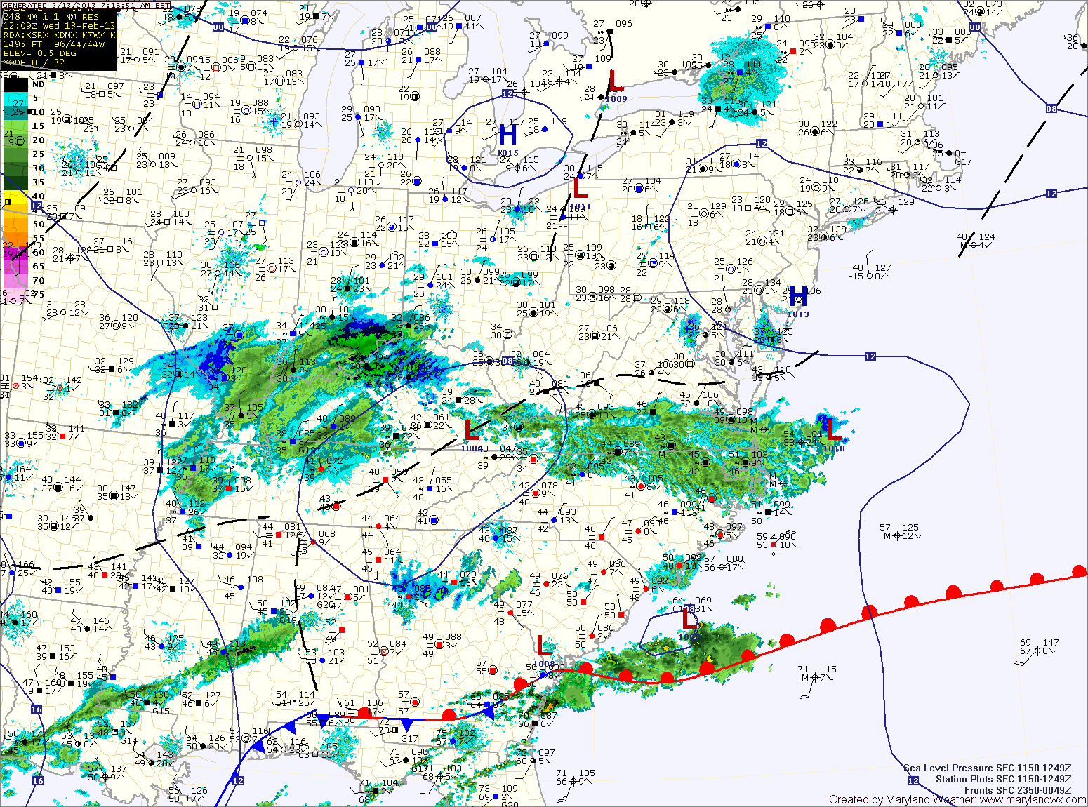
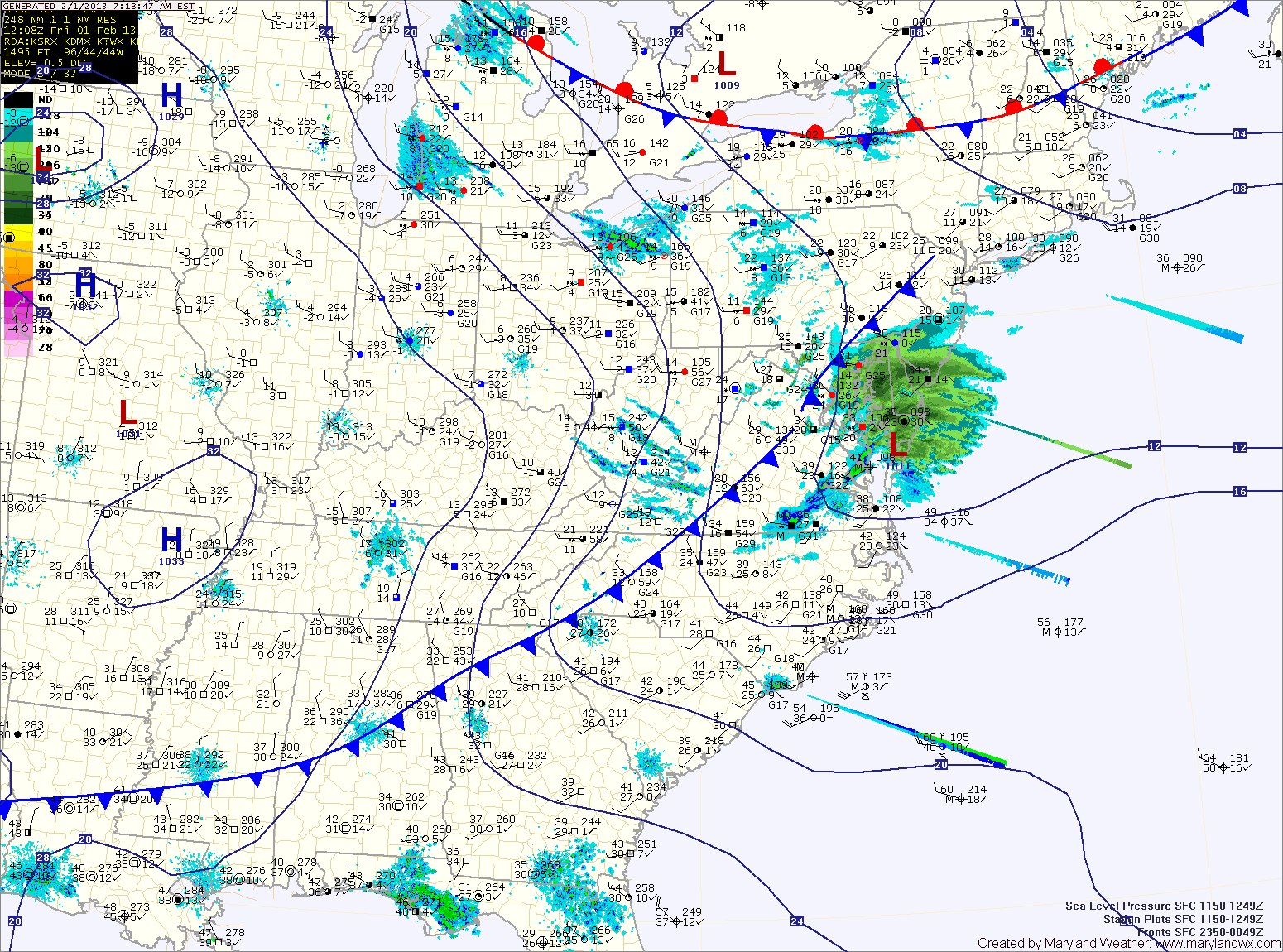
Current Surface MapLow pressure moving across the southeast will slide off the Virginia coast tonight. As it does, light rain will develop across the state this afternoon. Highs today will be around 40 degrees.
As temperatures drop tonight, the rain will mix with and then change to snow. An inch or two of snow is possible across northern Maryland, up to an inch across central Maryland with little to no accumulation across southern Maryland.
Skies will clear tomorrow, with a mostly sunny afternoon. Highs will be in the mid to upper 40s.
Friday will be dry, with clouds increasing through the day as a cold front approaches. Highs will be in the upper 40s to around 50.
Current Surface MapHigh pressure building into the region today will lead to a breezy but sunny day. Highs will top out around 50 degrees.
Clouds will increase tonight ahead of an area of low pressure. The low, currently over eastern Texas, will move northeastward and off the mid-atlantic coast tomorrow night.
The exact track of the storm will determine how much and of what type of precipitation falls. Current thinking is light rain will develop tomorrow afternoon, gradually changing to snow tomorrow evening into tomorrow night.
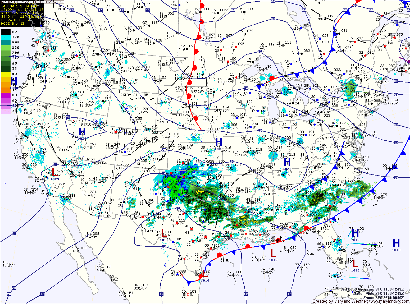
Current Surface MapThe main area of rainfall that brought nearly a half inch of rain overnight continues to push out of the area, leaving isolated to scattered showers behind it.
A cold front will cross the area this afternoon, bringing an end to the rain chances while increasing winds. Highs today will top out in the low 50s.
High pressure controls the weather tomorrow, delivering a mostly sunny day. Highs will be around 50.
Another area of low pressure will move towards the mid-atlantic Tuesday night into Wednesday. This system will bring precipitation to the area Wednesday and Wednesday night. While we’ll be on the colder/northern side of the low, the cold air will be marginal.
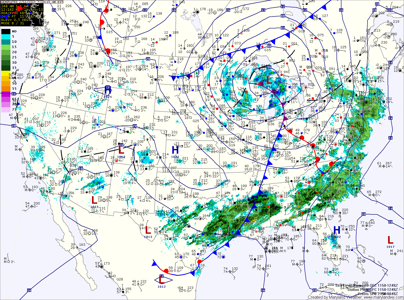
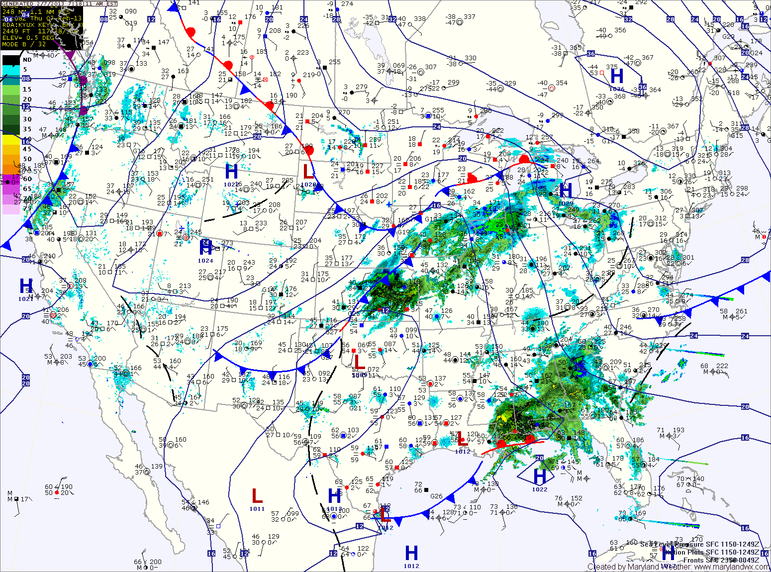
Current Surface MapAn area of low pressure continues to develop into a powerful Nor’Easter off the Carolina coast. As it moves northeast, it will continue to spread rain, sleet and snow over our area and will bring heavy snow and blizzard conditions to New England.
A Winter Weather Advisory remains in effect for counties north and west of I-95. These areas will gradually transition to rain today as highs top out around 40 degrees.
As the storm moves northeast and phases with a secondary low currently over Ohio, it will strengthen rapidly and as it does, colder air will be pulled into our area, possibly changing the rain to snow before ending tonight.
Accumulations of up to an inch are possible, especially over northeast Maryland. Additionally, winds will increase tonight and will gust to near 40mph at times.
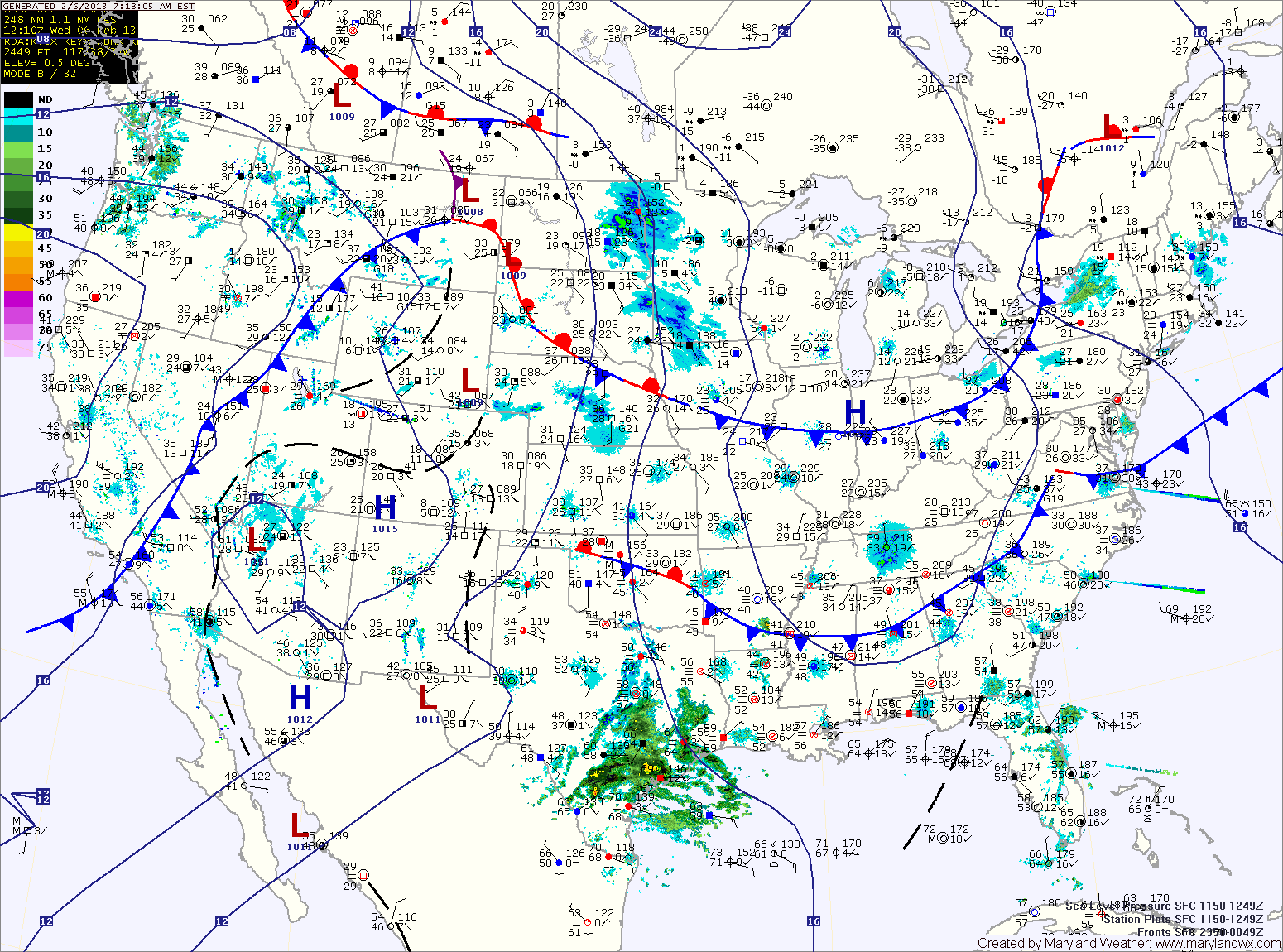
Current Surface MapAn area of low pressure currently over the deep south will combine with energy diving out of Canada to form a strong Nor’Easter. The storm is expected to bring blizzard conditions and possibly historic snows to New England.
The phasing of these systems will occur too late for our area to see any significant precipitation and warmer air will ensure that most if not all that falls will be in the form of rain.
Clouds will continue to overspread the area ahead of the system today. Highs will be in the upper 30s to around 40.
Precipitation will move into the region tonight, possibly beginning as a rain/snow/sleet mix before changing over to plain rain by morning. Rain will continue tomorrow, into tomorrow night, possibly ending as light snow showers. Highs will be in the mid 40s. Winds will increase through the day, possibly gusting to near 40 by tomorrow night.
Current Surface MapToday will be mostly sunny and breezy with a high in the low 40s. Northwest winds will gust to near 25mph this afternoon.
Tomorrow will feature increasing clouds, with a high in the upper 30s to around 40.
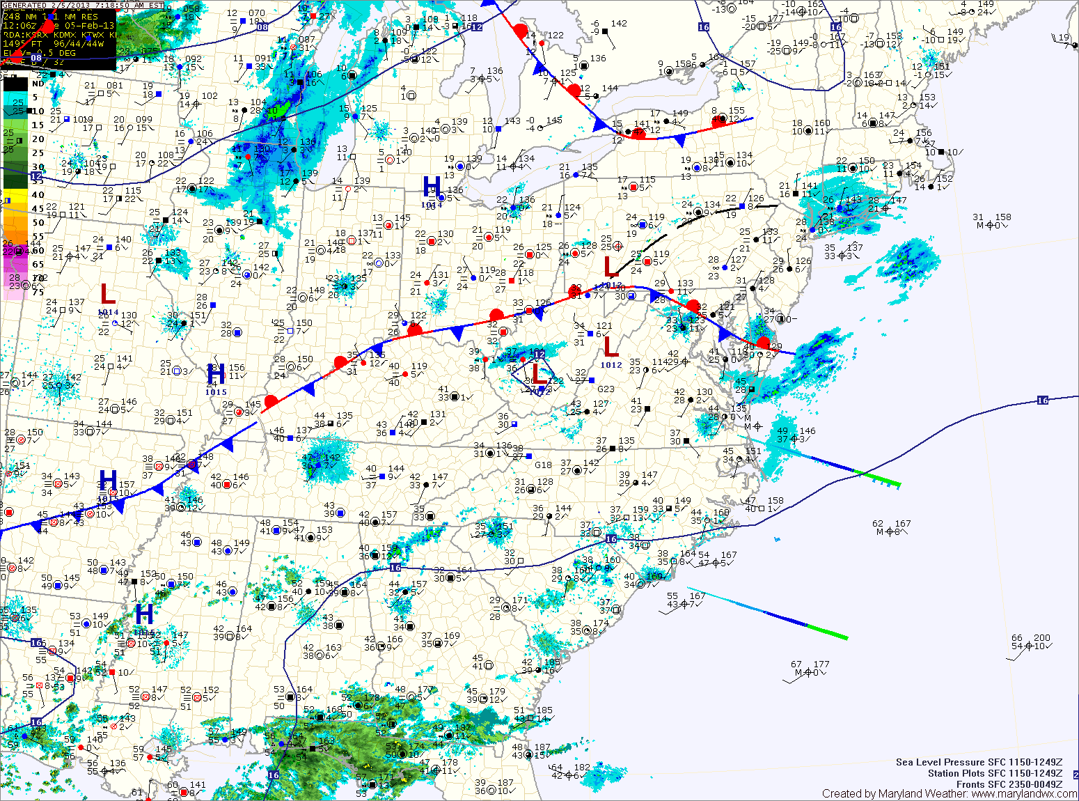
An area of low pressure developing over eastern Texas will move along the Gulf Coast and then up the coast Friday. With a lack of cold air, expect light rain or wintry mix to develop late Thursday night, changing to rain.
The rain will continue Friday into Friday night. Highs Friday will be in the mid 40s.
As the storm moves up the coast, major snowfall is expected to our north into New England.
Current Surface MapA stationary front is draped across the state today, keeping clouds over the area. Highs will top out in the low to mid 40s.
Yet another clipper system moving by to our north will bring another chance of light snow or flurries, mainly in the mountains and across northern Maryland.
Tomorrow will be breezy with clearing skies. Highs will be in the mid 40s.
Expect more of the same on Thursday. Variably cloudy with highs in the mid 40s.
A low pressure system will bring a chance of rain or rain/snow mix Thursday night and Friday. Highs Friday will be in the mid to upper 40s.
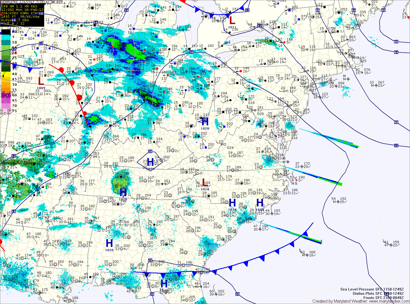
Current Surface MapToday will begin under partly sunny skies, with clouds increasing through the day. A clipper system will bring light snow to the area this evening and tonight. Accumulations will be light, with totals under an inch.
The system is expected to stall near the area tomorrow, continuing a slight chance of light snow or mix as temperatures warm tomorrow afternoon. Highs will be near 40 tomorrow.
Another clipper will move through tomorrow night, continuing the chance of snow through tomorrow night.
Current Surface MapLight snow will continue to taper off across the area this morning. As it does, expect winds to increase and gust to near 40mph again this afternoon. Highs today will be in the low to mid 30s.
Tomorrow will be partly sunny, as another clipper system approaches. Highs will be in the mid 30s.
Expect another round of light snow to develop tomorrow night as the next system moves in. The snow showers will continue Sunday.
A dusting to an inch of snow may accumulate during the overnight while Sunday’s snow will be falling with temperatures above freezing, which will limit additional accumulation. Winds will increase again Sunday evening into Sunday night.