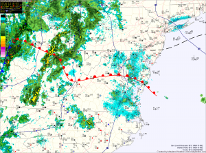
Severe weather day

A warm front is currently working it’s way through the state, allowing moisture and warmer temperatures to stream northward. This feature, combined with a cold front approaching from the west will provide the forcing necessary for shower and thunderstorm development.
At this time, it appears enough instability and lift will be present for some of these storms to become severe and produce damaging winds, large hail, torrential rain and possibly tornadoes.
