Welcome to (Meteorological) Spring!
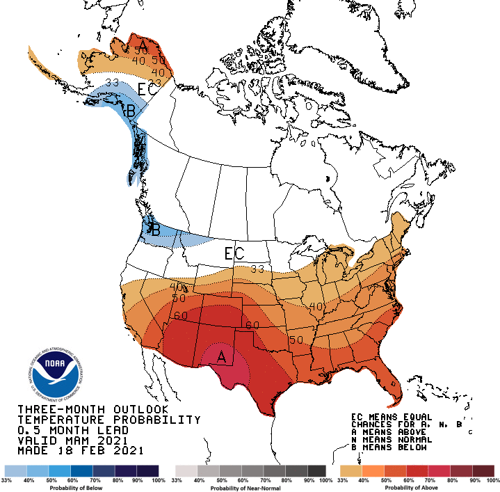
Today is March 1st, and it is the first day of Meteorological Spring! The current 3-month outlooks from the Climate Prediction Center show temperatures likely to be warmer than normal,…

Everything you need to know about the weather in Maryland
An upper level disturbance will push through tonight, bringing a slight chance of flurries or snow showers into tomorrow. An inch or two is possible in far western Maryland, elsewhere no accumulation is expected. Winds will continue to gust tomorrow, into the 25mph range. Highs will be in the low 40s.
Behind that system, high pressure builds back in for the end of the week and most of the weekend. Friday through Sunday will see highs in the mid to upper 40s under partly sunny skies.
Spring begins at 7:02am tomorrow. Clouds will increase again through the day as a weak area of low pressure approaches. It will be windy and cool, with a high around 50.
Weak low pressure scoots by to our south tomorrow night into Thursday morning, bringing a slight chance of showers or flurries. Highs Thursday will only be in the low to mid 40s under clearing skies.

Today will be partly sunny with a slight chance of showers and possibly a thunderstorm this afternoon and evening. Highs will be in the mid to upper 60s.