*WINTER STORM WARNINGS* are in effect for all areas north and west of I-95 as well as the upper Eastern Shore. *WINTER WEATHER ADVISORIES* are in effect for Anne Arundel,…
All of the models continue to show agreement that a major Nor'Easter will affect our state tomorrow night into Tuesday. As with any of these storms, precipitation type will be…
Summary: Colder air is working into the area today. An area of low pressure will develop to our south and move up the coast this weekend. High pressure builds in…
Summary: An area of low pressure will move by to our south tonight spreading light snow into our area this evening through tomorrow morning. - A Winter Weather Advisory is…
Summary: High pressure early today will give way to a cold front that will pass through this evening. Arctic high pressure builds in this weekend. Low pressure impacts our area…
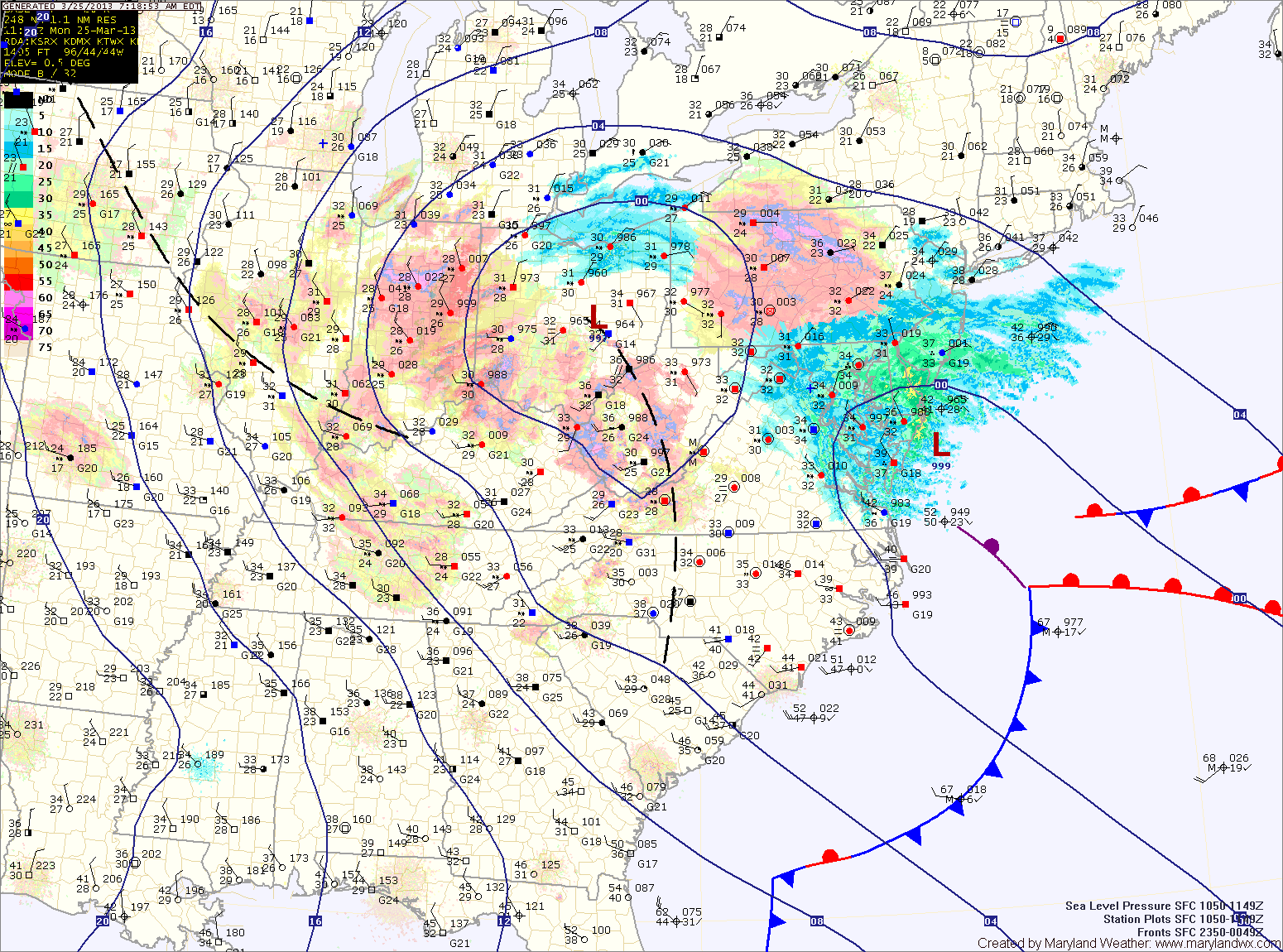
Current Surface MapAs coastal low pressure continues to strengthen off the Virginia coast today as energy from a dying low over Ohio is transfered to it. This will result in snow across the state.
The mountains of western Maryland will likely remain all snow, while areas further east will likely mix with rain this afternoon.
Updated Snowfall Forecast by county:
8-12″ – Garrett
4-8″ – Allegany
2-4″ – Baltimore, Baltimore City, Carroll, Cecil, Frederick, Harford, western Howard, western Montgomery, Washington
Current Surface MapThe Nor’Easter that was forecast to move up the coast will be close enough to the state to bring wintry precipitation, mainly across central and eastern Maryland.
The storm is currently situated off the Delmarva coast this morning. It will continue to strengthen as it moves north and will also continue to push light wintry precipitation into the state. Winds will increase today and into tomorrow, gusting to around 30mph.
Light precipitation has pushed into central Maryland where a light rain/snow/graupel mix is currently falling. Further south and east, light rain is falling.
The mix across central Maryland will eventually change to all snow later this afternoon and into this evening as colder air flows in from the north and evaporative cooling continues. The heaviest precip will fall late this afternoon and evening and the snow will taper off overnight.