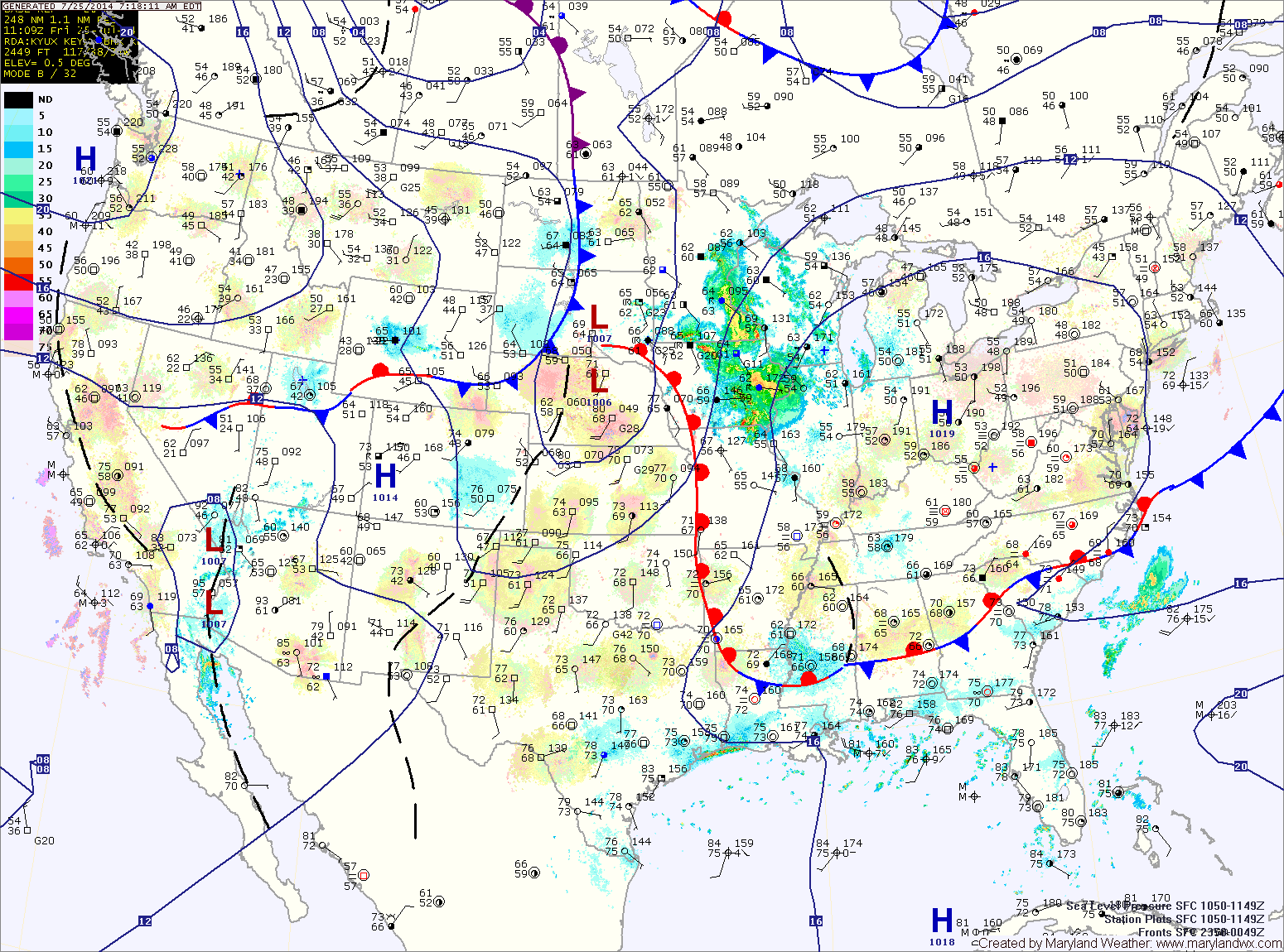
Soaking Rains Likely Tomorrow-Friday
An area of low pressure will drop southward from Canada into the Ohio Valley tomorrow and move to our southwest. This system will pull warm moist air into our region,…

Everything you need to know about the weather in Maryland
The high will slide off of the coast tonight into tomorrow. This will allow warmer, more humid air to flow back into the area. Expect highs to be in the upper 80s to around 90 under mostly sunny skies.
A disturbance will move into the area Saturday night and Sunday, bringing a chance of showers and thunderstorms. Some of the storms could be strong to severe on Sunday with damaging winds being the most likely threat. The storms will also be capable of producing heavy rainfall, leading to localized flash flooding. Highs will be in the mid to upper 80s.
Batches of showers and thunderstorms will continue to move through the area today, bringing locally heavy rainfall. A Flash Flood Watch is in effect for the entire state, except for the mountains. Highs will be in the low to mid 80s.
Scattered showers will continue through tonight. Another round of showers and thunderstorms are likely tomorrow and tomorrow night. Highs will be in the low to mid 80s.