
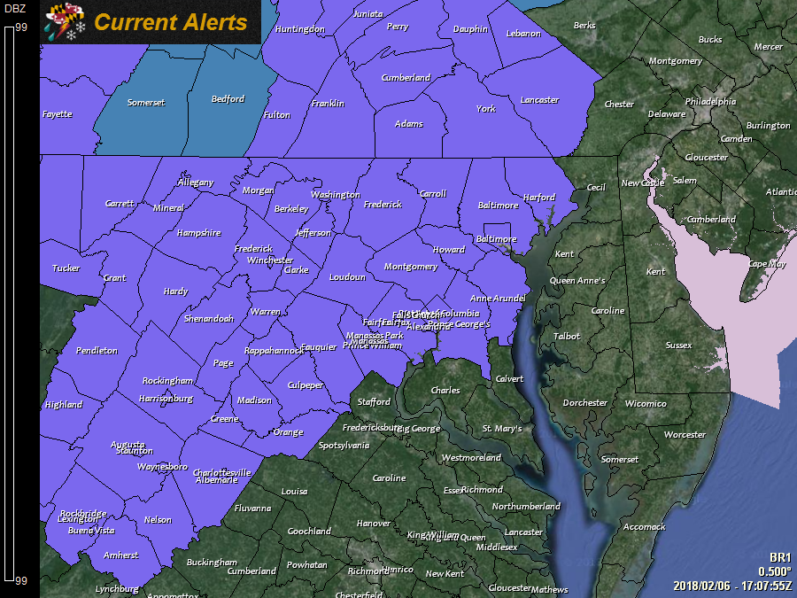
 Another storm system will impact our area tonight and tomorrow, bringing another round of wintry mix to the state. A Winter Weather Advisory has been issued for all counties along and north and west of I-95.
This system looks to pass by further west than the system that impacted us on Sunday, which should allow temperatures to rise more quickly and make it into the 40s.
As a result, icing concerns still exist, but the focus and impact looks to be mostly confined to the mountains and areas north and west of I-95. Along the I-95 corridor, a slight, light icing glaze is possible.
Timing wise, a wintry mix will enter western Maryland after midnight, spreading eastward during the early morning hours and reaching the metro area around sunrise or shortly thereafter. The mix will change to rain from southeast to northwest during the morning hours. Further east and across southern Maryland, temperatures should remain above freezing. By the afternoon, all but a few areas in the mountains should be above freezing and seeing plain rain.
Rain will continue through the afternoon, tapering off and ending during the evening from west to east.
Here are the Canadian, GFS, NAM and 3k NAM ice accumulation maps, showing the range of potential icing:
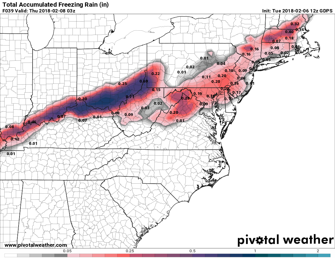
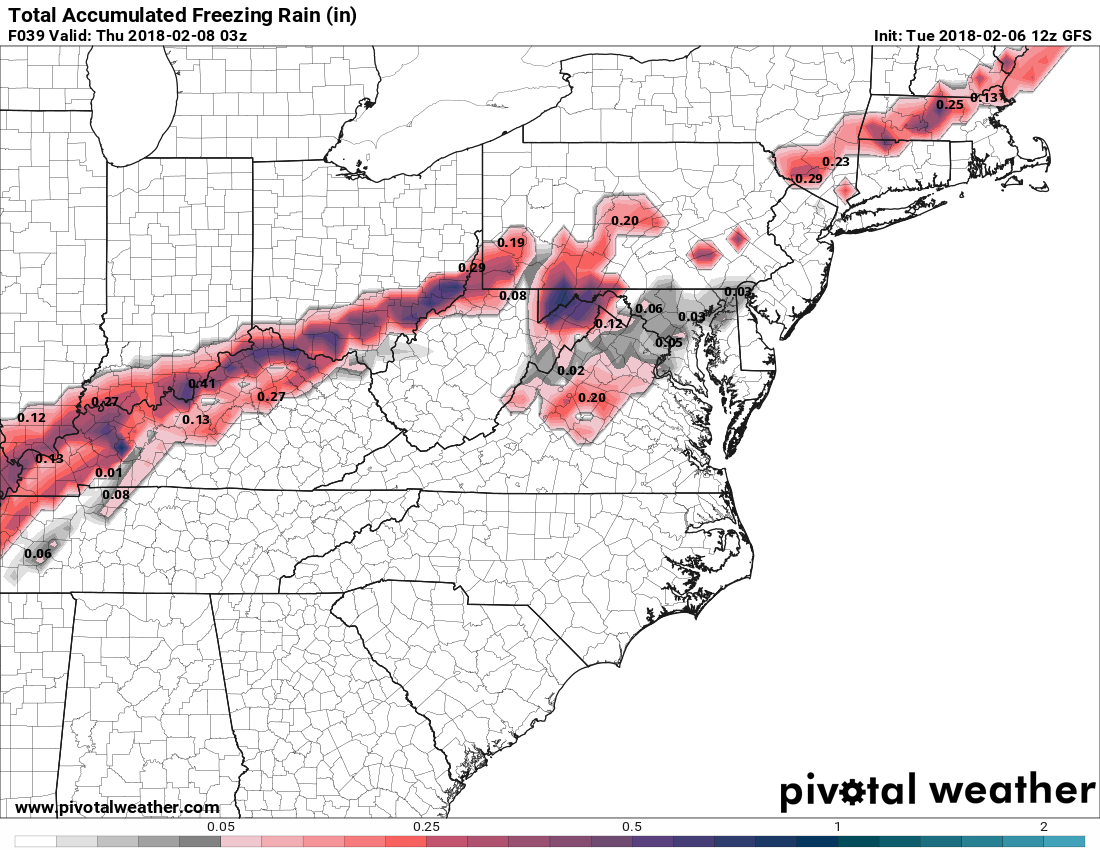
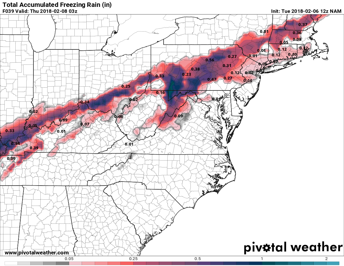
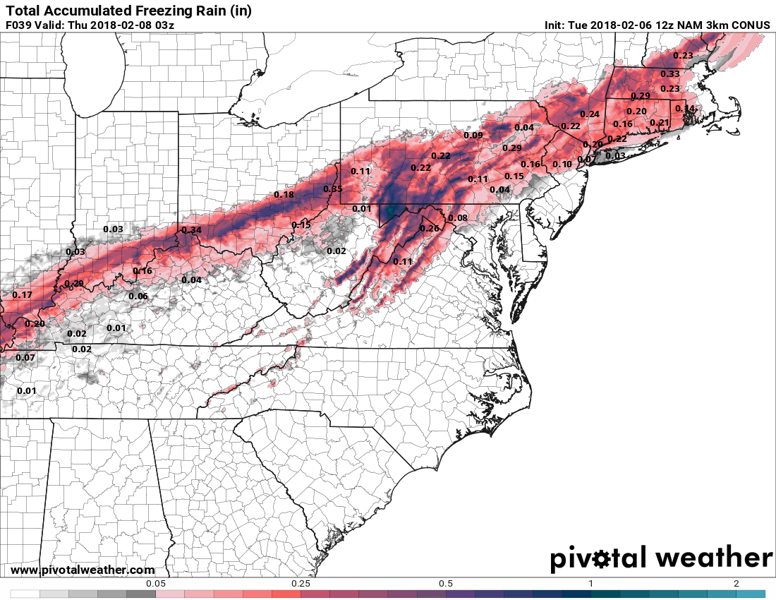
Notice that the Canadian model is the only one that has impactful ice accumulation in the Baltimore/Washington metro areas. So while there is the potential for an impact to the morning commute, those impacts are likely to be minimal around the cities, but north and west, moderate to perhaps significant ice accumulation is possible.
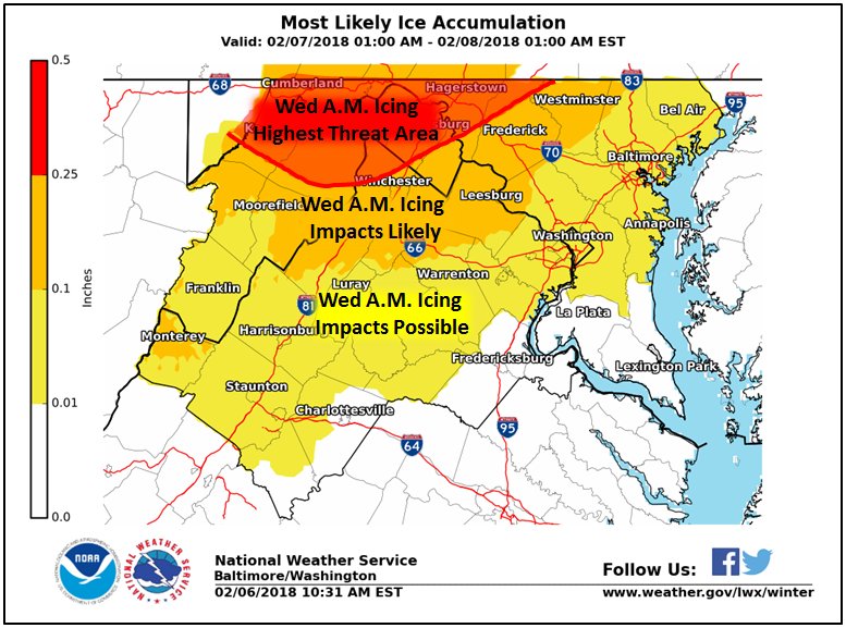
This graphic from the National Weather Service is a good illustration of what can be expected:
These events are often poorly handled by the models, as we saw on Sunday and a temperature difference of a few degrees can make all of the difference. Regardless of the details of the current forecast, if you live along I-95 or in areas north and west, you should plan for the possibility of icy conditions tomorrow morning, likely impacting the morning commute.
Want the latest blog posts emailed to you?