
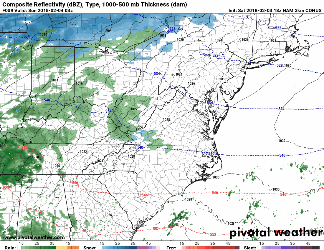
Low pressure will move by to our northwest tomorrow, bringing a mix of wintry weather to our state. Snow, sleet and freezing rain will overspread western parts of the state after midnight and move into central and eastern parts during the early morning hours. Snow will likely be the predominant precip type at the start, but it will quickly mix with or change over to sleet and freezing rain. The wintry mix will continue through the morning hours before changing over to plain rain during the afternoon.
Here is the high resolution NAM, showing the evolution of the storm tomorrow:
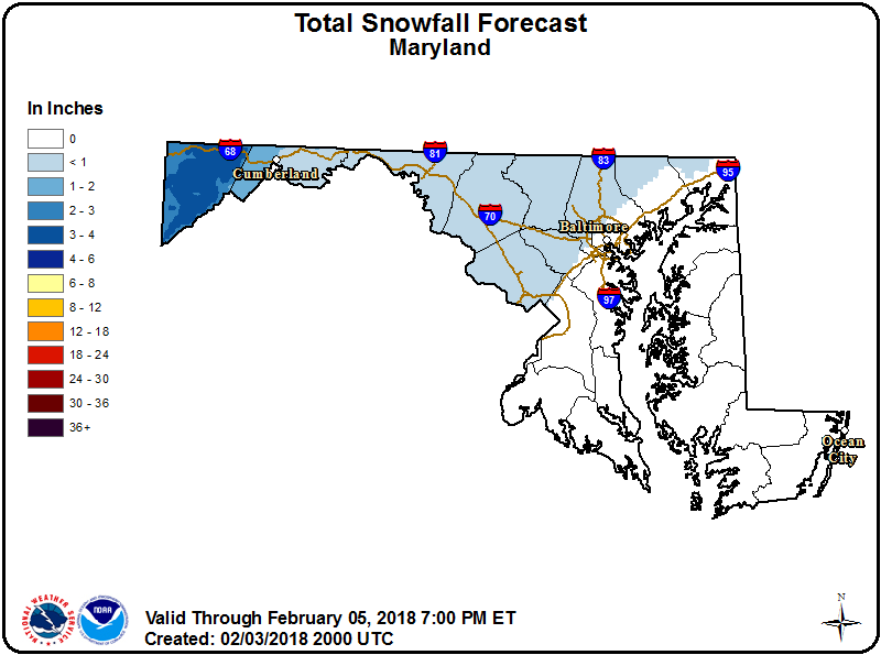
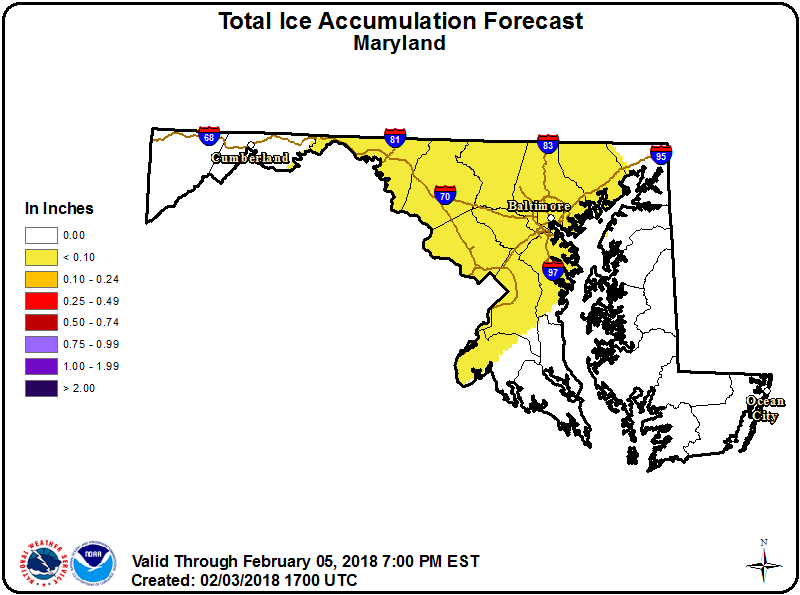
Areas south and east of I-95 will see minor snow/ice accumulation before changing to rain. Areas north and west of the cities will take longer to change over to rain. These areas will see a greater amount of snow and ice, with snow accumulations of up to a half inch, and ice accumulation of up to .10 of an inch. As a result, a *WINTER WEATHER ADVISORY* has been issued for all counties west of I-95.
Here is the NWS forecast for snow and ice accumulation:
By the late afternoon, all areas should be warm enough to be seeing plain rain, except perhaps far western Maryland. The precipitation will end from west to east during the evening hours.
Want the latest blog posts emailed to you?