
 ---
---
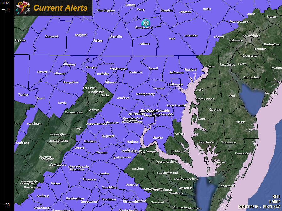
A *WINTER WEATHER ADVISORY* has been issued for: Allegany, Anne Arundel, Baltimore, Carroll, Charles, Frederick, Garrett, Harford, Howard, Montgomery, Prince George's, and Washington counties.
---
A *SPECIAL WEATHER STATEMENT* has been issued for the Baltimore and Washington, DC metro areas for a potentially hazardous Wednesday morning commute.
---
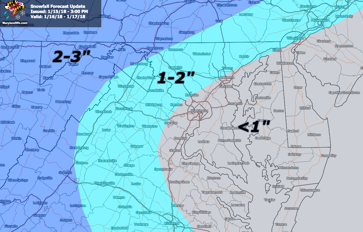
While light snow is falling across western portions of the state now, it will make slow but steady progress eastward later this afternoon and into tonight. Snow will likely reach the metro areas between 10pm and midnight and last into tomorrow morning. While snowfall totals will be light, it doesn’t take much to impact travel. Be prepared for slick spots and a slower commute tomorrow morning as the snow tapers off and moves out.
As far as snowfall totals go, today’s model runs have trended drier over our area. It now looks like the heaviest snowfall will be to our south, as well as to our north, while we are in sort of a dry spot. As a result, I have lowered my expected totals:
Be sure to follow along with my Facebook page and Twitter account for more updates as the event unfolds.
Want the latest blog posts emailed to you?