
------
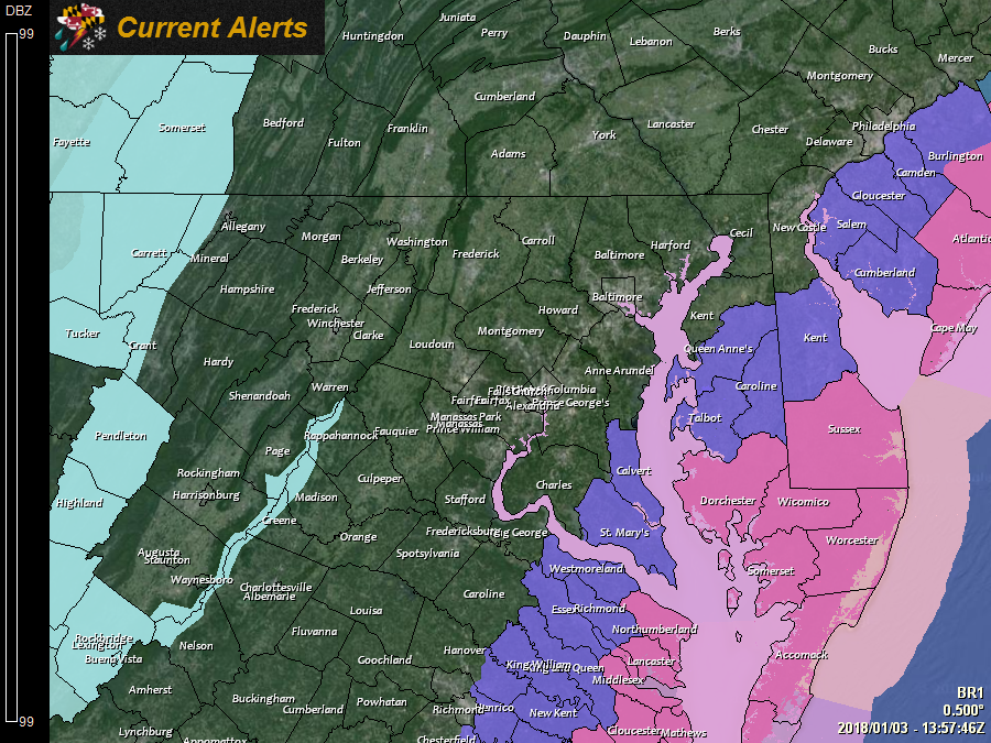
The National Weather Service has issued a *WINTER STORM WARNING* for: Dorchester, Somerset, Wicomico, and Worcester counties.
The National Weather Service has issued a *WINTER WEATHER ADVISORY* for: Calvert, Caroline, Queen Anne's, St. Mary's, and Talbot counties.
The National Weather Service has issued a *SPECIAL WEATHER STATEMENT* for: Anne Arundel, Baltimore, Carroll, Charles, Frederick, Harford, Howard, and Montgomery counties.
------
A powerful storm system developing off of the Florida coast will continue to strengthen and move along the eastern seaboard. The system will begin impacting our state tonight and will last into tomorrow afternoon or evening. Snowfall amounts will be greatest across the Delmarva, but accumulating snowfall is likely as far westward as the I-95 corridor.
Here is my snowfall forecast:
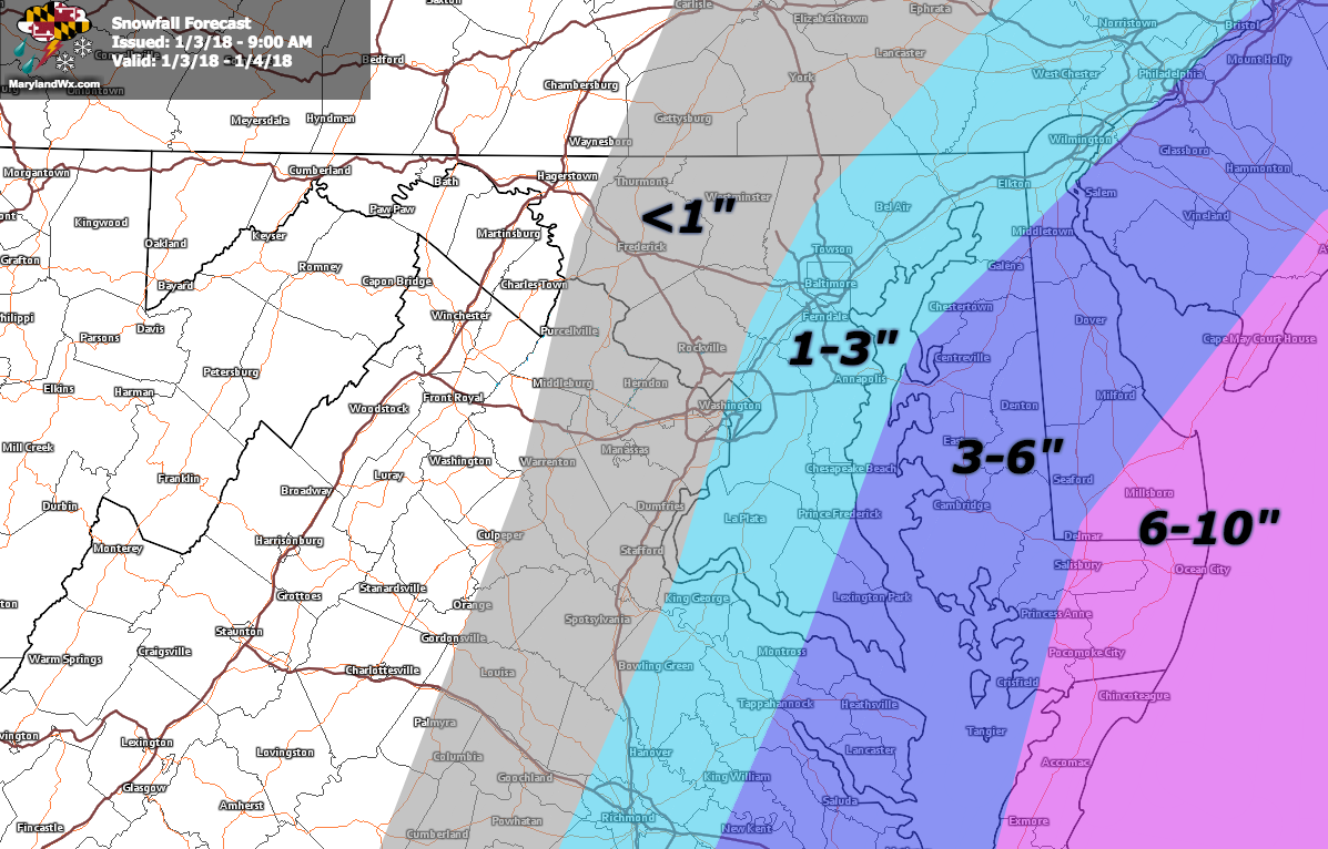
This will be a very strong and powerful storm. While snowfall will be a major impact, especially east of the bay, strong winds and another shot of bitterly cold air, even colder than what we’ve seen thus far is likely behind the system. Highs on Friday will most likely range from the single digits in the mountains to the teens elsewhere. Any snow that falls will stick, and will stick around for a while as temperatures remain below freezing into next week.
While confidence in the overall evolution of the system is quite high, pinpointing the exact track and subsequently snowfall amounts has been harder than usual. There are several key pieces of energy coming together to create, strengthen and steer this system. The models have been having a difficult time with the timing of these pieces and how they interact. Changes in intensity and more importantly the track of the system have been occurring run to run resulting in varied snowfall totals. Since we are on the western edge of the system, any change in the track creates dramatic changes in snowfall accumulations.
As of this morning, there remains a spread in the snowfall totals. Some models have the storm farther off the coast, with minimal snowfall while others have the system closer with more snowfall. Take a look at the various snowfall forecasts from the NAM, NAM 3km, GFS and Canadian models:
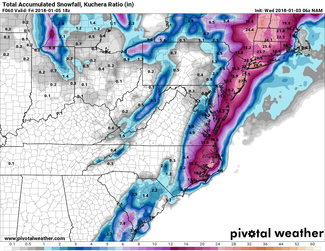
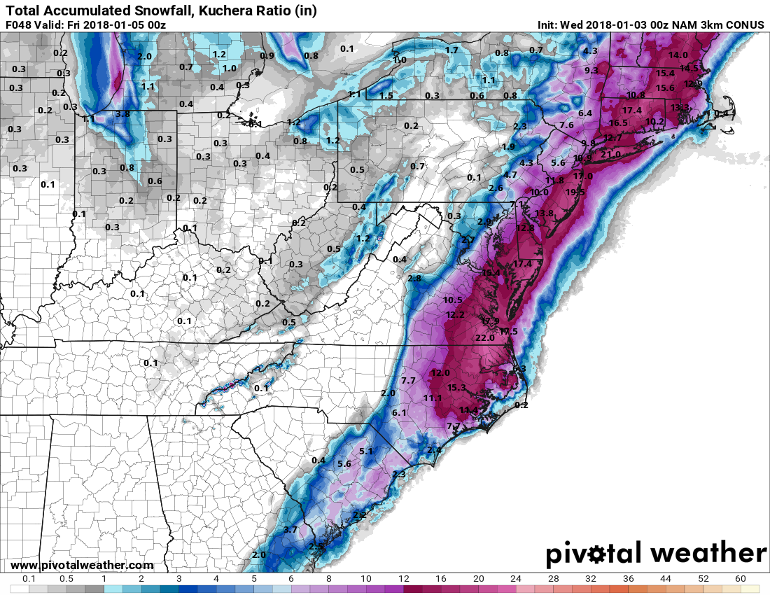
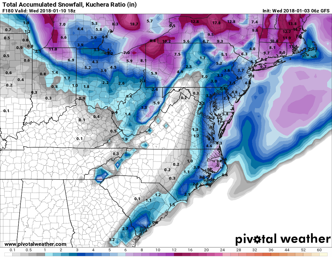
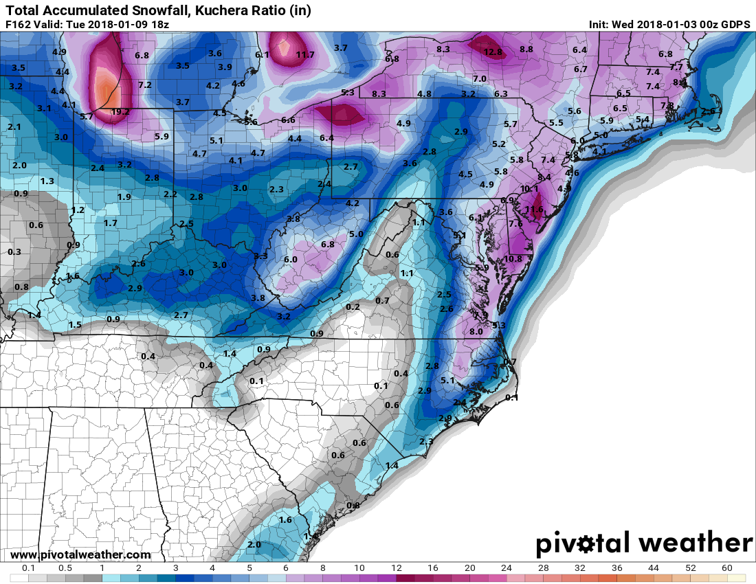
As you can see, there is quite a range and gradient to the snowfall on these models. There will likely be more changes with today’s model runs as the various pieces come together and can be resolved more clearly. If needed, I will update my snowfall forecast this afternoon.
Want the latest blog posts emailed to you?