
------
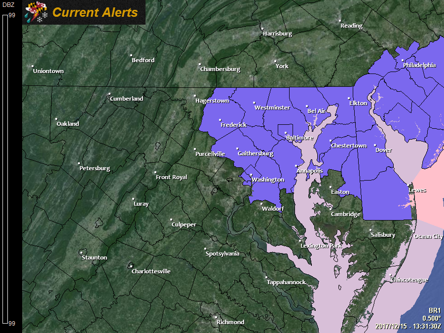
The National Weather Service has issued a *WINTER WEATHER ADVISORY* for: Anne Arundel, Baltimore, Caroline, Carroll, Cecil, Frederick, Harford, Howard, Kent, Montgomery, Prince George's, and Queen Anne's counties.
------
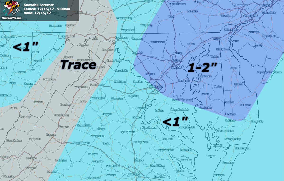
An area of low pressure off of the North Carolina coast will move northeastward today, spreading a period of light snow into our state this afternoon, mainly affecting central and eastern parts of the state. With temperatures staying at or below freezing in most areas, the snow will likely cause slick spots and could cover untreated roads and sidewalks.
Current Advisory Map:
Timing
Snow will begin to develop around 10am and persist for a few hours, winding down during the early evening. This snowfall has the potential to impact the afternoon commute.
Accumulation
Areas east of Garrett county and west of the metro areas will see very little snowfall, perhaps up a trace. Further east, accumulations of up to 2″ are possible, especially in north/central Maryland and the Eastern Shore.
Want the latest blog posts emailed to you?