
So far, this winter has been anything but winter-like. With only 0.7″ of snow officially at BWI, we are currently tied for the least snowiest snow in the record books but our fortunes may be changing this weekend.
A cold front will push southward tonight, ushering in much colder air, setting the stage for two potential snow events.
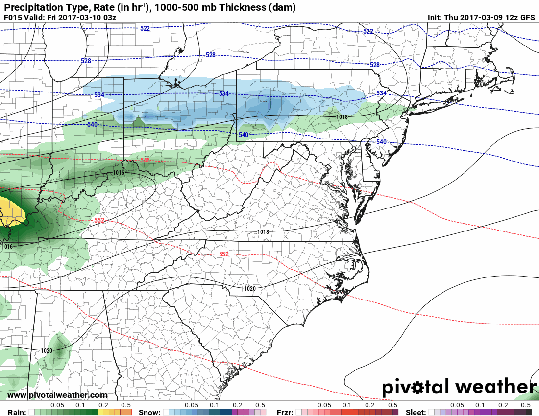
An area of low pressure will moves through tonight into tomorrow. This system has trended colder in recent model runs but temperatures remain marginal for any snow accumulation outside of the mountains and areas along the Mason-Dixon line. Nonetheless, this system is one of two potential snowfalls for our area.
Here is an animation of the rain and rain to snow transition for tomorrow’s system from 10pm tonight through 4pm tomorrow:
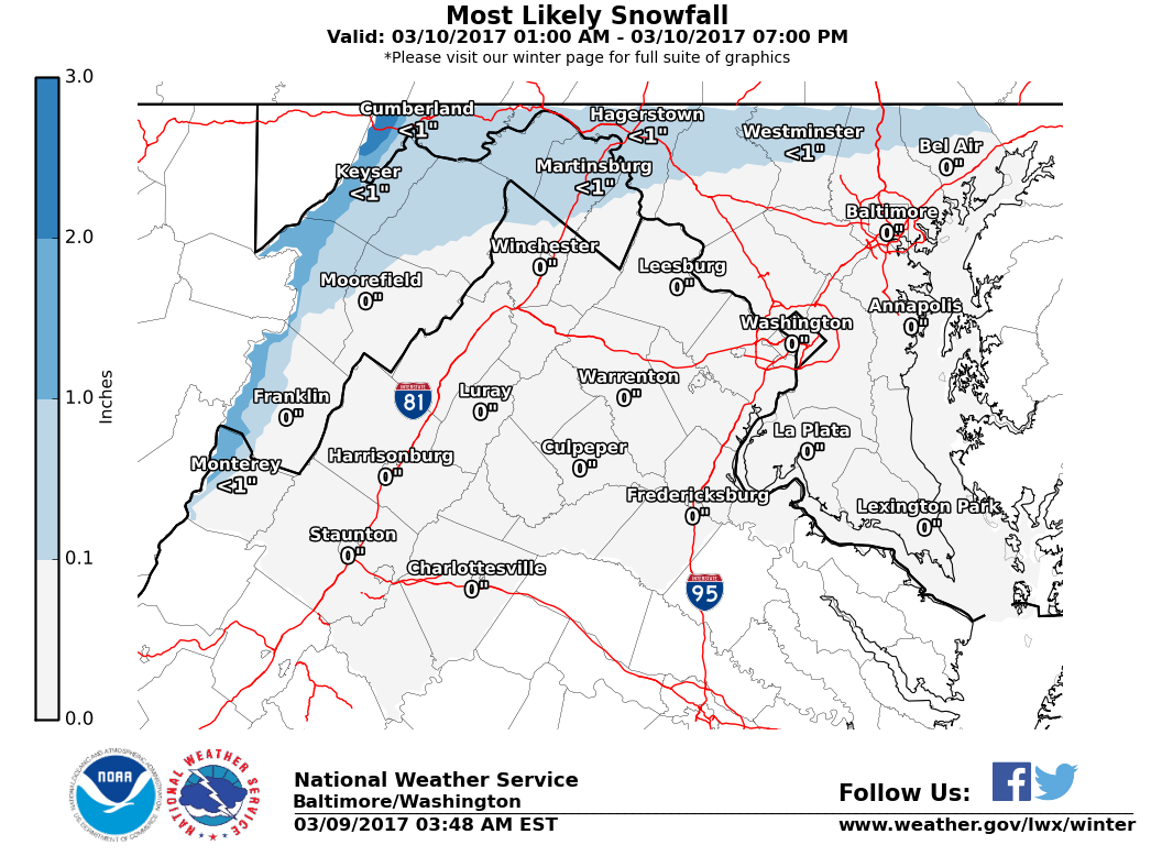
Here is the most likely snowfall totals from the National Weather Service, with any accumulation likely limited to grassy or elevated surfaces:
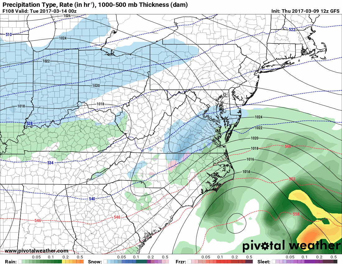
Earlier this week, it appeared a second, stronger system would swing through our area over the weekend but that system will now pass well to our south but could become part of a larger system that could bring a more significant snowfall to our area late Monday night into Tuesday.
While the details and potential impacts of this system will be resolved over the next day or so, here is the current GFS from 8pm Monday to 8am Wednesday showing a potential significant system affecting our area:
Regardless of the actual snowfall totals from these two systems, the cold air that will be in place will be a definite reminder that it is still winter!
I will monitor the bigger snow threat for next Tuesday and will have a more detailed post about that tomorrow with a snowfall forecast map over the weekend if needed.
Want the latest blog posts emailed to you?