
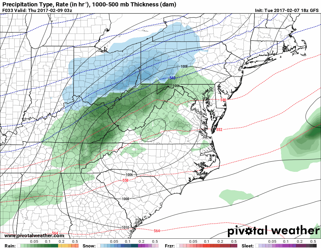
A cold front will move through the area tomorrow, stalling out just to our south. An area of low pressure will develop and move along the front tomorrow night into Thursday, spreading precipitation into the state.
The storm will move by just to our south as colder air works in from the north. Initially, most areas will see rain as temperatures will be very warm again tomorrow, pushing into the mid 60s before falling into the 30s tomorrow night. As the storm intensifies, rainfall rates will increase during the overnight and begin to transition to snow across the northern parts of the state. The rain will continue to change to snow from north to south during the early morning hours on Thursday, possibly reaching the cities during the AM commute. The snow will continue during the morning hours Thursday, ending from west to east during the late morning hours.
Here is the 18z GFS, showing the timing of the storm from 10pm tomorrow night to 10am Thursday:
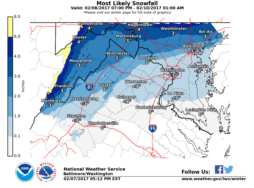
Since temperatures have been warm, snow accumulations will be limited and will mostly be confined to areas north and west of I-95. In these areas, 1-3″ of snow are possible, while areas south and east of I-95 will only see minor accumulations, mainly on grassy and elevated surfaces.
Here is the National Weather Service’s current snowfall forecast:
I will post an update tomorrow, with my snowfall forecast.
Want the latest blog posts emailed to you?