
After temperatures surged to record-tying highs yesterday, a cold front moved through overnight, ushering in colder air and setting the stage for a wintry mix tomorrow.
Temperatures will fall through the day and tonight, falling below freezing. The front will stall out just to our south then return tomorrow as a warm front. The warm air will ride over top the cold air that will be held in place due to cold air damming. This will cause precipitation to form and fall, first as sleet and snow then eventually freezing rain. While heavy precipitation isn’t expected, it only takes a little bit of freezing rain to cause major problems. The cold air is likely to remain in place for most of the day, slowly rising through the afternoon hours, but a prolonged period of light precip and sub-freezing temperatures is expected for most areas, especially in the normally colder spots.
Timeframe
Light precipitation will overspread the state during the early morning hours tomorrow. It will likely start as snow or a snow/sleet mix before changing to primarily sleet. The sleet will change to freezing rain from south to north during the morning hours. Light sleet and freezing rain will stick around through the afternoon, with areas south and east of I-95 possibly getting above freezing and changing over to plain rain by the evening.
We will continue to slowly warm during the evening but areas mainly west of I-95 could remain below freezing for the duration of the event. The precipitation will taper off to drizzle/freezing drizzle during the overnight and comes to an end during the morning hours Sunday. Temperatures will climb into the 40s in most areas by Sunday afternoon.
Accumulation
The first map shows my expected snow and sleet accumulation and the second shows my expected freezing rain accumulation:
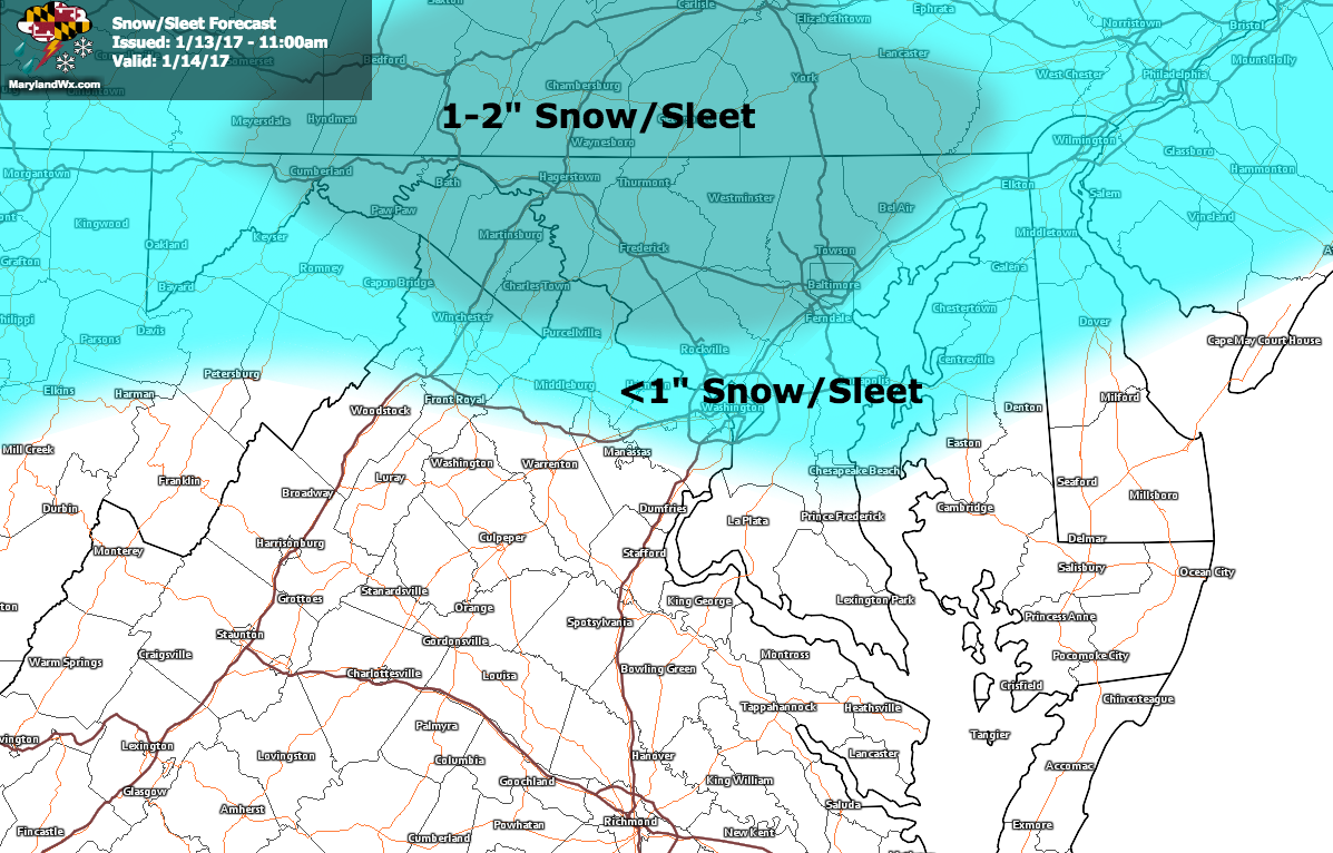
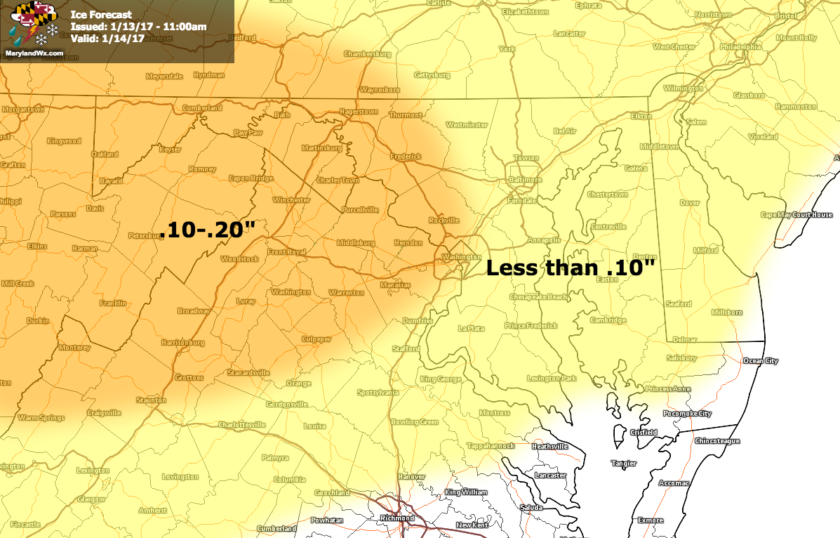
These events are always difficult to pinpoint but the general idea is that light snow, sleet and freezing rain is expected tomorrow, possibly making travel hazardous. With temperatures in the upper 20s to low 30s, any treated surfaces should remain mostly wet, but nonetheless, slick spots should be expected.