
The forecast for tonight’s system remains on track, with an upper level disturbance poised to move through the area during the overnight hours. As it moves through, light snow is likely with totals of a dusting to perhaps 2″ in some areas.
Timeframe
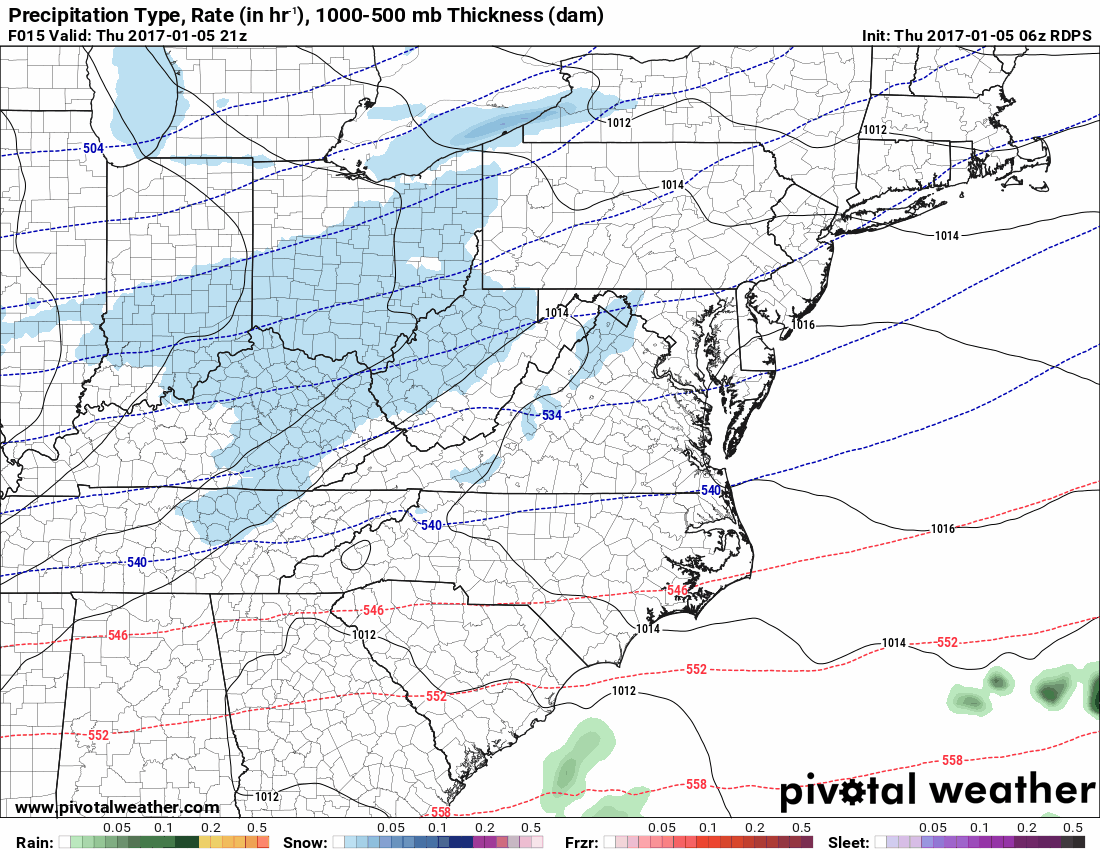
The system will move through during the evening and overnight hours. Light snow move into the state during the late afternoon or evening hours and taper off from west to east during the early morning hours tomorrow.
Here is the Canadian model from 4pm today through 10am tomorrow:
Accumulation
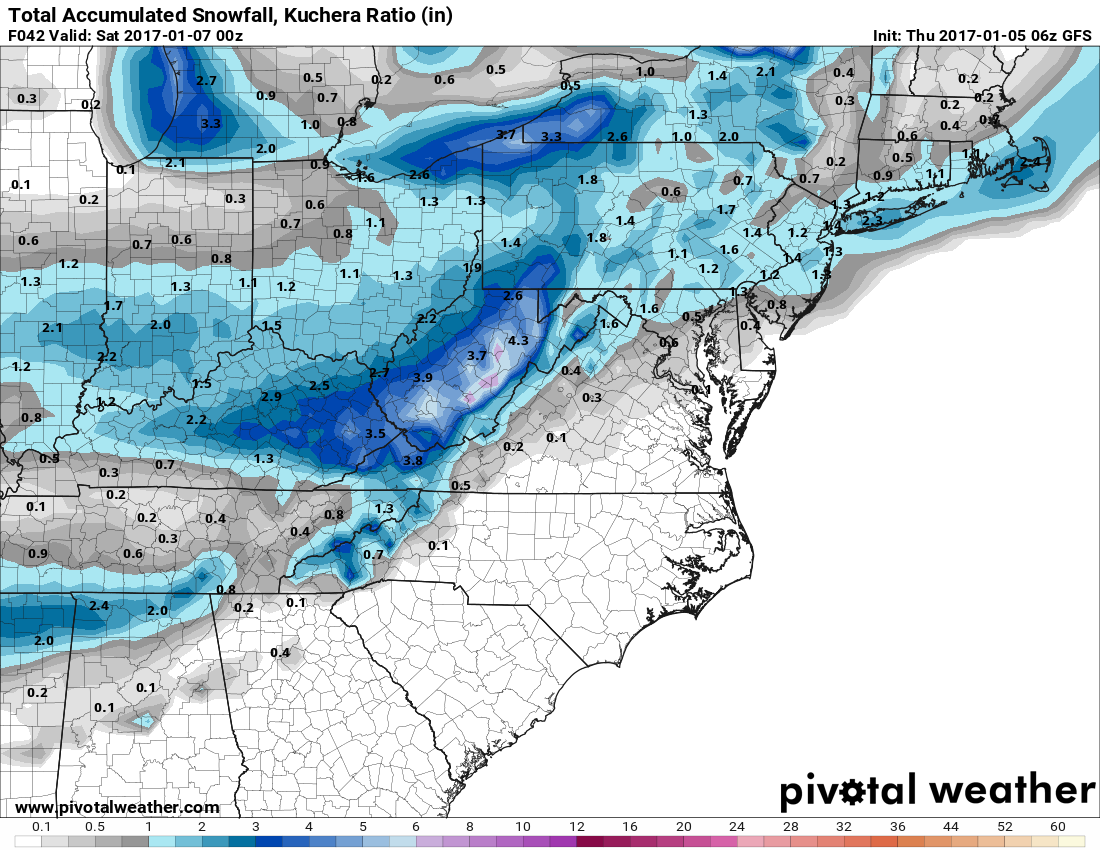
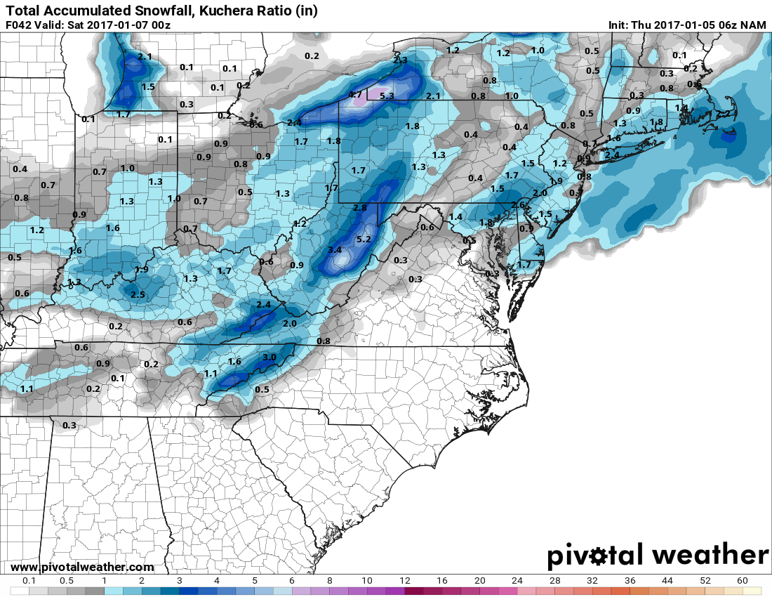
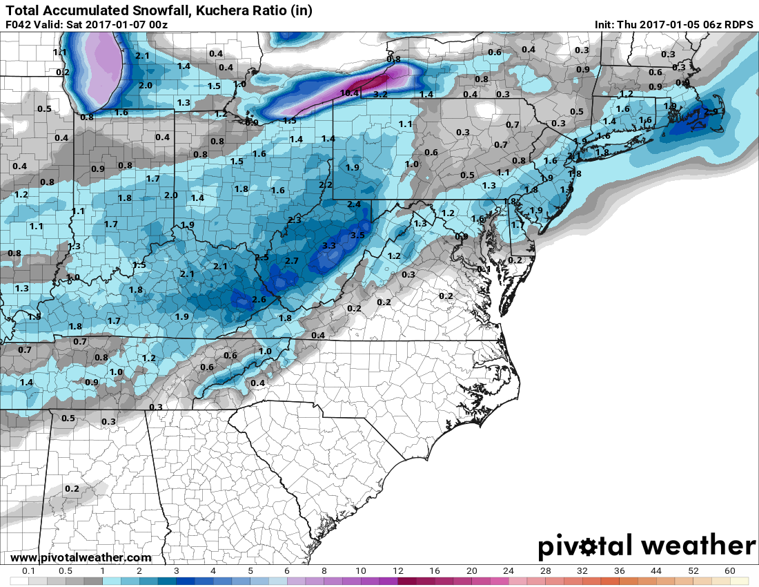
This is not a major system and most areas will see under an inch of snow, but some spots could see up to 2″.
Here are the latest snowfall forecasts from the GFS, NAM and Canadian models for tonight’s system:
Summary
This is a minor system that will hit mostly after the evening rush and before tomorrow’s rush. A dusting to up to 2″ is possible making untreated and elevated surfaces slick. Expect some impact to tomorrow’s commute as the system departs.
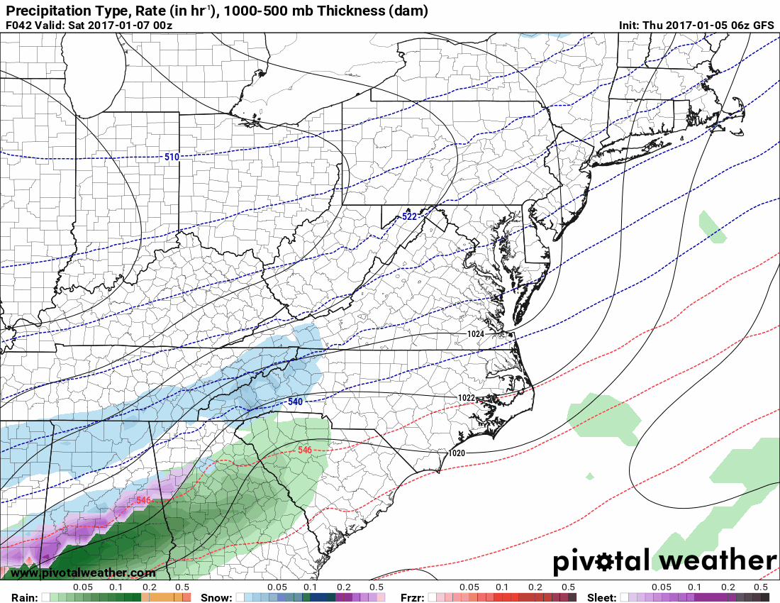
The Next System
Another system will move into the southeast tomorrow, spreading snowfall across areas of the Deep South, the Carolinas and Virginia. We will be on the very northern fringe of the system and for the most part, we will not be impacted by it. The one exception is lower Southern Maryland and the Delmarva. Right now it seems the lower Eastern Shore could see several inches of snowfall starting late Friday night or early Saturday morning and ending during the evening hours on Saturday.
Timeframe
Here is the GFS model, starting 7pm tomorrow through 1am Sunday:
Accumulation
Right now, the lower Eastern Shore looks to see several inches of snow, with perhaps a dusting to an inch across southern Calvert and St. Mary’s counties. This could change if the track shifts. A minor shift north or south could have a major impact on the snowfall totals not just for these areas, but elsewhere.
Here is the latest snowfall forecast from the GFS:
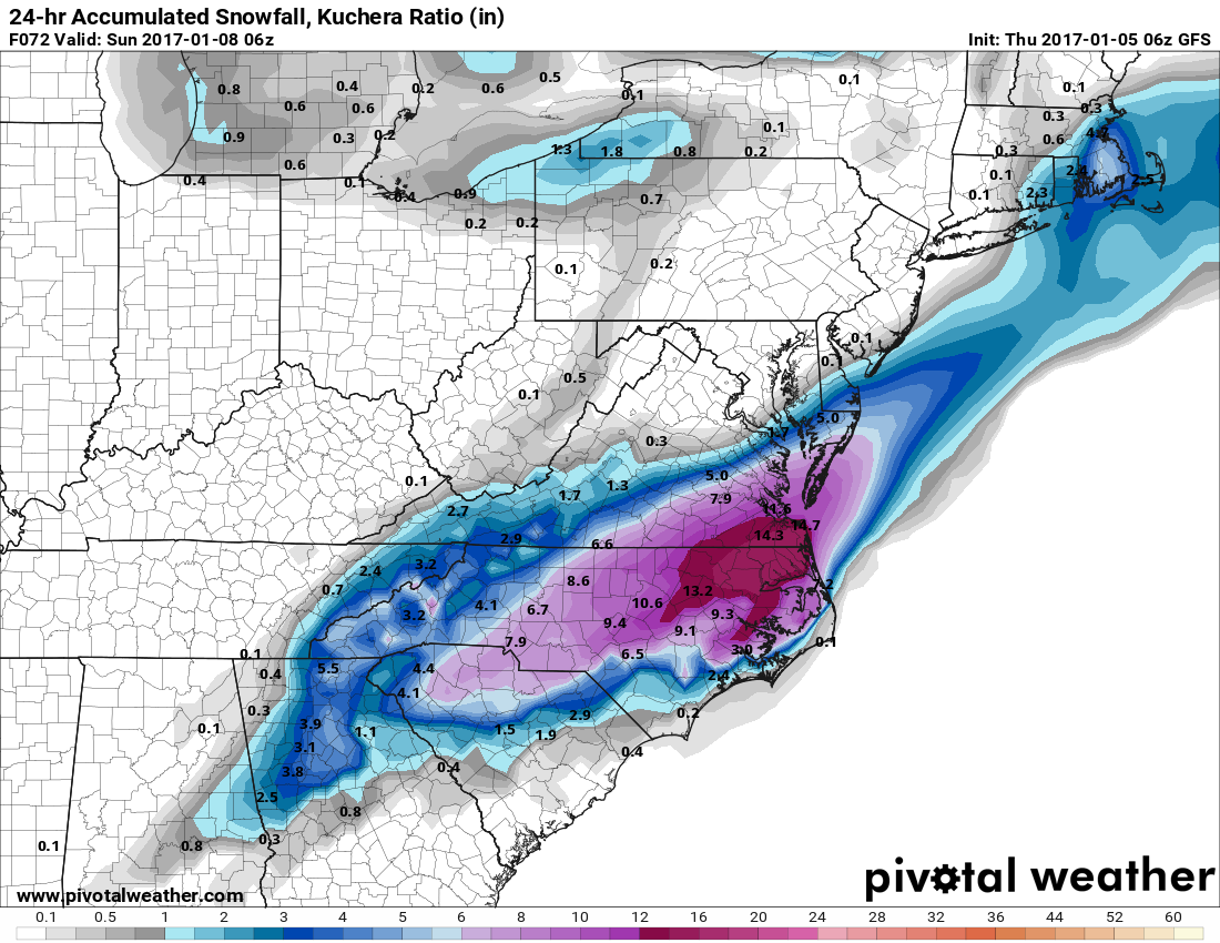
Summary
This system has been handled very well by the models for several days now, with the track consistently far enough south of our area to only provide a glancing blow to our state. Nonetheless, several inches of snow are likely across the Delmarva but interests elsewhere should keep an eye out for any shifts in the track that could bring accumulating snowfall further north.