
A cold front will pass through the state today, ushering in colder air on gusty northwest winds. Before it does, highs will top out in the low 50s but wind gusts to near 30 mph will make it feel colder.
The colder air will settle in tonight and highs tomorrow and Friday will only be in the low to mid 30s. As the cold air moves in, an upper level disturbance will approach tomorrow from the west. This system will pass over our area tomorrow night with a round of light snow. This is not a major event, with snowfall totals of perhaps .5 to 1.5″ across the state.
Here is the Canadian model run from last night showing the timing of the system from 4pm tomorrow to 1pm Friday:
[slideshow_deploy id=’11692′]
Here is the resultant snowfall totals, showing on average, .5 to 1.5″ in most places:
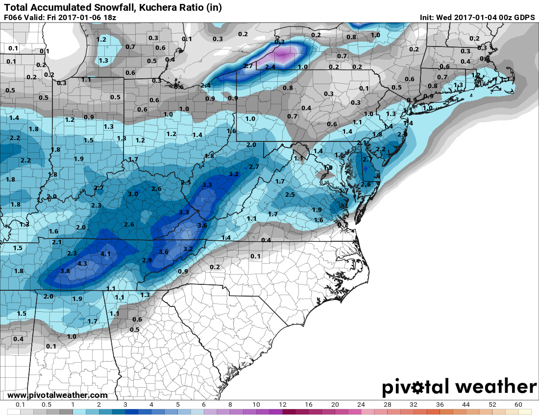
The other thing to note, on the last image of the loop above is a second system that has been talked about this week. This system will likely bring snowfall to parts of the southeast, including Georgia, the Carolinas and Virginia. It looks like it will remain south of our area, possibly brushing the lower eastern shore with a bit of snow late Friday into Saturday. I will have more info on that system tomorrow. In any case, it will remain cold through the weekend, with highs likely remaining below freezing both Saturday and Sunday.