
A cold front will pass through the state today, bringing showers and possibly a thunderstorm this afternoon. Highs will be in the low to mid 80s.
The front will clear the area this evening and skies will clear out tonight. Tomorrow will be mostly sunny with highs around 80.
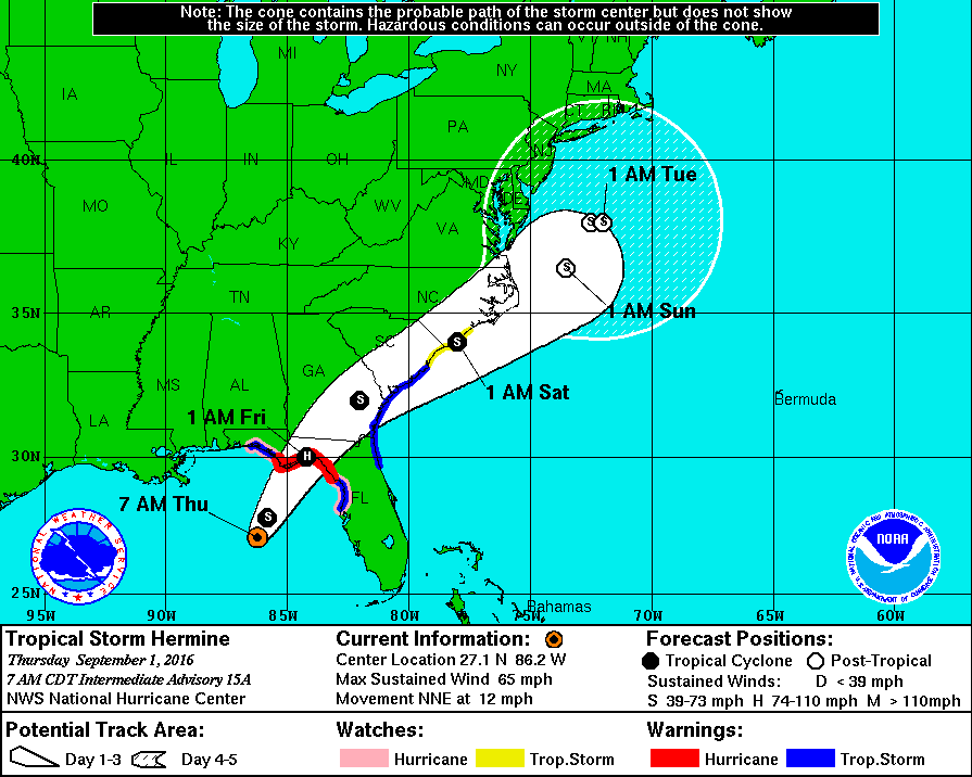 Meanwhile, Tropical Storm Hermine, currently in the Gulf of Mexico will trek north-northeastward and make landfall on the Florida coast late tonight and early tomorrow as a Category 1 hurricane.
Hermine will continue to move northeastward and interact with the cold front that is passing through today. Expectations are that the storm will lose tropical characteristics but will bring heavy rainfall and gusty winds to portions of the east coast this weekend.
The latest forecast track keeps the center of the storm to our south and east. This would spare most of the state from a rainy and windy weekend, but central and eastern portions of the state would still see heavy rain late Saturday into Sunday. The track has been shifting a little east and west as the details of the storm become clearer. I anticipate further changes to the forecast track as the storm continues to evolve.
If the track shifts westward again, more of the state would be impacted. If it shifts further east, then most if not all of the state could be spared. Stay tuned today and tomorrow!
Regardless of the track, right now it looks like most of Sunday and Monday will end up dry, salvaging the Labor Day weekend.