
Summary: A cold front stalled to our south will provide a path for areas of low pressure to move through this weekend.
We remain on the north side of a cold front that is stalled out to our south. As a result, expect continued cloudy skies and areas of drizzle today and tonight. As low pressure approaches from the west, steadier rainfall will begin to move back into the state from west to east tomorrow afternoon into tomorrow night. Rain will continue tomorrow night into Sunday morning.
Another wave of low pressure will be quick on the heels of the first, keeping showers in the forecast throughout the day on Sunday. A few thunderstorms may also be possible during the afternoon hours.
Showers will continue Sunday night into Monday before tapering off as the low pulls away.
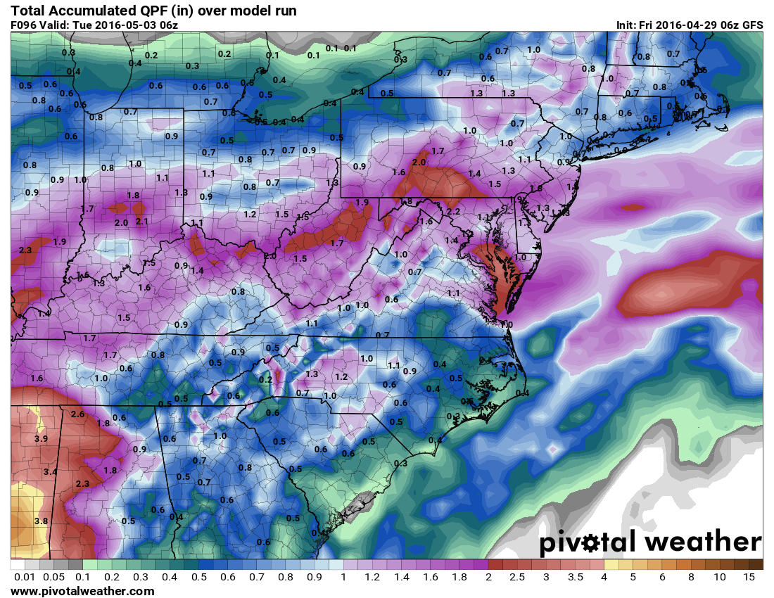
Rainfall totals of about 1-2″ are possible:
Expect high temperatures in the 50s today and tomorrow and 60s on Sunday.