
Summary: A cold front will move into the area today and pass through this evening. The front will then stall out to our south tomorrow evening through Friday. High pressure returns this weekend.
Warm and humid air ahead of a cold front will support scattered showers and thunderstorms today. Some of the storms could become strong to severe with damaging wind and hail as the main threats. It will be warm, with highs in the mid to possibly upper 80s across the state.
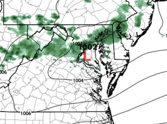
Here is a snapshot of this morning’s HRRR model showing the showers and storms moving through between 5 and 9pm this evening:
The storm threat will diminish tonight as the front pushes through.
Tomorrow will be much cooler, with a slight chance of showers and highs in the low to mid 60s under otherwise partly sunny skies.
Rain chances increase again tomorrow night as warmer air over-runs the stalled out front to our south. Expect scattered showers tomorrow night through Friday. Highs will be in the 60s both Thursday and Friday.
High pressure builds in Saturday leading to drier but continued cooler conditions. Highs will be in the 60s to near 70.
Rain chances increase again on Sunday.