
Summary: Colder air is working into the area today. An area of low pressure will develop to our south and move up the coast this weekend. High pressure builds in behind the system.
Saturday, 11:00am Update:
Based on the latest data, here is my final call for snowfall for today through tomorrow:
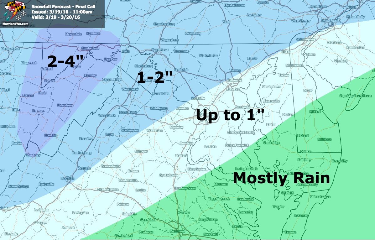
Again, accumulations will be mostly confined to elevated and grassy surfaces.
Here is an updated timeline of the storm, from the 12z NAM starting now and running through 8am Monday:
[slideshow_deploy id=’11349′]
Original post below:
A colder air mass will be settling into the region today while low pressure develops to our south. The system will move northward, along the coast this weekend, impacting our area late tomorrow into Sunday. Right now, it appears that light rain or a rain/snow mix will overspread the state from the southwest during the afternoon hours, with temperatures remaining above freezing except in the mountains. As we move into the evening, steadier precip will move into the state and temperatures will fall closer to freezing statewide. During this time, the rain/snow mix will become mostly snow for all areas except southern Maryland and the lower Eastern Shore where it will likely remain mostly rain. Astronomical Spring begins at 12:30am on Sunday, but the weather will certainly resemble winter.
As we warm again Sunday morning, the snow will likely change back over to a rain/snow mix or even rain for most areas east of I-95 during the afternoon and evening Sunday then perhaps ending as mostly snow during the evening or overnight Sunday.
The storm pulls away Sunday night and high pressure returns to begin the new work week.
While there are still discrepancies over the timing, here is a reasonable timeline for the storm, from this morning’s NAM:
[slideshow_deploy id=’11328′]
Here is my first call for accumulation:
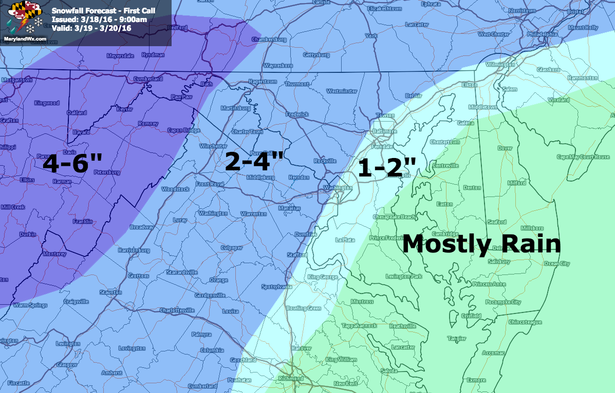
Note: these accumulation totals are for grassy and elevated surfaces. I do not expect much if any accumulation on roadways so travel impacts will be minimal.