
Summary: Low pressure is pulling away from the area this morning. Another, weaker system will move through Saturday night into Sunday morning. High pressure builds in Sunday, followed by a warming trend.
We will seemingly transition from late winter to early spring this weekend as one last system brings a slight chance of rain and snow showers Saturday night into Sunday morning, with temperatures slightly below our averages both Saturday and Sunday, topping out in the 40s.
By Sunday, high pressure will build into the region and begin a warming trend that will bring spring like conditions to our state through most of the week.
Here is a meteogram showing the forecast temperatures at BWI over the coming week:
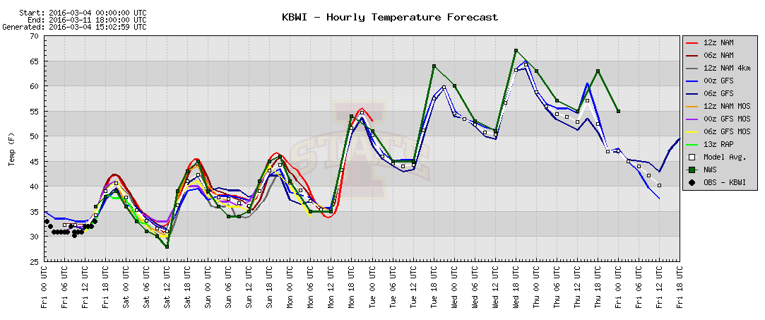
As you can see, temperatures trend upward, maxing out in the mid to upper 60s Wednesday and Thursday. We drop off a bit by next Friday, but long range model trends indicate that spring is likely here to stay, with temperatures generally remaining well above normal over the next 2 weeks.
Here is the GFS surface temperature plot for 1pm Monday, March 14th, showing temperatures reaching the mid to upper 60s in our area:
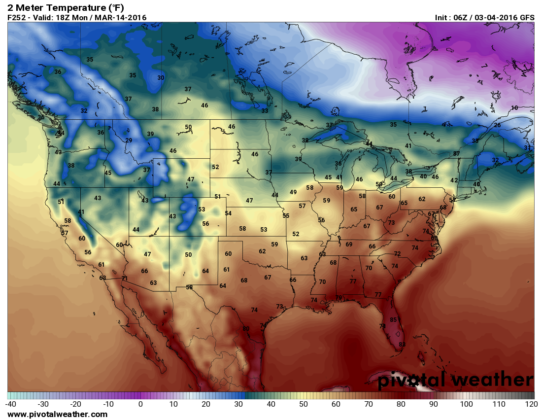
Of course, exact numbers are not important at this time, but overall, the pattern suggests that this morning’s snowfall was our last real shot of accumulating snowfall for the winter of 2015-16 and this weekend will be our transition to spring.