
Summary: An area of low pressure will move by to our south tonight spreading light snow into our area this evening through tomorrow morning.
- A Winter Weather Advisory is in effect tonight through tomorrow morning for: E. Allegany, Anne Arundel, Baltimore, Baltimore City, Calvert, Caroline, Carroll, Cecil, Charles, Frederick, Harford, Howard, Kent, Montgomery, Prince George's, Queen Anne's, St. Mary's, Talbot and Washington counties...(Click here for details)
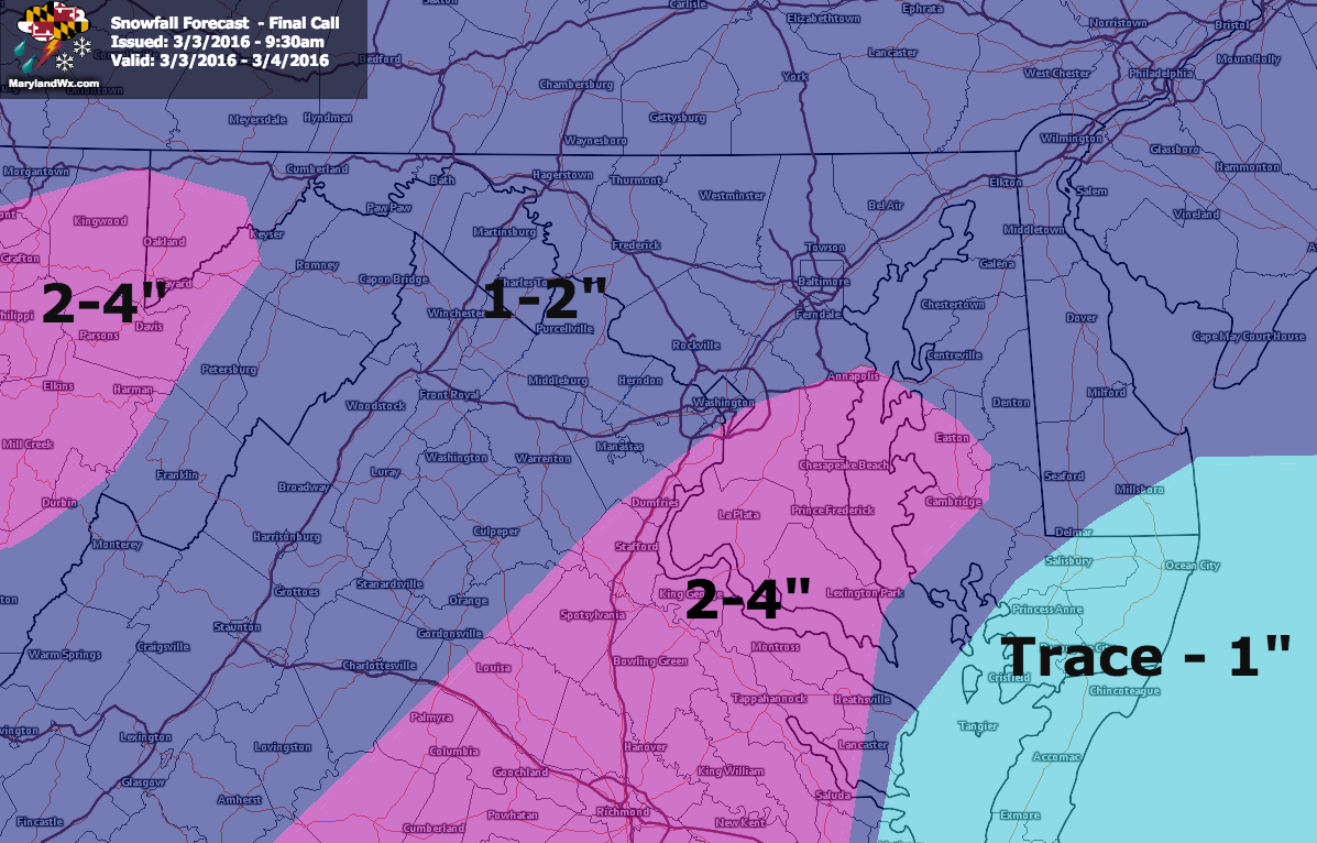
Low pressure currently over the midwest will track eastward today. The storm will track over the Carolinas and off of the east coast by tomorrow morning. With cold air in place, expect the system to spread light snow into the state this evening. The snow will likely start as rain/snow mix or even just plain rain across the southern counties but will turn to snow overnight. With a southern track, expect the heaviest of the snow to fall across southern portions of the state, with lighter amounts elsewhere. Across the lower Eastern Shore, warmer temps will limit accumulations.
With the bulk of the snow falling during the overnight, expect a few inches to accumulate, especially on grassy and elevated surfaces. A general 1-2″ is expected, with up to 4″ possible across southern Maryland.
After sunrise tomorrow, the snow may mix with rain again before ending during the late morning or early afternoon from west to east. Highs will push well above freezing and the combination of the warmer air and March sun will likely melt most if not all of the snow by tomorrow evening.
Here is a simulated radar from this morning’s NAM, showing the likely timing of the system from 7pm this evening through 1pm tomorrow:
[slideshow_deploy id=’11273′]