
Summary: An area of low pressure will move by to our south late tomorrow into Friday spreading snow into our area. Warming trend next week.
The models are coming into agreement regarding the timing and strength of an area of low pressure that will track to our south late tomorrow through Friday. The storm will spread light snow into our area tomorrow evening after sunset. Light to possibly moderate snow will continue through the night and taper off from west to east Friday morning into Friday afternoon as seen on this morning’s GFS run:
[slideshow_deploy id=’11257′]
The high March sun angle and marginal temperatures will limit accumulations, especially on roads. But with most of the snow falling during the overnight hours, a couple of inches of snow are likely, especially on grassy and elevated surfaces.
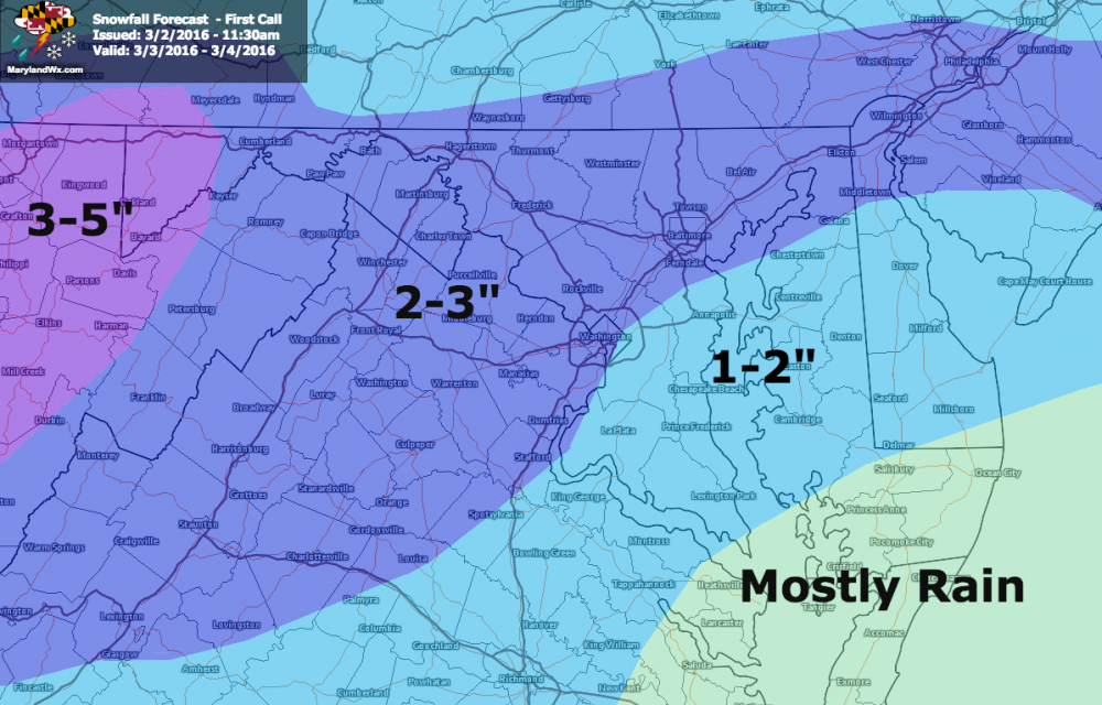
Here is my first call forecast:
Behind the system, high pressure will build in Saturday followed by a weak system Saturday night that may touch off a few snow showers as it passes through.
We clear out on Sunday and begin a warming trend that will bring spring-like conditions across the state for much of next week.