
Summary: An area of low pressure will approach from the southwest and affect our area tomorrow into Tuesday with a variety of precipitation types. High pressure will return for the second half of the week.
- A Winter Storm Warning is in effect for the mountains, except for Garrett County.

- A Winter Weather Advisory is in effect for areas east of the mountains and west of the bay as well as Garrett County.
The first wave of precipitation associated with an area of low pressure is approaching the state this evening and will continue to push into our area overnight. It will take a while for the precipitation to hit the ground in this very dry airmass but as the lower levels moisten, it will fall as light snow late tonight or early tomorrow morning.
While the snow continues to fall during the morning hours, much warmer air will be working into the state on southeast winds. The snow will last through the morning hours before the warmer air changes it over to sleet and then freezing rain from east to west by the afternoon.
The first wave of precipitation will move out during the afternoon, at which point we will likely experience a lull in the action but not before several inches of snow fall across the state, with highest amounts north and west of I-95 where the colder air hangs on longer.
The lull will likely last into the evening hours, with just light rain east of the bay and light sleet or freezing drizzle west of the bay and into the mountains.
Another batch of precipitation will move in Tuesday night, mainly west of I-95 and will initially fall as sleet or freezing rain. By early Tuesday morning, most if not all areas will rise above freezing, changing the frozen precipitation over to rain. Steady to heavy rainfall will overspread the state from west to east as the low tracks over the state during the afternoon hours.
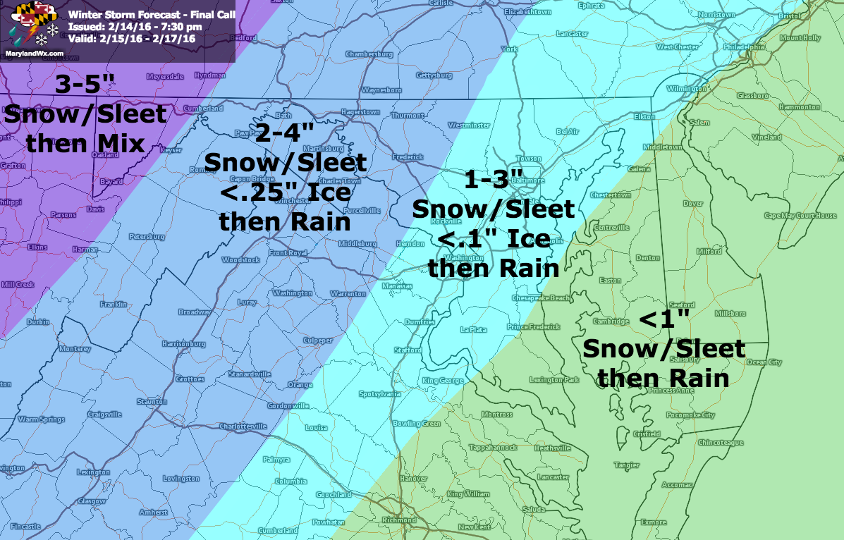
Here is my snow and ice forecast for this storm:
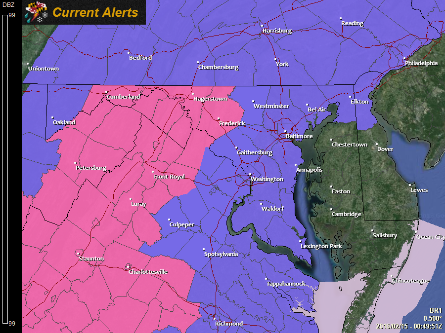
Here is the 18z NAM simulated radar, showing the precipitation types and timeline of the storm:
[slideshow_deploy id=’11113′]
Rainfall will taper off and end from southwest to northeast during the evening hours but an additional round of light rain or snow is possible overnight or early Wednesday morning as a smaller disturbance moves through behind the storm.