
Summary: High pressure will build into the region today. A strong cold front will move through on Friday. Arctic high pressure builds in this weekend. Low pressure may impact the area Monday and Tuesday.
Good Morning! Expect more clouds than sun today as a few impulses of energy work through, possibly triggering a few flurries or snow showers this afternoon. It will be breezy as well, as high pressure builds in later today. Highs will be in the mid to upper 30s.
Colder air will pour into the region tonight and tomorrow on strong northwest winds. These winds could also transport scattered flurries into the area through tomorrow. Highs will only reach the mid to upper 20s but with gusty winds, it will feel even colder.
Lows tomorrow night will range from the single digits in the mountains to the mid 10s in central and eastern parts of the state.
Arctic high pressure will slide in on Saturday. It will be very cold and windy, with highs in the single digits in the mountains to low to mid 20s elsewhere.
Saturday night will be the coldest night of the stretch, withs lows below 0 in the mountains to the single digits elsewhere.
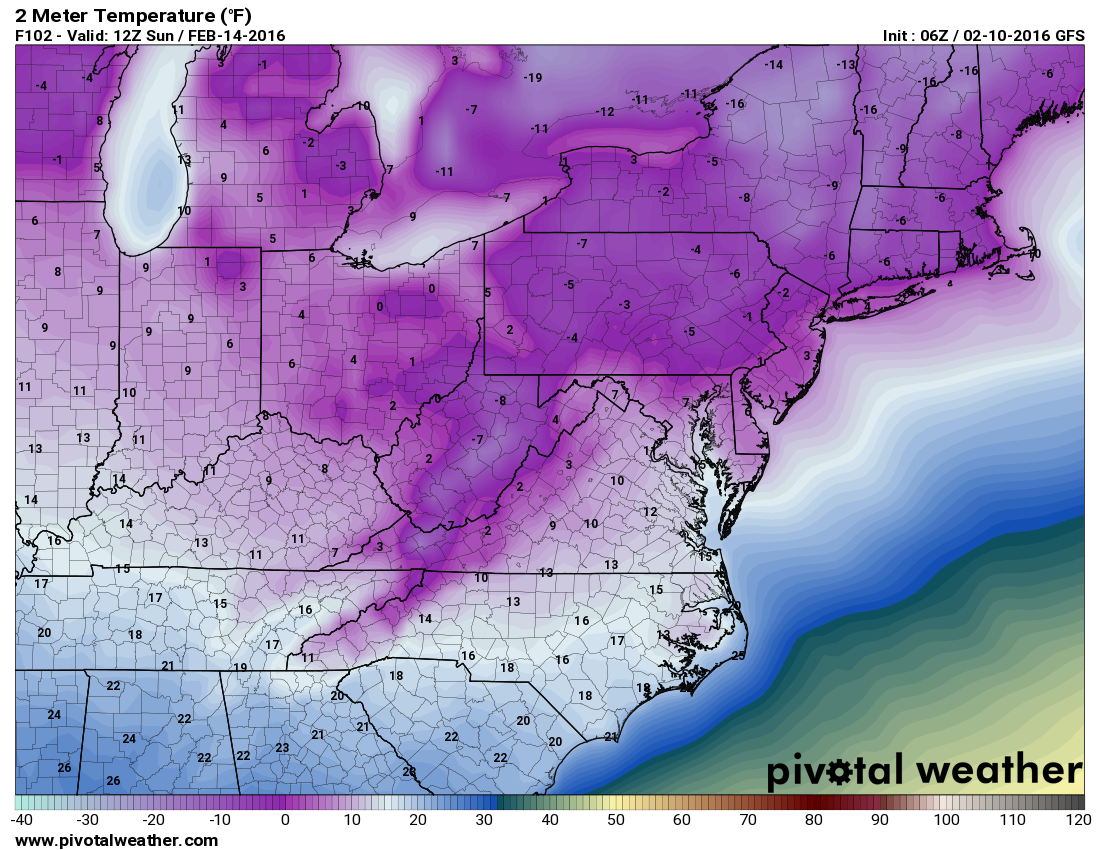
Despite plenty of sunshine, Sunday will be bitterly cold with highs struggling above the single digits in the mountains to the upper 10s to near 20 elsewhere.
Temperatures will moderate a bit on Monday, ahead of a system that is now showing up on most models. This system will approach from the southwest Monday, possibly impacting our area late Monday and Tuesday. While they all show the system, the models disagree at this point on what (if any) impact it will have on our area.
Here is a slideshow showing 3 model solutions (Euro at 7pm Tuesday, GFS at 1pm Tuesday and Canadian at 1am Tuesday):
[slideshow_deploy id=’11055′]
As you can see, the timing and positioning and ultimately the impact still differ greatly but at this time, they all show “something” that could threaten our area in the late Monday – late Tuesday timeframe.
Once the impact of this weekend’s cold shot is fully resolved, we will hopefully see some agreement and a convergence on a solution for this system in the coming days.