
Summary: Low pressure will continue to affect the area today before pulling away tonight. High pressure builds in tomorrow through Friday. A cold front will move through Friday night, ushering in cold high pressure for the weekend.
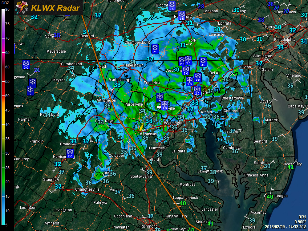 As low pressure continues to move through and intensify today, expect periods of light to moderate snow to continue. The snow may mix with rain at times, mainly in areas south and east of I-95.
There have been reports of 1 to 4″ of snow, mainly north and west of I-95 with lighter amounts elsewhere. Expect another inch or so, especially on elevated and grassy surfaces as we move through the afternoon. With the delayed transition and lighter precipitation amounts, the National Weather Service downgraded the Winter Storm Warnings to a Winter Weather Advisory and now anticipate snowfall totals more in line with what I predicted yesterday.
The snow will taper off from west to east this evening as the storm pulls away.
Cold high pressure will begin to move into the area tomorrow. Expect a mix of clouds and sun, with highs in the mid to upper 30s.
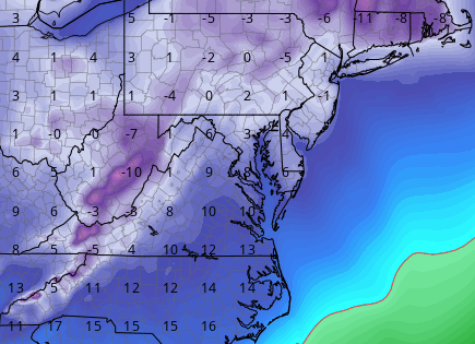
It will be clear and cold Thursday night, with lows in the low to mid 10s.
A reinforcing cold front will pass through on Friday, bringing in the coldest air of the season for the weekend. Highs on Saturday will remain in the 20s with lows Saturday night falling into the single digits statewide, except in western Maryland where lows will fall below 0.
We will struggle into the low 20s on Sunday, despite mostly sunny skies.
Temperatures will begin to moderate on Monday, with highs pushing back into the 30s.