Summary: An area of low pressure will impact our area tonight through tomorrow night. High pressure returns late Wednesday through the weekend.
Low pressure will move into the area later today from the southwest and spread precipitation into the state by this evening. With temperatures well above freezing today, expect mostly rain but as colder air moves in, the rain or rain/snow mix will change over to snow and become heavy at times.
Periods of snow will continue tomorrow with accumulations likely. While it will become cold enough to snow, and remain cold tomorrow, temperatures will remain near or even slightly above freezing through the storm. This will cut down on potential accumulation but several inches of snow are still expected, especially north and west of I-95. The NWS has issued a Winter Storm Watch for central and northern portions of the state.
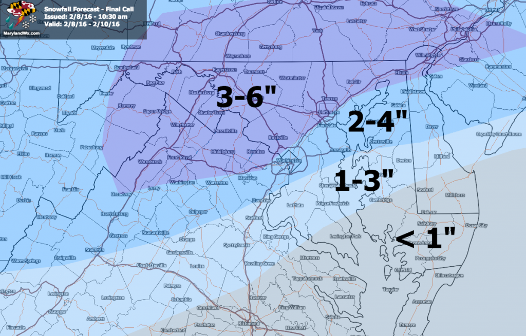
Here is my updated snowfall map. Not much has changed and this remains an low confidence forecast:

Should colder air become more firmly entrenched, expect totals on the higher end of each of these ranges. Conversely, should it not work in as expected, expect snowfall on the low end of these ranges or even lower.
Here is a slideshow for timing purposes:
[slideshow_deploy id=’11033′]
No matter how much snow falls, one thing that is certain, high pressure will build in behind the system and bring very cold air into our region. Highs on Wednesday will be in the mid 30s but by the weekend, highs will likely stay the 20s, perhaps low 20s by Sunday. Overnight lows this weekend could be in the single digits across most of the state.
