
Summary: An area of low pressure will impact our area tomorrow through Tuesday before moving away from the area on Wednesday. Cold high pressure will build in behind the system, controlling the weather through the weekend.
An area of low pressure will spread showers into the area tomorrow evening into tomorrow night. As colder air works into the region tomorrow night and Tuesday, the rain is expected to change to snow with snow continuing into Tuesday night. There is a bit of spread amongst the models with this system and the exact timing and extent of the colder air. As a result, this is a difficult and low confidence forecast at this time.
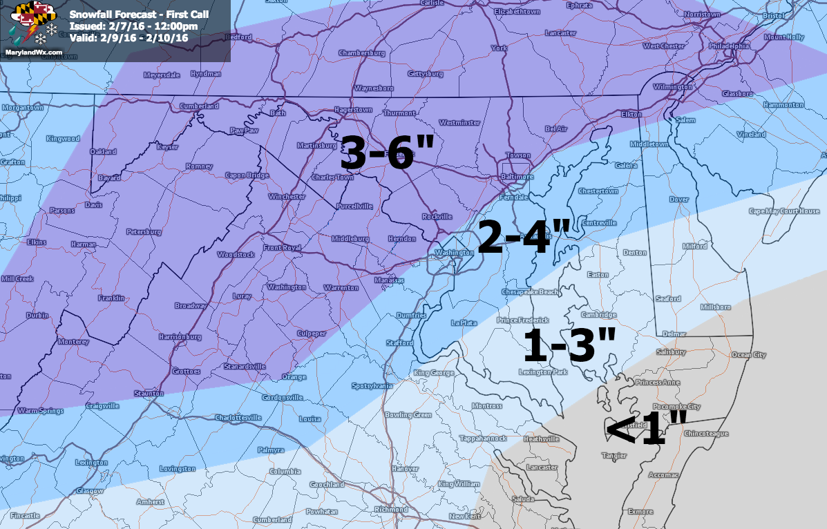
Generally, I expect snowfall totals to remain below 6″ for just about everyone, with perhaps up to 6″ possible along the northern and western parts of the state. South and east of there, along I-95, 2-4″ is expected with 1-3″ possible along southern Maryland and the middle Eastern Shore while along the lower Eastern Shore little accumulation is expected.
Temperatures will be marginal and with any “changeover” event, the exact timing of the colder air and strength of the system will ultimately determine how much snow falls and where.
(click to enlarge)
I will have an update to this forecast tomorrow morning. Meanwhile, here is a slideshow showing the potential timing of this system:
[slideshow_deploy id=’11004′]
The storm will pull away on Wednesday, ushering in much colder air to end the week. Highs Thursday through Sunday will be in the upper 20s to low 30s.