
Summary: A cold front will pass through this evening followed by high pressure. Low pressure will impact the state Friday and Saturday. High pressure returns Sunday and into next week.
Today will feature a mix of clouds and sun with snow showers likely this evening as a cold front passes through. A Winter Weather Advisory has been issued for the DC/Baltimore metro counties, where up to an inch of snow could impact the evening commute. Highs will be in the low 30s.
Now for the weekend storm. All model information continues to support a major snowfall for our state, with snow beginning Friday afternoon and lasting into Saturday night. The National Weather Service has issued a Blizzard Watch for central Maryland, and a Winter Storm Watch for the western counties.
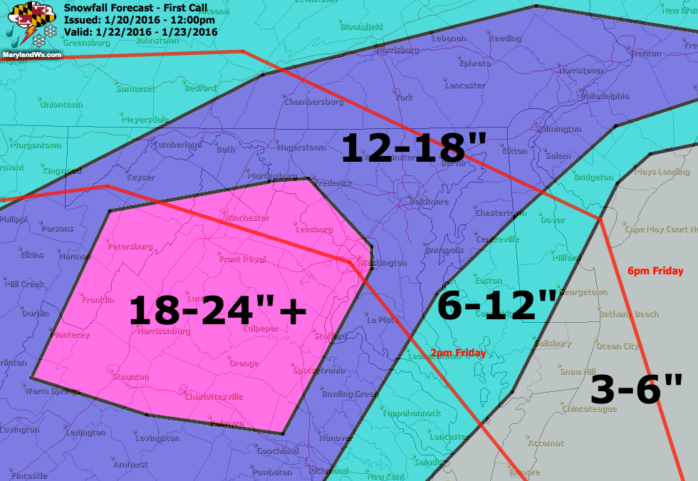
Generally, over a foot of snow is expected, with higher amounts north and west of I-95. Along I-95 and areas south and east will likely experience a period of mixed precipitation Friday night that would cut down on snow totals.
The red lines indicate the approximate start time of the event.
Please remember, this is a first call and will be updated as needed as we get closer to the event and the exact track comes more into focus.
I will continue to post intermediate updates on Facebook, Twitter and Google+.
Stay up to date with storm information on your favorite social media site!
Follow me on Twitter, Facebook and Google+!