
Summary: High pressure will build in today into tomorrow. A cold front will cross on Sunday. High pressure builds back in Monday and Tuesday. Another system will affect our area Wednesday and Thursday.
Shower chances increase late tomorrow night as a cold front approaches from the west. The front will slowly push through on Sunday with scattered showers.
Showers will be most likely during the morning and early afternoon hours. Highs on Sunday will be in the mid to upper 60s.
The front will sag south of the state by Sunday night as high pressure builds in from the north. This will result in mostly sunny skies both Monday and Tuesday, with highs in the upper 50s to around 60°.
(click to animate)
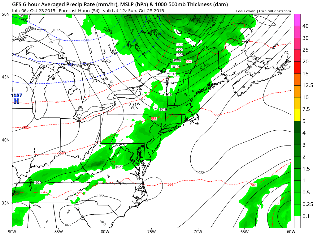
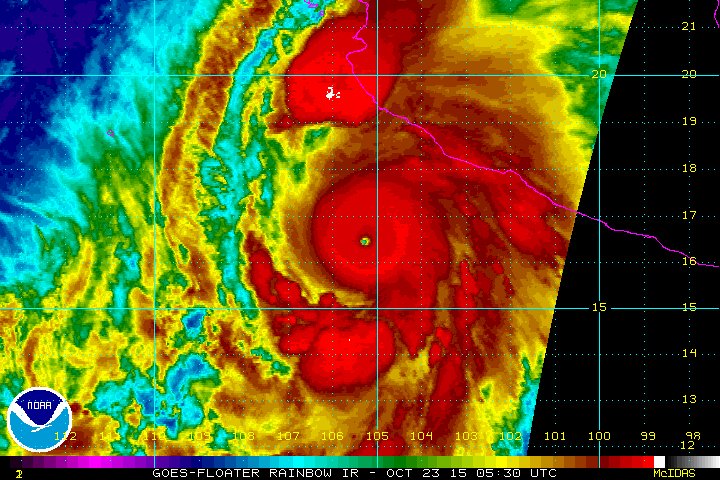
Right now, it appears that moisture from Hurricane Patricia, a storm in the eastern Pacific, with winds of 200 mph (making it the strongest hurricane ever recorded) could get pulled into the system as it moves across the eastern US.
If that occurs, a widespread heavy rainfall event could occur Wednesday and Thursday.
The details of how the hurricane and that system interact will be worked out over the next several days.
Stay up to date with storm information on your favorite social media site!
Follow me on Twitter, Facebook and Google+!