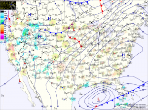
Summary: High pressure overhead today will slide south and east tomorrow. A cold front will approach and move through on Thursday, followed by high pressure that will work in for the end of the week and into the weekend.

There will be more clouds on Thursday as a cold front approaches and pushes through. Right now it looks like it will be a dry frontal passage and highs will once again push into the low 70s.
Temperatures will fall back on Friday as high pressure builds back in. Highs will be in the low 60s under mostly sunny skies.
Saturday will be mostly sunny and warmer than Friday as another cold front approaches. Highs will be in the mid to upper 60s.
A cold front will work through the state on Sunday, this time with scattered showers.
Stay up to date with storm information on your favorite social media site!
Follow me on Twitter, Facebook and Google+!
