
Summary: High pressure remains over the eastern US today. A cold front will slide through tomorrow ushering in cool Canadian high pressure this weekend.
Under the influence of high pressure, today will be mostly sunny with near normal temperatures. Highs will be in the mid 60s.
The high will shift offshore tonight as a cold front approaches from the west. The front will pass through the area during the morning hours with only a slight chance of showers. Skies will begin to clear behind the front and highs will reach the mid 60s.
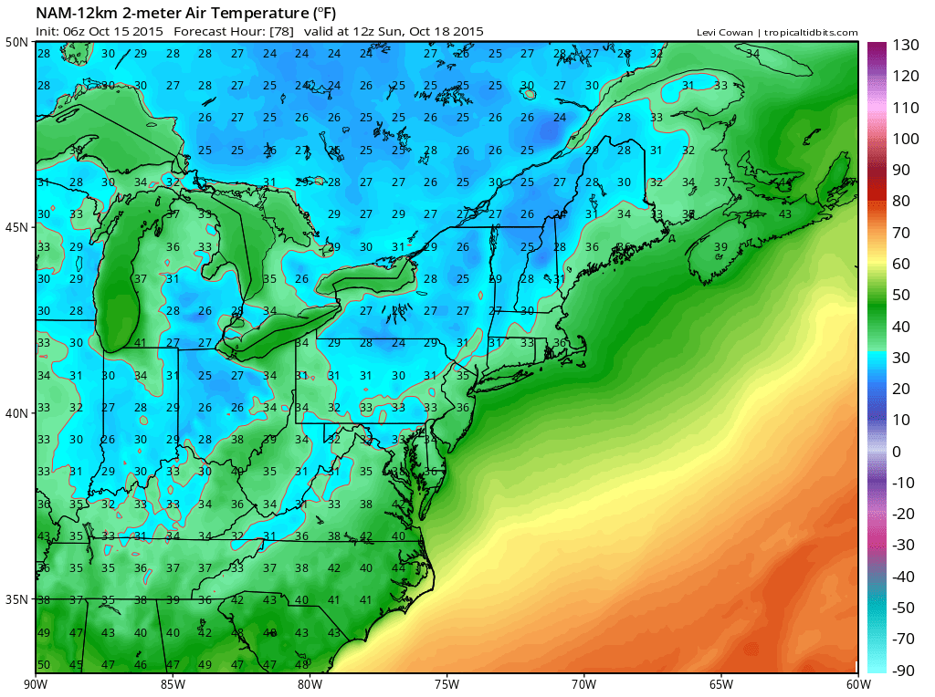
Lows on Saturday will dip into the mid 30s across most of the state with low 30s likely across western Maryland. Sunday night looks to be a few degrees cooler, with widespread lows in the low 30s and upper 20s likely in western Maryland. Frost and possibly Freeze Warnings will likely be issued by the National Weather Service both nights.
The coldest of the air will stick around into Monday with highs only reaching the mid 50s before a gradual warmup takes place next week. Highs will be in the 60s on Tuesday and around 70 on Wednesday and Thursday.
Stay up to date with storm information on your favorite social media site!
Follow me on Twitter, Facebook and Google+!