
Summary: High pressure will move off shore today as a cold front approaches from the west. The front will pass through tomorrow with high pressure returning for the middle of the week. Another front will cross on Friday with cool high pressure building in for the weekend.
Today will be mostly sunny and warm, with highs in the mid 70s. Clouds will begin to increase tonight ahead of a cold front that will push through tomorrow. The front will have limited moisture, but a few showers are possible, especially during the late morning and early afternoon hours. Highs will once again be in the mid 70s.
Another cold front will push through on Friday. As a result, there is a slight chance of a shower during the day Friday as the front moves through. Highs will be in the mid 60s.
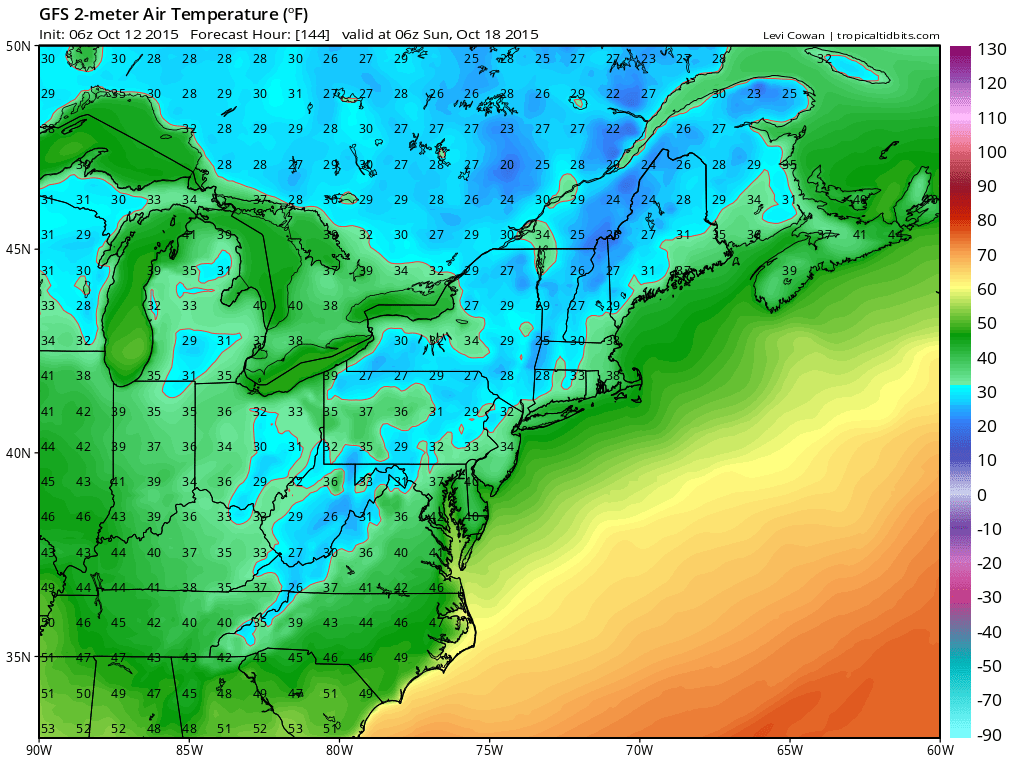
High pressure and the coolest air of the season thus far move in over the weekend. Highs on Saturday will be near 60 and highs on Sunday will likely remain in the 50s. Overnight lows will dip down into the 30s with upper 20s possible over the mountains both nights.
Temperatures will slowly start to moderate as we head into next week.
Stay up to date with storm information on your favorite social media site!
Follow me on Twitter, Facebook and Google+!