
Before we get to the specifics of Joaquin, expect another round of potentially heavy rainfall tomorrow through Friday night with showers likely lingering into Saturday as a disturbance moves through. This rainfall is not associated with Joaquin but could be very heavy at times with flooding possible.
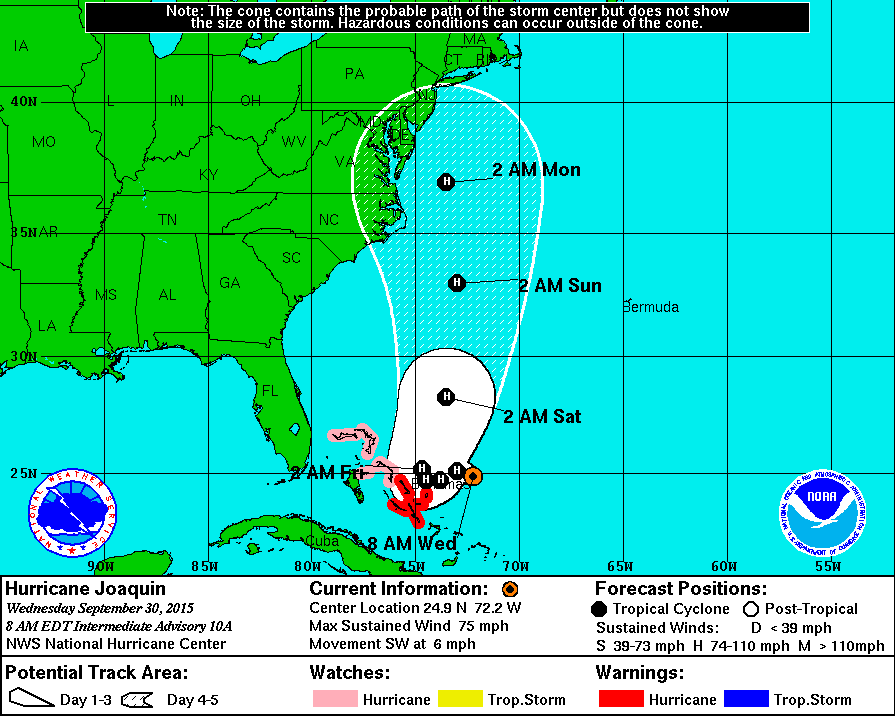
The hurricane is expected to turn to the north over the next day or so and move towards the east coast by this weekend. Recent model trends have brought the storm further west with a landfall in some form or fashion near the North Carolina/Virginia coastline.
This is a very complicated forecast with many different variables that will affect the eventual outcome. First, a trough of low pressure will dig into the region with a deep low pressure developing over the south east states.
The exact position and timing of this trough and low as well as the exact position of a blocking area of high pressure to the northeast of the storm will all combine to determine the ultimate fate of Joaquin.
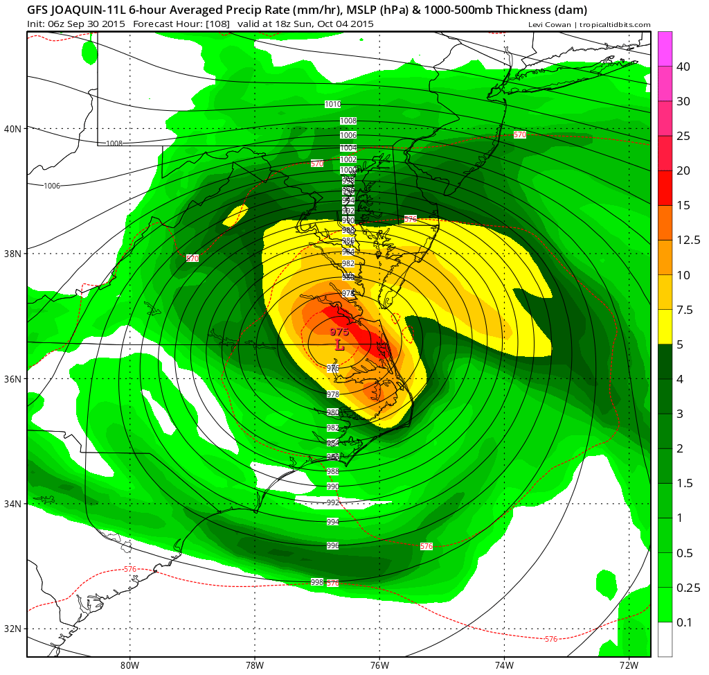
It should be noted that the European model, which generally handles tropical systems very well, does not show this. In fact, it is the only major model that has Joaquin moving out to sea and not directly impacting the coast at all. Having a reliable model show a very different solution also lowers confidence in the forecast at this time.
In any case, this situation needs to be monitored for the obvious possible impacts to our area. Right now, it is just too complicated with too many moving parts to pin down a forecast but there is a distinct possibility that our state could see a significant impact from this system on Sunday.
Stay up to date with storm information on your favorite social media site!
Follow me on Twitter, Facebook and Google+!