
THE NATIONAL WEATHER SERVICE IN STERLING VIRGINIA HAS ISSUED A FLASH FLOOD WATCH FOR PORTIONS OF MARYLAND...INCLUDING THE FOLLOWING AREAS... ANNE ARUNDEL, CARROLL, CENTRAL AND EASTERN ALLEGANY, CENTRAL AND SOUTHEAST HOWARD, CENTRAL AND SOUTHEAST MONTGOMERY, CHARLES, EXTREME WESTERN ALLEGANY, FREDERICK, NORTHERN BALTIMORE, NORTHWEST HARFORD, NORTHWEST HOWARD, NORTHWEST MONTGOMERY, PRINCE GEORGES, SOUTHEAST HARFORD, SOUTHERN BALTIMORE AND WASHINGTON.
* FROM LATE TONIGHT THROUGH LATE SATURDAY NIGHT
An area of low pressure will move by to our northwest tomorrow, dragging a cold front through our area with abundant moisture. The front will clear by Sunday morning. Another system will affect the area on Tuesday.
TODAY: We will be between systems today, with last night’s low pulling away and another moving towards the area from the west. As a result, today will be mostly dry with highs in the upper 70s to low 80s.
Rain will spread back into the state by this evening from west to east.
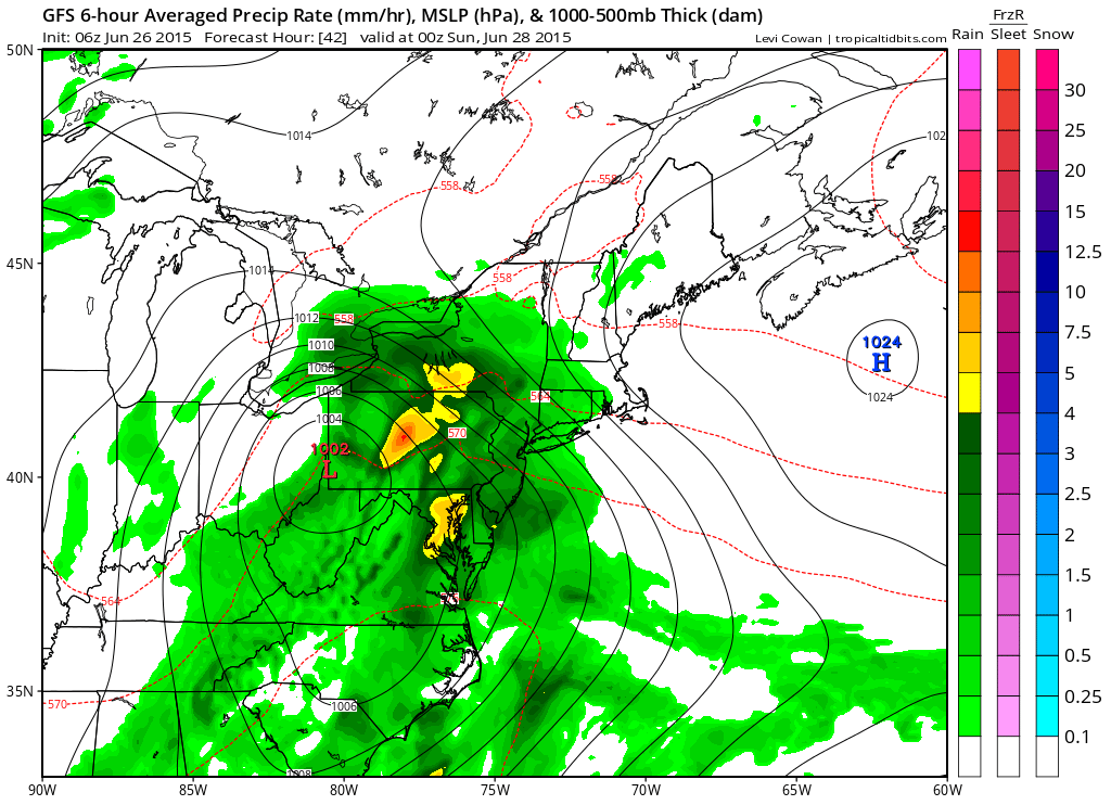
The rain will continue into the night, tapering off from west to east by the early morning Sunday. Rainfall totals of 1-3″ are possible across the state before all is said and done.
SUNDAY: Expect a mix of clouds and sun and breezy conditions as the front pushes off to the east and northwest flow increases. Highs will be in the upper 70s to low 80s.
MONDAY: Another day in between systems, expect mostly sunny skies, with clouds increasing late in the day. Highs will be in the low 80s.
OUTLOOK: A cold front will approach and move through on Tuesday, bringing another chance of rain. Another system looks to affect the area later in the week as well. Highs will generally be in the 80s during this period.
Stay up to date with storm information on your favorite social media site!
Follow me on Twitter, Facebook and Google+!