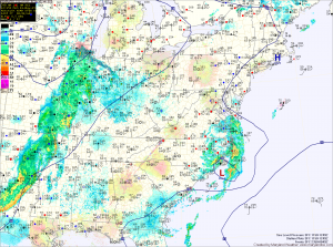
TODAY: With the remnants of Ana sliding by to our south and a front approaching from the west, there is a slight chance of an afternoon thunderstorm, especially east of I-95. There is also a better chance of storms across the mountains tonight as the front approaches. It will remain warm, with highs in the low 80s.
TUESDAY: The front will cross during the afternoon hours. It looks like it will be a mainly dry passage, with just a slight chance of a shower or storm. Warm air will build ahead of the front, with afternoon highs in the mid to upper 80s with a few spots likely topping 90°.
WEDNESDAY: It will turn breezy and much cooler as high pressure begins moving into the region. Highs will be in the low 70s under mostly sunny skies.
THURSDAY: Another mostly sunny and cooler day, with highs around 70°.
FRIDAY: The area of high pressure will push off of the coast, causing southerly flow to develop. This will allow temperatures to warm into the mid 70s. There is a slight chance of showers or storms during the evening.
WEEKEND OUTLOOK: Temperatures will remain in the mid 70s with a chance of showers and thunderstorms both days.
Stay up to date with storm information on your favorite social media site!
Follow me on Twitter, Facebook and Google+!
