
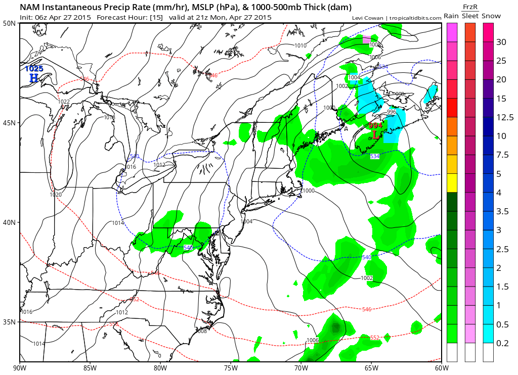
With an upper level low still spinning over the northeast, we remain cooler than normal to start the week. A weak disturbance will rotate through today with high pressure returning tomorrow. Another system may affect the area towards the end of the week.
TUESDAY: High pressure builds into the region resulting in breezy but sunny conditions. Highs will be in the mid to upper 60s.
WEDNESDAY: Winds will decrease and skies will remain mostly sunny. Highs will approach 70°.
THURSDAY: An area of low pressure from the Gulf of Mexico will likely move northeastward and towards our area by Thursday morning.
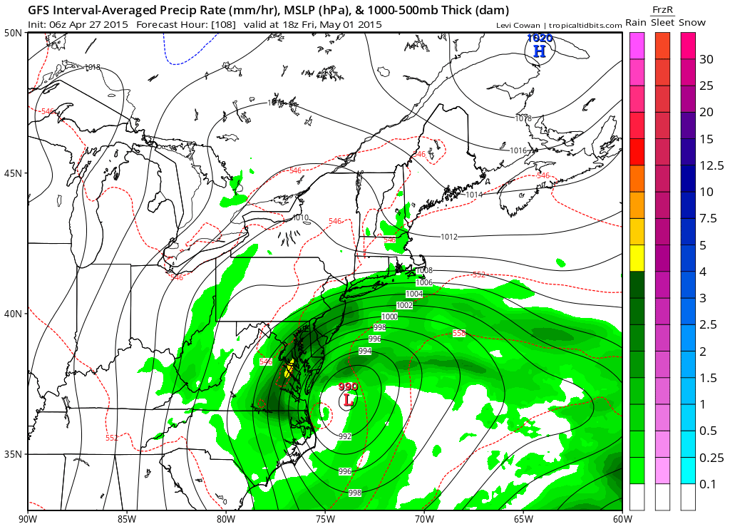
As a result, there is a chance of rain developing during the day Thursday and lasting into Friday. Highs will be in the mid 60s.
FRIDAY: The storm will be departing the region during the day. If the storm makes it this far north, it will be tapering off. Highs will be in the mid to upper 60s.
WEEKEND OUTLOOK: With high pressure building in, expect a pleasant weekend. Highs will be in the upper 60s to near 70° on Saturday and low to mid 70s on Sunday under mostly sunny skies.
Stay up to date with storm information on your favorite social media site!
Follow me on Twitter, Facebook and Google+!