
High pressure will maintain control of our weather today while a disturbance moves towards the area from the west, bringing showers tonight and tomorrow.
FRIDAY: Showers are likely through the morning hours, becoming more isolated during the afternoon as the system pushes through. Rain chances will continue to diminish during the evening hours. Highs will be in the upper 60s to low 70s.
SATURDAY: Expect a nice day as high pressure moves back in. Clouds will decrease and temperatures will warm into the mid 70s.
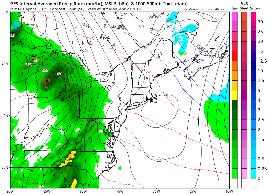
MONDAY: Rain likely with thunderstorms possible during the afternoon. The front should pass through late in the day with showers likely into Monday night. Highs will be in the mid 60s.
LOOKING AHEAD: High pressure will return on Tuesday and Wednesday, with another system likely affecting the area by Thursday.
Stay up to date with storm information on your favorite social media site!
Follow me on Twitter, Facebook and Google+!