
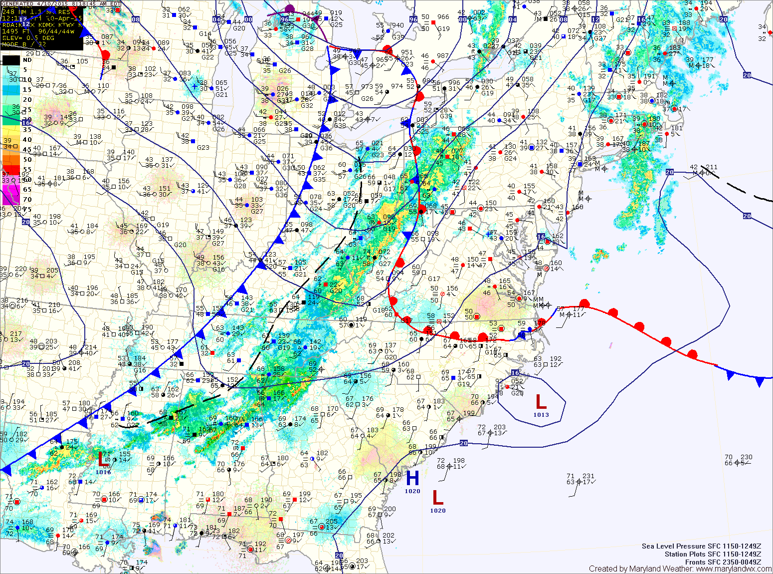
The front is already beginning its northward trek and should push through the state over the next few hours.
Once it moves through, much warmer air will flow into the area with temperatures jumping into the mid 70s by this afternoon. Some breaks in the clouds are possible as well as the dense moist air is dislodged.
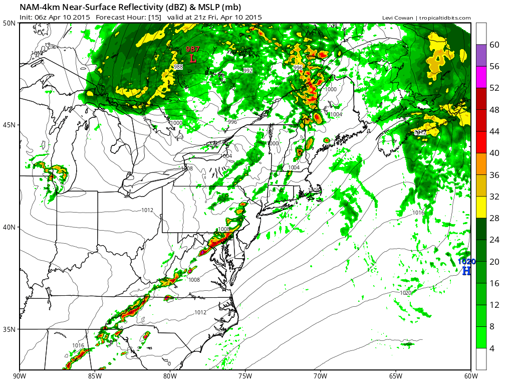
This line looks to hit central Maryland including DC and Baltimore between 4 and 6pm, likely disrupting the Orioles home opener. Once the storms push through, it should clear out so a complete rain out is highly unlikely.
If you are at the game, stay alert as watches and warning will likely be issued this afternoon.
The line will push through Southern Maryland and the lower Eastern Shore around 7pm and finally clearing the entire state by 10pm.
High pressure builds in Saturday, leading to breezy conditions under mostly sunny skies. Highs will be in the mid 60s.
Sunday will be very pleasant, with sunny skies and light winds. Highs will be in the mid 60s.
Clouds will increase on Monday and temperatures will push back into the 70s as another cold front approaches from the west. This front will bring a chance of showers on Tuesday.
Stay up to date with storm information on your favorite social media site!
Follow me on Twitter, Facebook and Google+!